Here’s the specific timing on thunderstorms today in central Indiana.
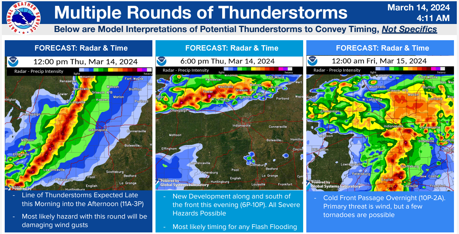
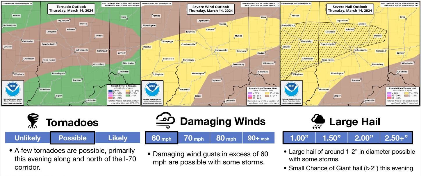
Wind is the biggest threat in the afternoon, but large hail and tornadoes are also possible tonight.
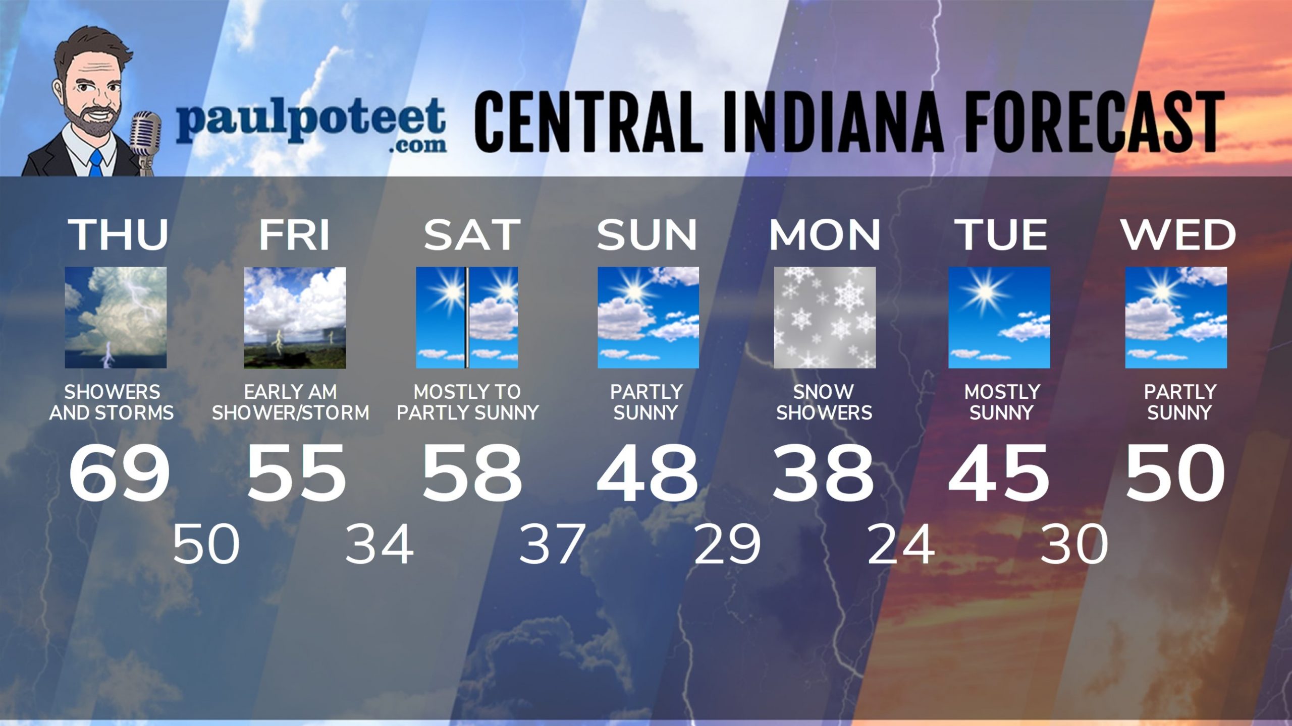
INDY SEVEN DAY FORECAST
Today: Mostly cloudy. Periods of showers and storms, mainly in the early to mid afternoon. A few could be severe. Wind gusts to 30 mph. High 69.
Tonight: Showers and storms. A few could be severe. Low 50.
Friday: Showers and storms end in the early morning. Mostly cloudy, and not as warm. High 55.
Friday Night: Clearing and cooler. Low 34.
Saturday: Mostly sunny morning. Partly sunny by late afternoon. Afternoon wind gusts to 30 mph. High 58.
Saturday Night: Partly to mostly cloudy, with a stray shower. Low 37.
Sunday: Partly sunny, and breezy. High 48.
Sunday Night: Clouding up, with overnight snow showers possible. Low 29.
Monday: Cloudy, breezy, colder, with scattered snow showers. High 38.
Monday Night: Evening snow showers, then some clearing. Low 24.
Tuesday: Mostly sunny. High 45.
Tuesday Night: Mostly clear. Low 30.
Wednesday: Partly sunny. High 50.
Never miss me! Subscribe for free. My Huge Radar has real-time weather tracking, current temperatures, and severe weather watches and warnings. Get detailed Indiana conditions by clicking here. Click here to see my central Indiana 7-Day Forecast. Follow these links to get my forecasts for Lafayette, Muncie, Hendricks County, and Hamilton County. Need a second opinion? Click here for central Indiana National Weather Service forecasts. (Some charts via WeatherBELL.)


