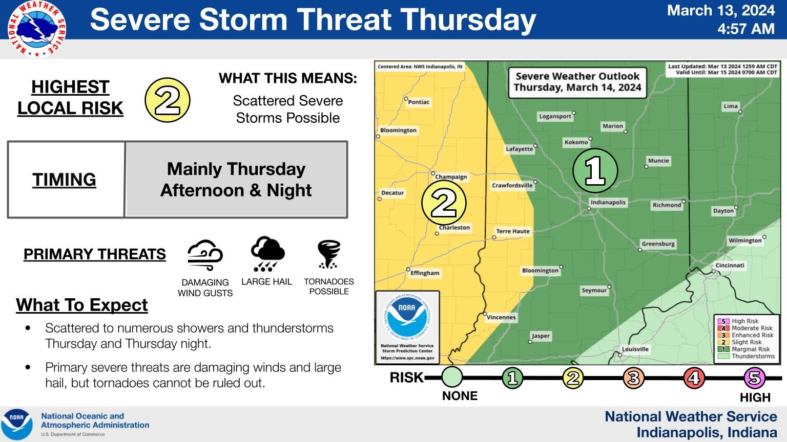
Showers and thunderstorms will move across central Indiana at times Thursday into Thursday night. Some severe storms are possible, mainly Thursday afternoon and night. The primary threats will be damaging winds and large hail, but tornadoes cannot be ruled out.
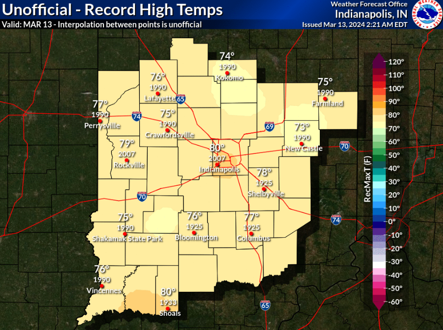
Temps today will be 20 degrees above average, but it doesn’t look like any records will be set. It will be closest in Lafayette and around Muncie.
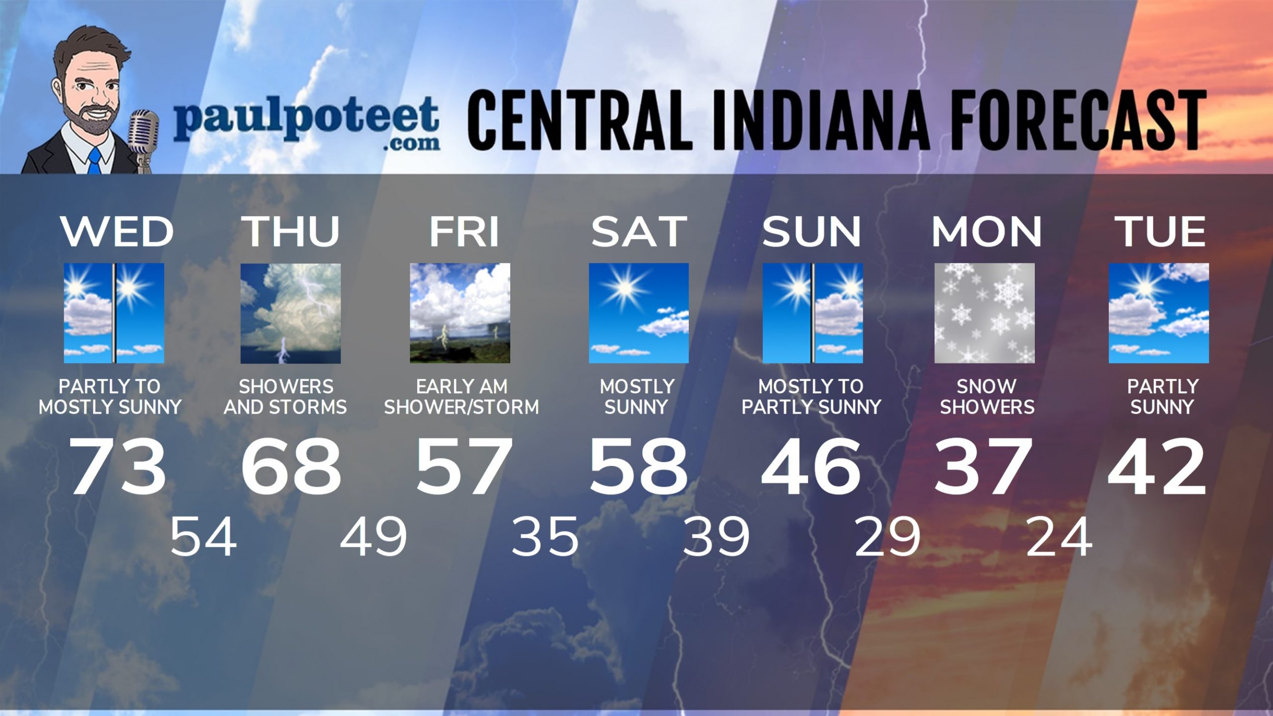
INDY SEVEN DAY FORECAST
Today: Partly to mostly sunny. High 73.
Tonight: Partly cloudy. Scattered showers and storms possible after midnight. Low 54.
Thursday: Mostly cloudy. Periods of showers and storms. A few could be severe. Wind gusts to 30 mph. High 68.
Thursday Night: Showers and storms. Low 49.
Friday: Showers and storms end in the early morning. Mostly cloudy, breezy and not as warm. High 57.
Friday Night: Clearing and cooler. Low 35.
Saturday: Mostly sunny. Breezy. High 58.
Saturday Night: Partly cloudy. Stray overnight shower. Low 39.
Sunday: Mostly sunny morning. Partly sunny afternoon.Breezy. High 46.
Sunday Night: Clouding up, with overnight snow showers possible. Low 29.
Monday: Cloudy, breezy, colder, with scattered snow showers. High 37.
Monday Night: Evening snow showers, then some clearing. Low 24.
Tuesday: Mostly sunny. High 42.
Never miss me! Subscribe for free. My Huge Radar has real-time weather tracking, current temperatures, and severe weather watches and warnings. Get detailed Indiana conditions by clicking here. Click here to see my central Indiana 7-Day Forecast. Follow these links to get my forecasts for Lafayette, Muncie, Hendricks County, and Hamilton County. Need a second opinion? Click here for central Indiana National Weather Service forecasts. (Some charts via WeatherBELL.)


