Indy was juuuuuuuuust below average yesterday on the high temp. We go above it today, and it stays positive all week.
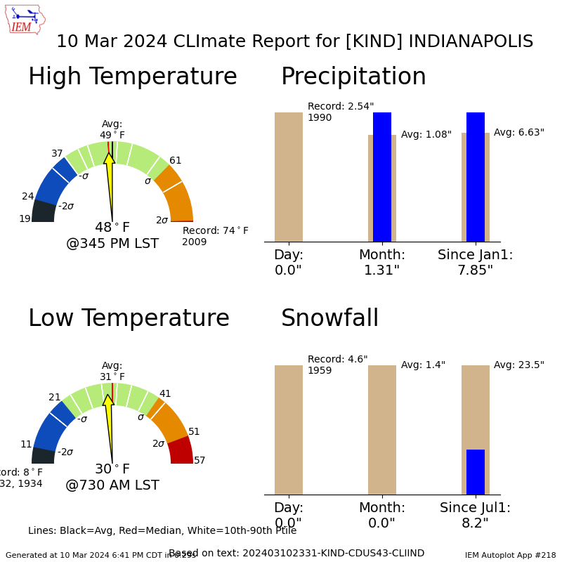
We are a little above average on precipitation for the month and year, but when it comes to snow the total is about one-third of what it should be. There might be a little snow mixed with rain a week from today.
Rain Thursday and Friday may get past one-half inch over much of the state.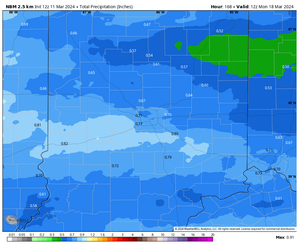
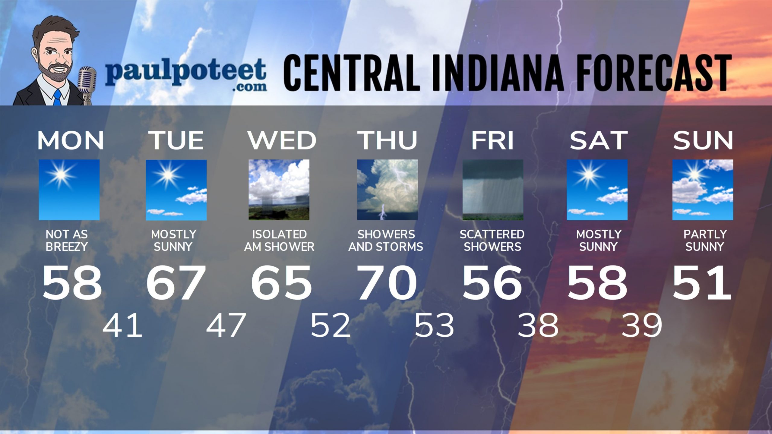
INDY SEVEN DAY FORECAST
Today: Sunny. Not as cold, and not as breezy. High 58.
Tonight: Clear. Low 41.
Tuesday: Mostly sunny. High 67.
Tuesday Night: Mostly cloudy. Isolated shower overnight. Low 47.
Wednesday: Mostly cloudy with a stray morning shower possible. Partly sunny afternoon. High 65.
Wednesday Night: Partly cloudy. Low 52.
Thursday: Partly to mostly cloudy, with scattered showers. Afternoon storms. High 70.
Thursday Night: Showers and storms. Low 53.
Friday: Mostly cloudy, with scattered showers. High 56.
Friday Night: Partly cloudy. Low 38.
Saturday: Mostly sunny. High 58.
Saturday Night: Mostly clear. Low 39.
Sunday: Partly sunny. High 51.
Never miss me! Subscribe for free. My Huge Radar has real-time weather tracking, current temperatures, and severe weather watches and warnings. Get detailed Indiana conditions by clicking here. Click here to see my central Indiana 7-Day Forecast. Follow these links to get my forecasts for Lafayette, Muncie, Hendricks County, and Hamilton County. Need a second opinion? Click here for central Indiana National Weather Service forecasts. (Some charts via WeatherBELL.)


