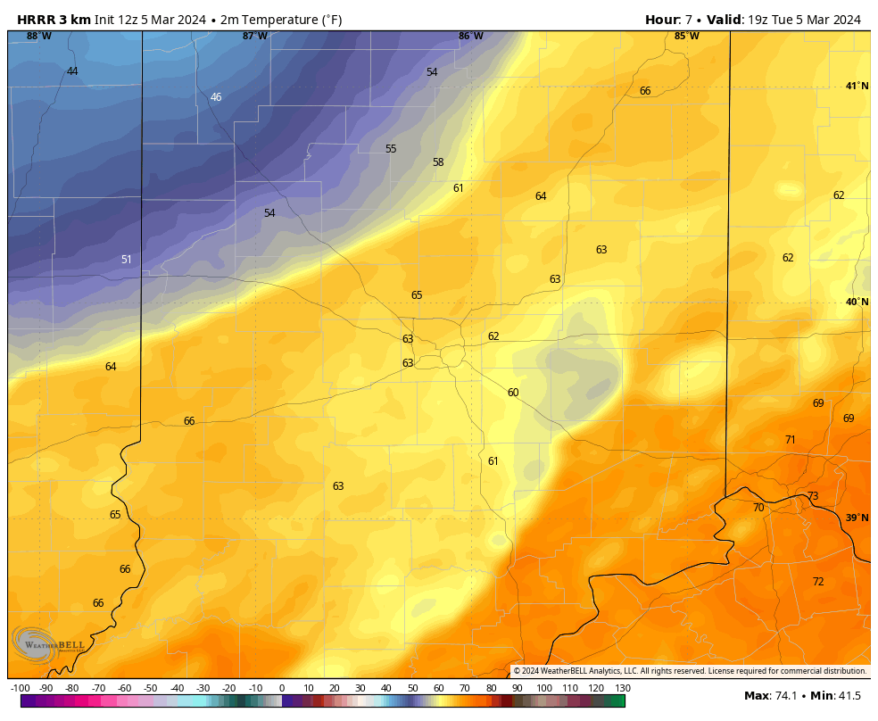
Small hail, frequent lightning, and downpours of rain are all possible from showers and storms moving through Indiana today along a cold front. Look at the temp difference along that front by the start of afternoon drive time today.
UPDATE
Thunderstorm Update:
Via @NWSIndianapolis… T-storms are developing across W/SW portions of Central Indiana and moving northeast. Expect coverage of storms to increase…(More:) https://t.co/a1jq5n2SvA pic.twitter.com/Xw4i6LRQlu— Paul Poteet Dot Com 🇺🇸 (@PaulPoteet) March 5, 2024
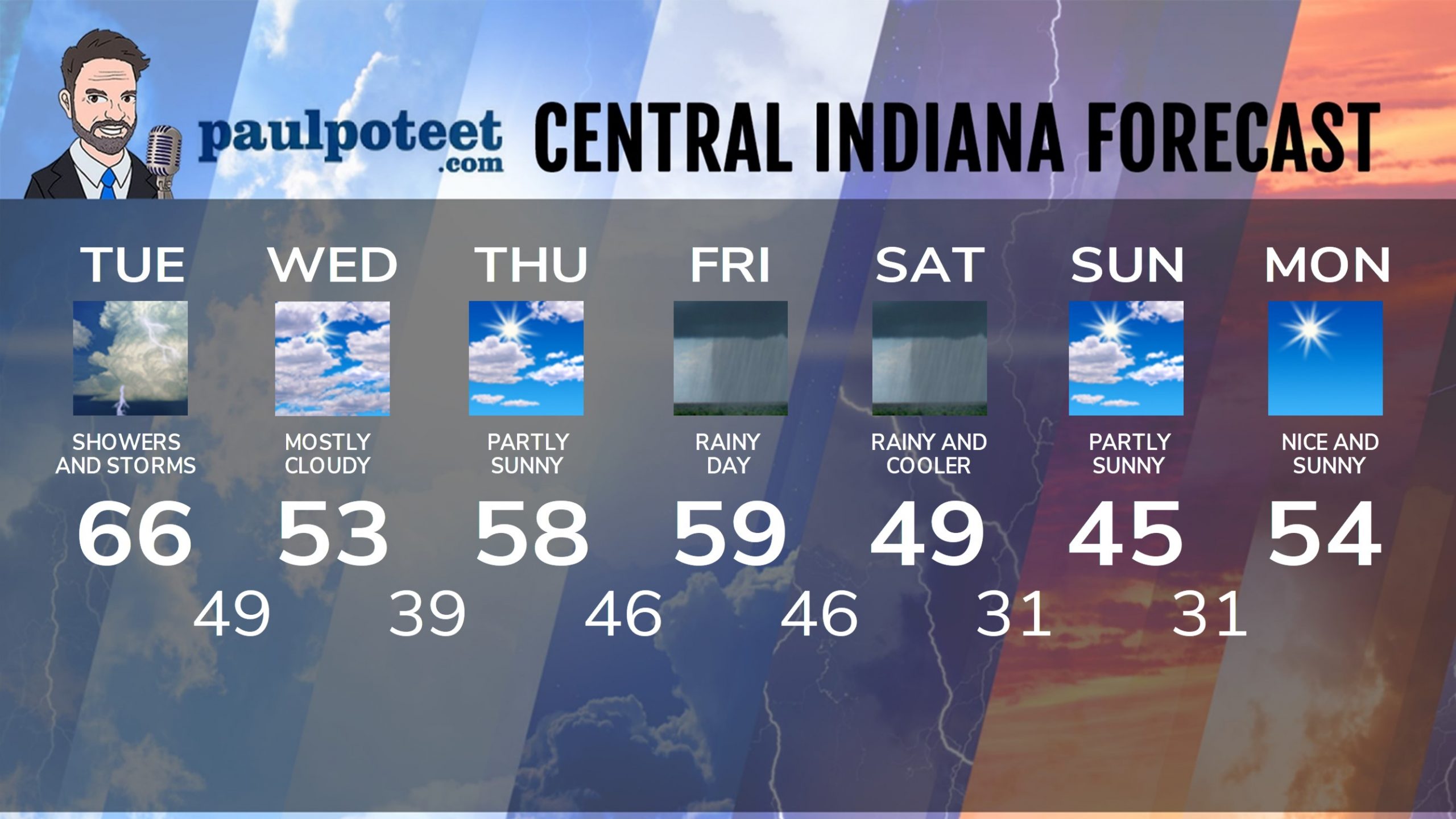
INDY SEVEN DAY FORECAST
Today: Showers and some thunderstorms. Storms could produce downpours of rain and small hail. High 66.
Tonight: Scattered showers in the evening. Cloudy overnight. Low 49.
Wednesday: Mostly cloudy. High 53.
Wednesday Night: Partly cloudy. Low 39.
Thursday: Partly sunny. High 58.
Thursday Night: Clouding up. Low 46.
Friday: Periods of rain. High 59.
Friday Night: Periods of rain. Low 46.
Saturday: Periods of rain. High 49.
Saturday Night: Mostly cloudy. Low 31.
Sunday: Partly sunny. High 45.
Sunday Night: Clearing. Low 31.
Sunday: Partly sunny. High 54.
Never miss me! Subscribe for free. My Huge Radar has real-time weather tracking, current temperatures, and severe weather watches and warnings. Get detailed Indiana conditions by clicking here. Click here to see my central Indiana 7-Day Forecast. Follow these links to get my forecasts for Lafayette, Muncie, Hendricks County, and Hamilton County. Need a second opinion? Click here for central Indiana National Weather Service forecasts. (Some charts via WeatherBELL.)


