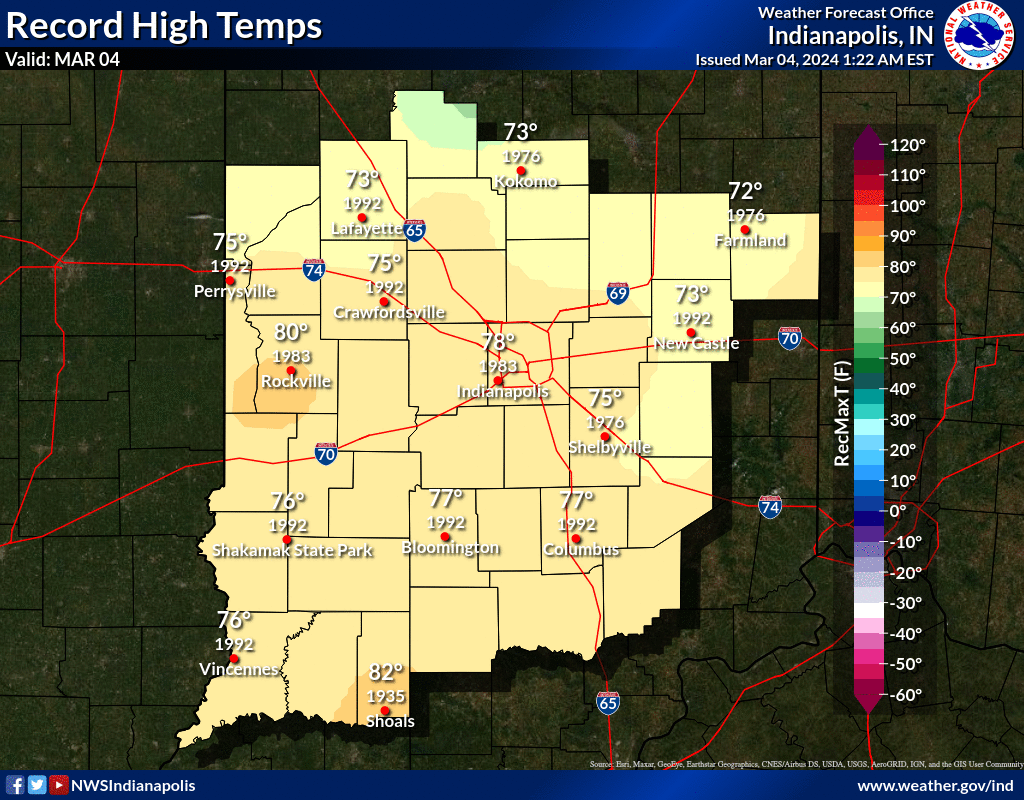
At the risk of sounding like a broken record…we may break a record today. The present Indy high temp record is 78, and my forecast is 75. The record dates back to 1983, which btw was another (1982-1983) El Nino Winter in the US.
The chart below shows the other records in place for March 4th presently.
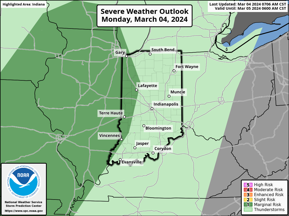
There is now a marginal risk of severe weather (large hail and damaging wind gusts) west of Lafayette late tonight and overnight.
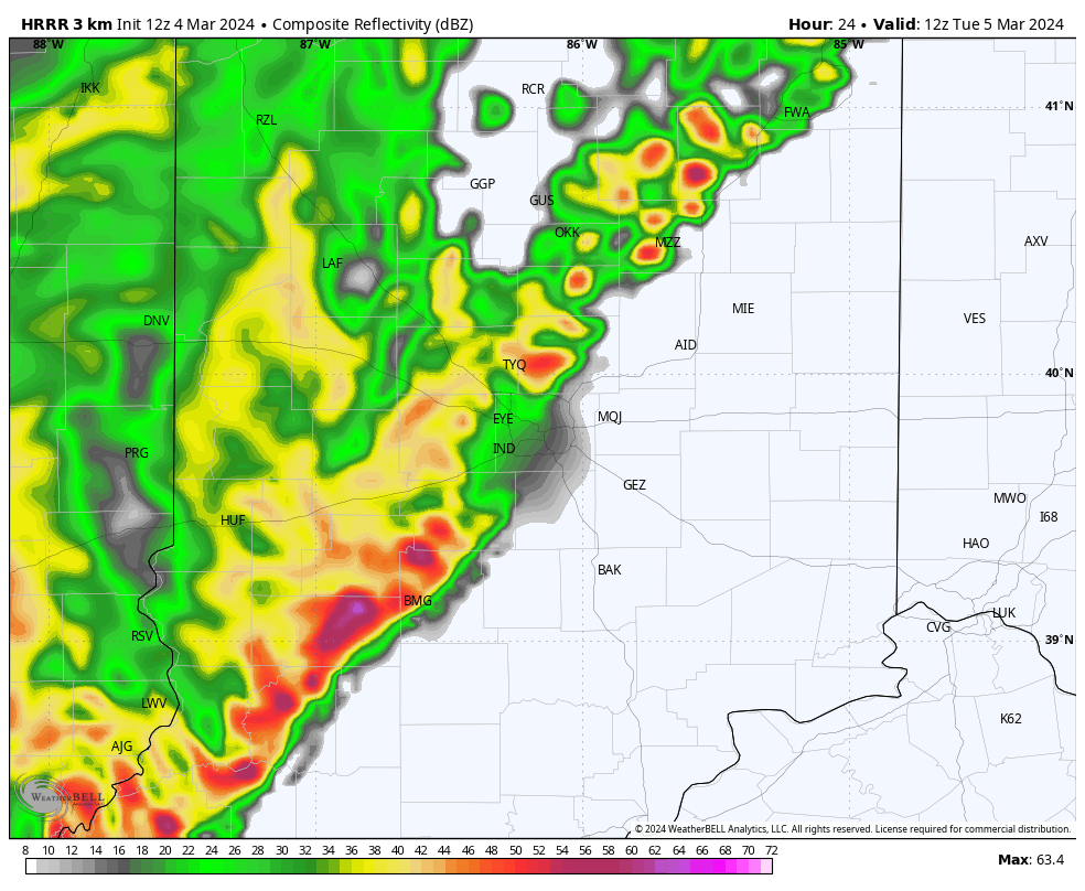
The system will lose some energy moving into the state Tuesday morning, but morning drive will feature rain and some rumbles of thunder. This is computer modeling for 7am Tuesday.
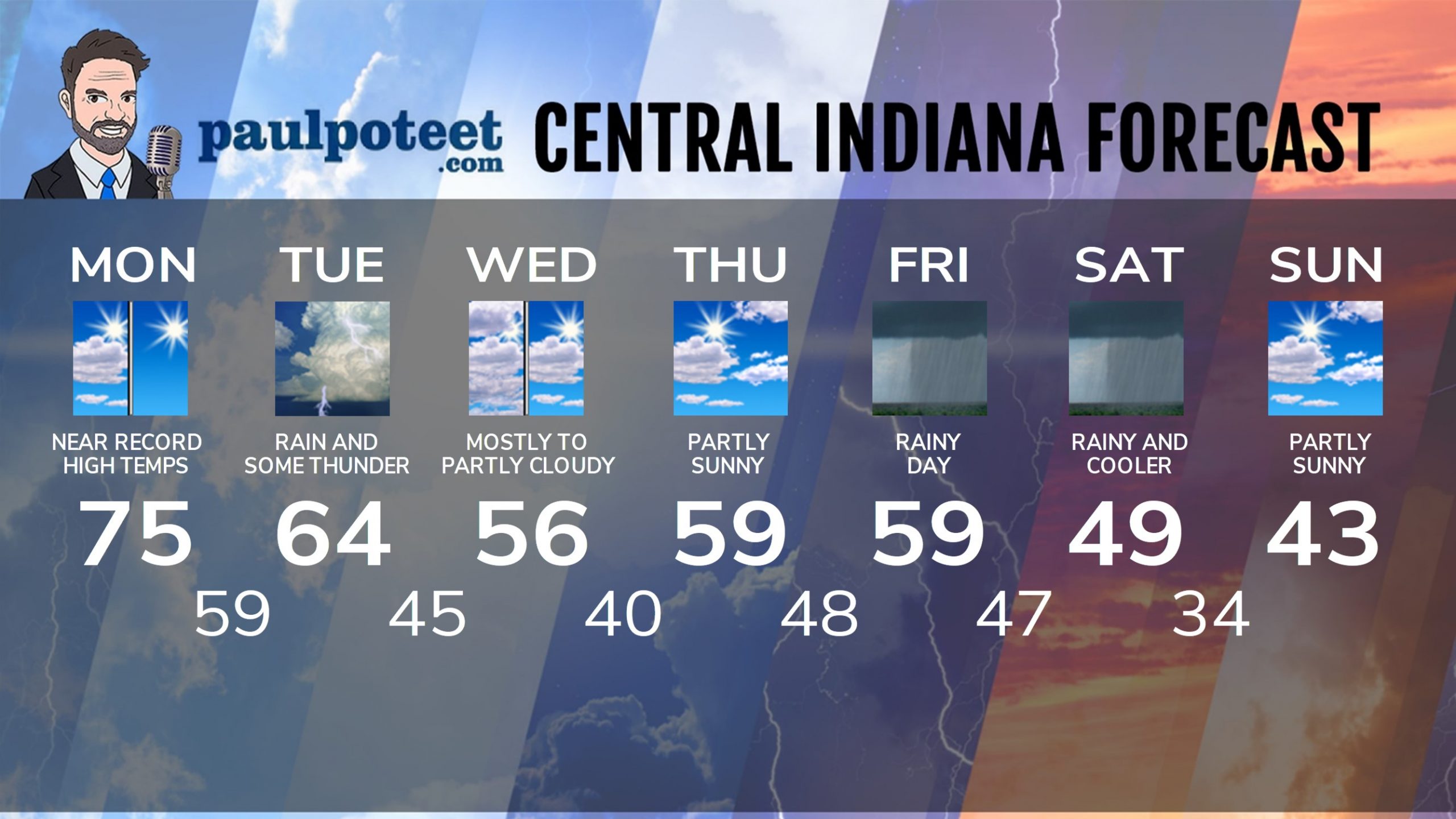
INDY SEVEN DAY FORECAST
Today: Mix of morning clouds and sun. Partly to mostly sunny, with a near-record high. High 75.
Tonight: Partly cloudy. Overnight showers and storms. Low 59.
Tuesday: Showers and some thunderstorms. High 64.
Tuesday Night: Evening showers and some thunderstorms. Showers move out late. Low 45.
Wednesday: Mostly to partly cloudy. High 56.
Wednesday Night: Partly cloudy. Low 40.
Thursday: Partly sunny. High 59.
Thursday Night: Clouding up. Low 48.
Friday: Periods of rain. High 59.
Friday Night: Periods of rain. Low 47.
Saturday: Periods of rain. High 49.
Saturday Night: Mostly cloudy. Low 34.
Sunday: Partly sunny. High 43.
Never miss me! Subscribe for free. My Huge Radar has real-time weather tracking, current temperatures, and severe weather watches and warnings. Get detailed Indiana conditions by clicking here. Click here to see my central Indiana 7-Day Forecast. Follow these links to get my forecasts for Lafayette, Muncie, Hendricks County, and Hamilton County. Need a second opinion? Click here for central Indiana National Weather Service forecasts. (Some charts via WeatherBELL.)


