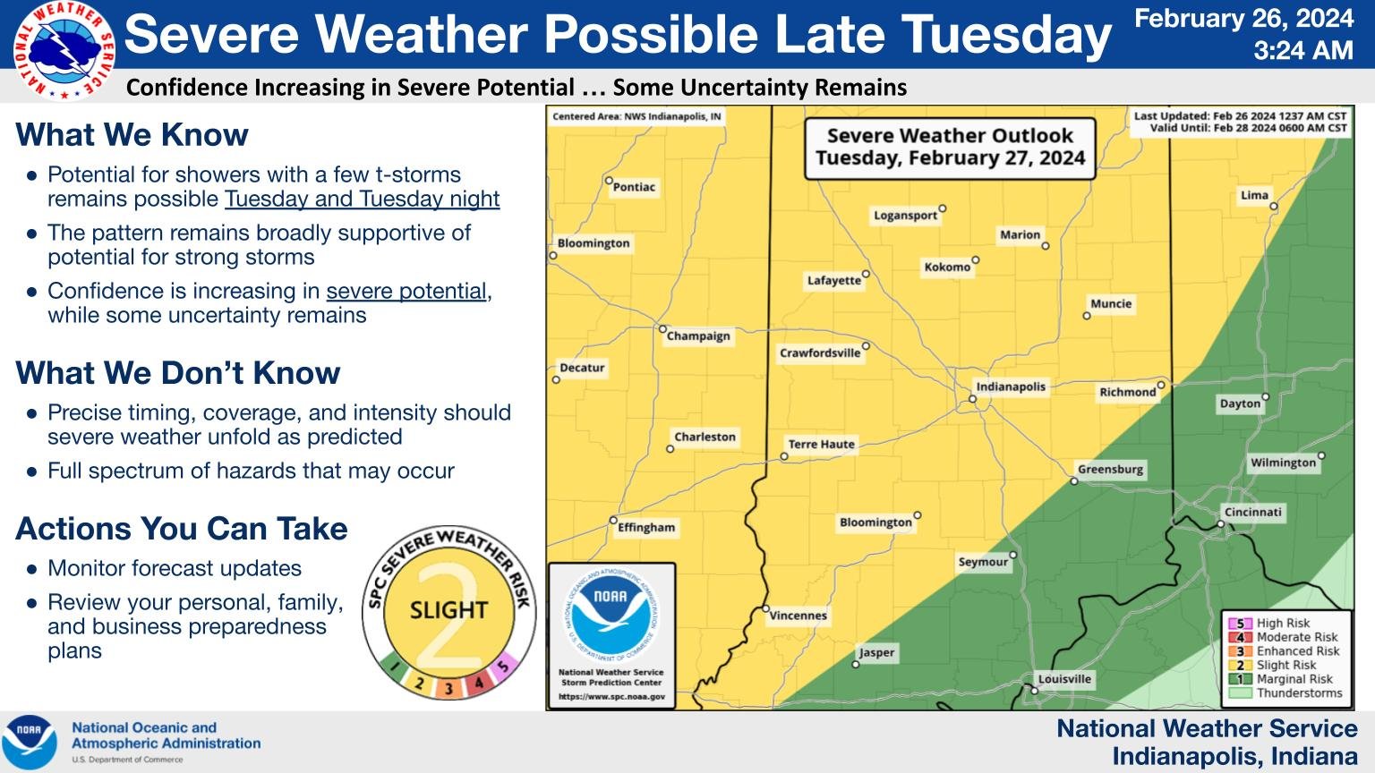
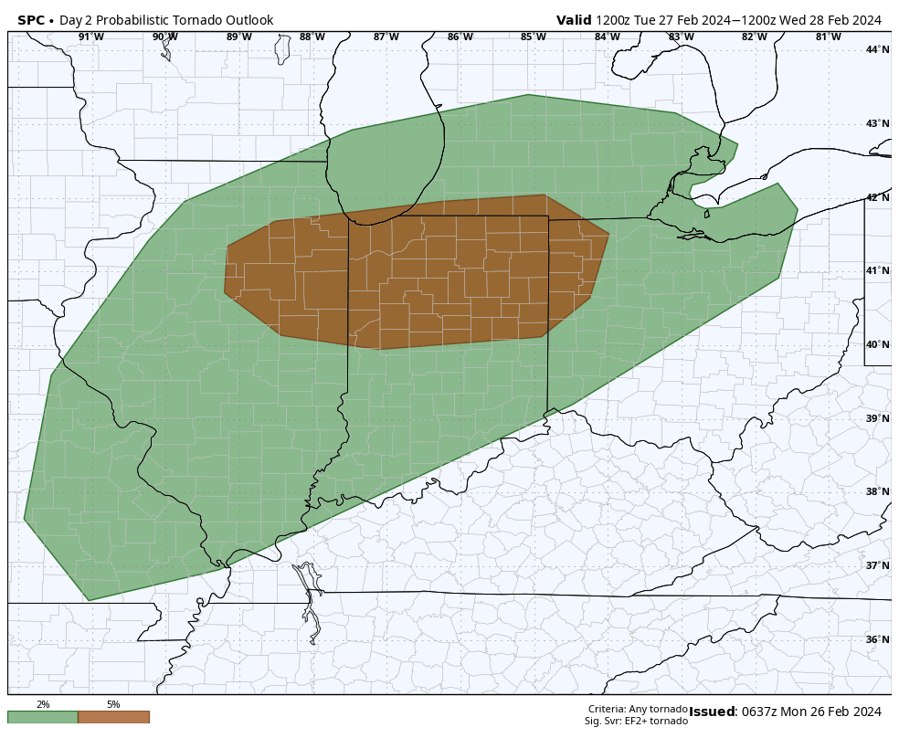
A busy 48 hours in central Indiana, with strong low pressure coming together to our west today, sweeping a cold front through Tuesday night that could bring some severe storms.
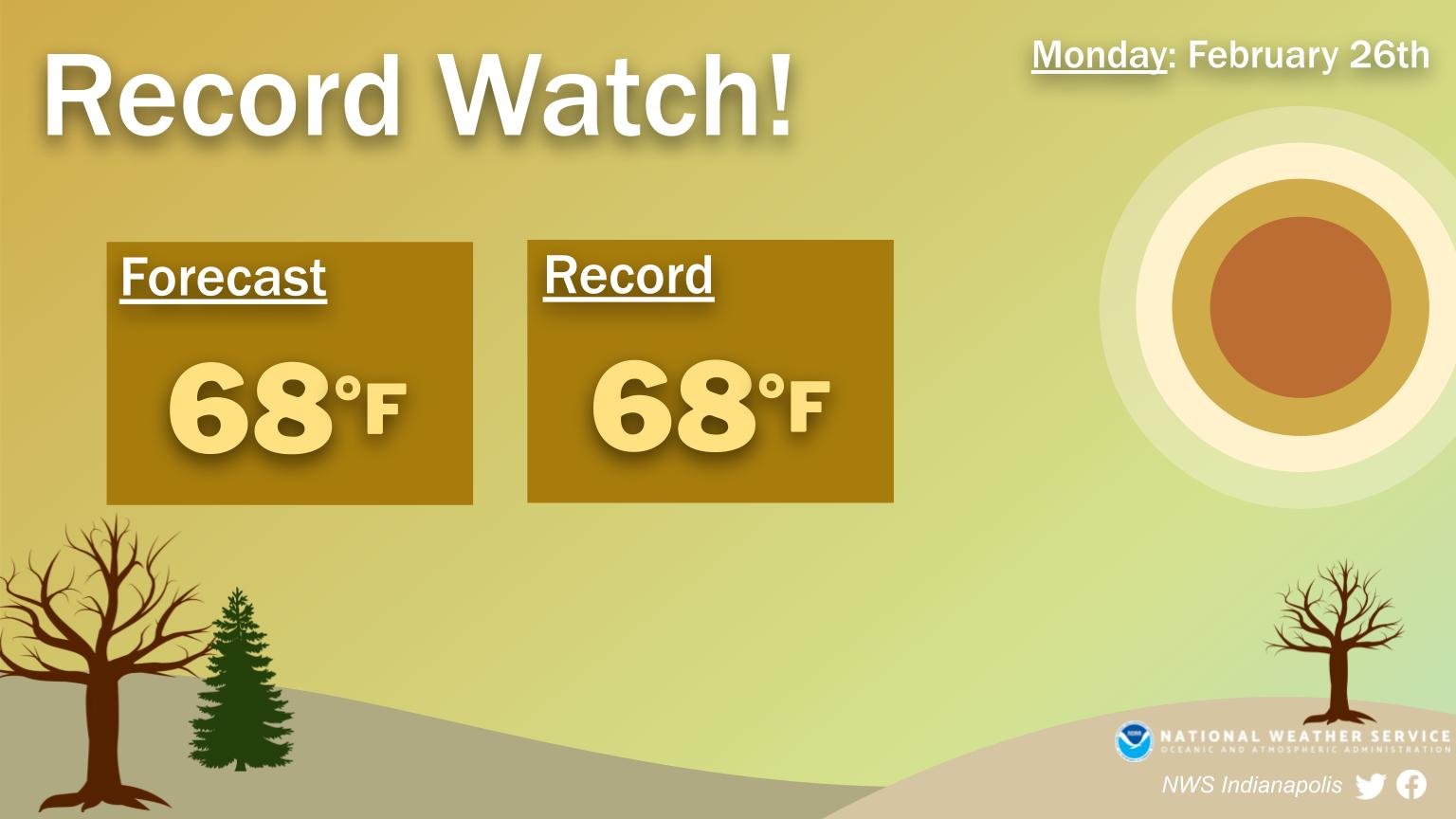
Before all that: a sort-of-Spring-stunner today!
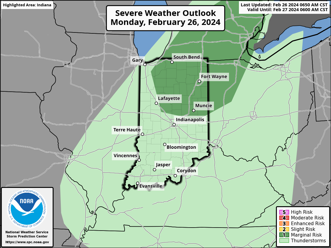
The northern half of Indiana has a threat of storms with large hail in the overnight tonight into Tuesday morning.
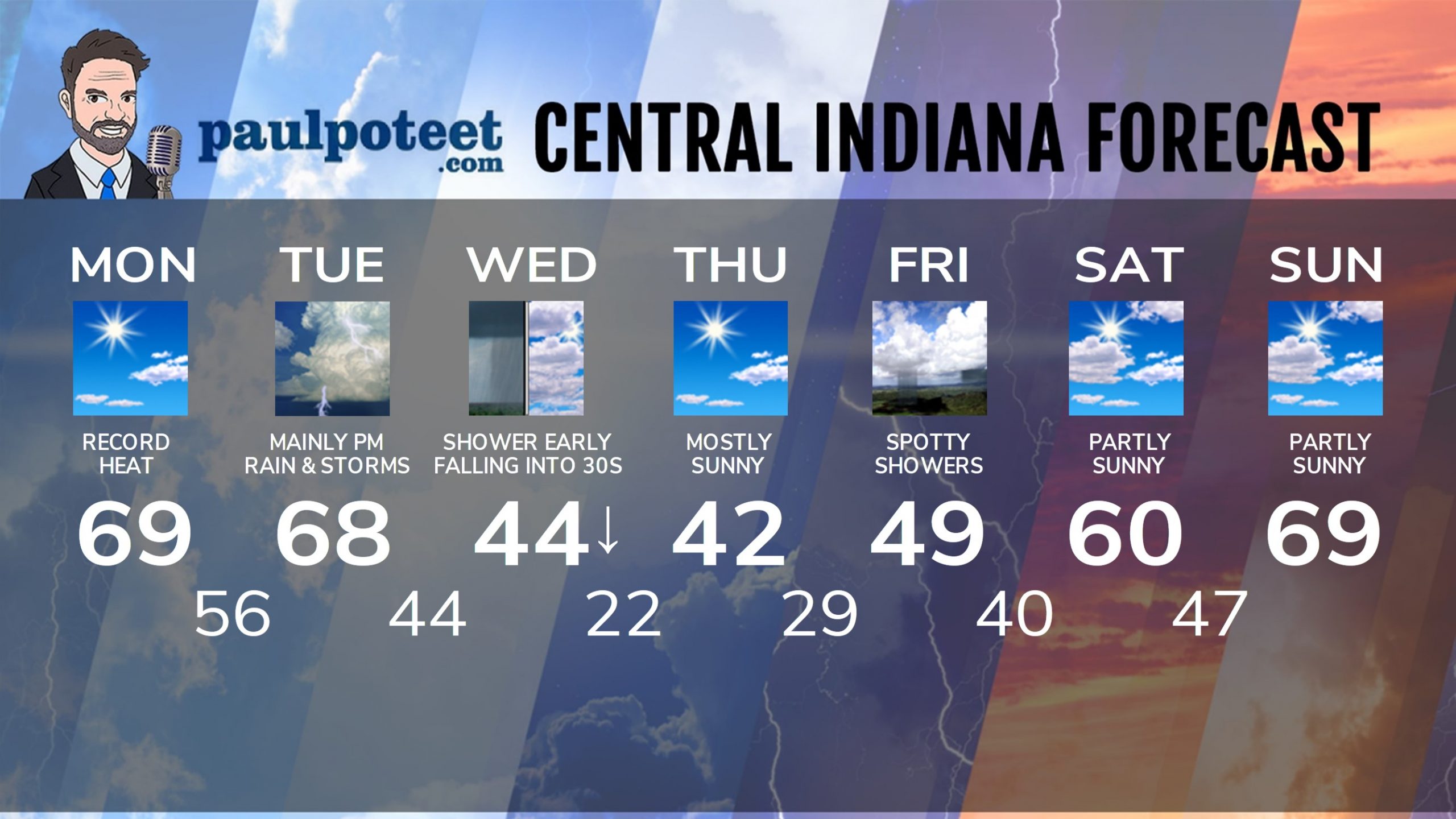
INDY SEVEN DAY FORECAST
Today: Mostly sunny, with record-breaking heat possible. Afternoon wind gusts to 25 mph. High 69.
Tonight: Clouds increase. Scattered showers and storms after midnight. Low 56.
Tuesday: Peeks of sunshine, and still very warm and windy. Scattered showers and storms, mainly in the afternoon. High 68.
Tuesday Night: Showers and storms. Some could be strong to severe. Low 44.
Wednesday: Showers could linger into the early morning. A few snowfalkes could mix in. Temps fall ifrom the mid 40s around sunrise into the 30s by afternoon. High 44.
Wednesday Night: Clear and colder. Low 22.
Thursday: Mostly sunny. High 42.
Thursday Night: Mostly clear. Low 29.
Friday: Partly to mostly cloudy. Spotty showers possible. High 49.
Friday Night: Partly cloudy. Low 40.
Saturday: Partly sunny. High 60.
Saturday Night: Partly sunny. Low 47.
Sunday: Partly sunny. High 69.
Never miss me! Subscribe for free. My Huge Radar has real-time weather tracking, current temperatures, and severe weather watches and warnings. Get detailed Indiana conditions by clicking here. Click here to see my central Indiana 7-Day Forecast. Follow these links to get my forecasts for Lafayette, Muncie, Hendricks County, and Hamilton County. Need a second opinion? Click here for central Indiana National Weather Service forecasts. (Some charts via WeatherBELL.)


