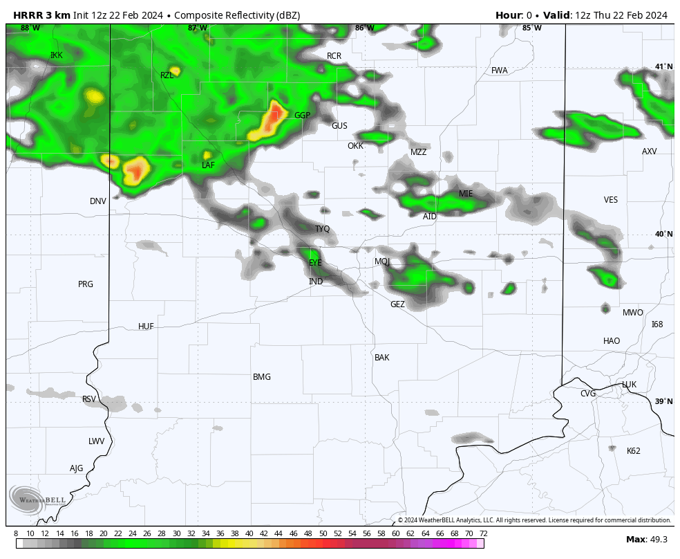
One round of rain and storms in the morning from around Lafayette to Frankfort to Muncie northward, with more to come in the afternoon.
Morning thunderstorms moving into western central #Indiana bringing #hail with them. Storms will continue moving easterly through the morning. #INWX pic.twitter.com/c3EdixEXfZ
— NWS Indianapolis (@NWSIndianapolis) February 22, 2024
The more intense action will start right around Noon, and will be heaviest from Indy east and southeastward.
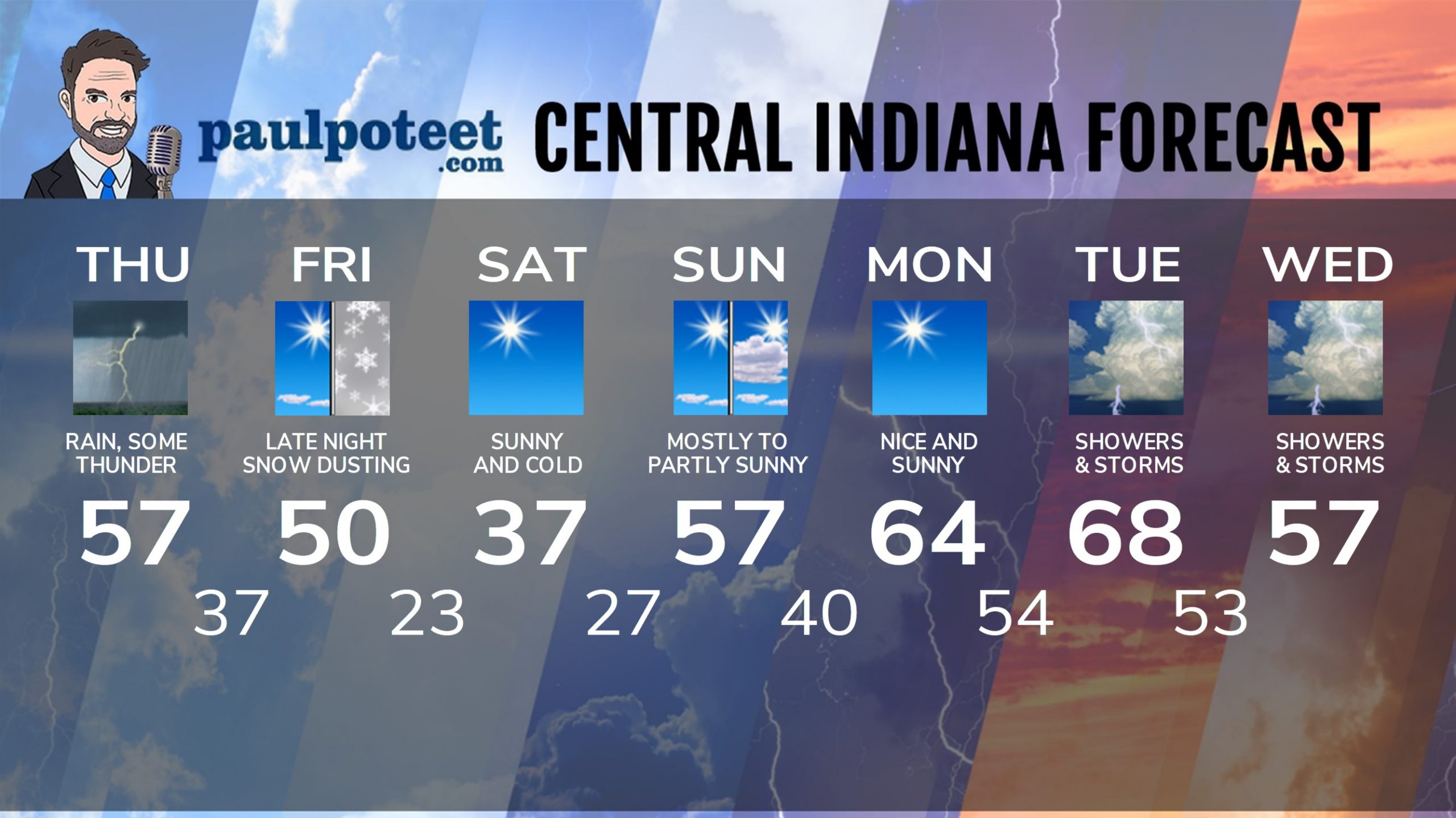
INDY SEVEN DAY FORECAST
#: Indianapolis Forecast#
Today: Scattered morning showers. Periods of rain and storms in the afternoon. High 57.
Tonight: Showers end early. Partly cloudy. Low 37.
Friday: Mostly sunny. High 50.
Friday Night: Clouding up. Snow showers overnight, with a dusting possible. Low 23.
Saturday: Snow showers end early morning, then sunny. High 37.
Saturday Night: Mostly clear. Low 27.
Sunday: Mostly sunny morning. Partly sunny afternoon. High 57.
Sunday Night: Mostly clear. Low 40.
Monday: Sunny. High 64.
Monday Night: Clouding up. Scattered showers late. Low 54.
Tuesday: Scattered showers and storms. Some could be strong to severe. High 68.
Tuesday Night: Scattered showers and storms. Some could be strong to severe. Low 53.
Wednesday: Scattered showers and storms. Some could be strong to severe. High 57.
Never miss me! Subscribe for free. My Huge Radar has real-time weather tracking, current temperatures, and severe weather watches and warnings. Get detailed Indiana conditions by clicking here. Click here to see my central Indiana 7-Day Forecast. Follow these links to get my forecasts for Lafayette, Muncie, Hendricks County, and Hamilton County. Need a second opinion? Click here for central Indiana National Weather Service forecasts. (Some charts via WeatherBELL.)


