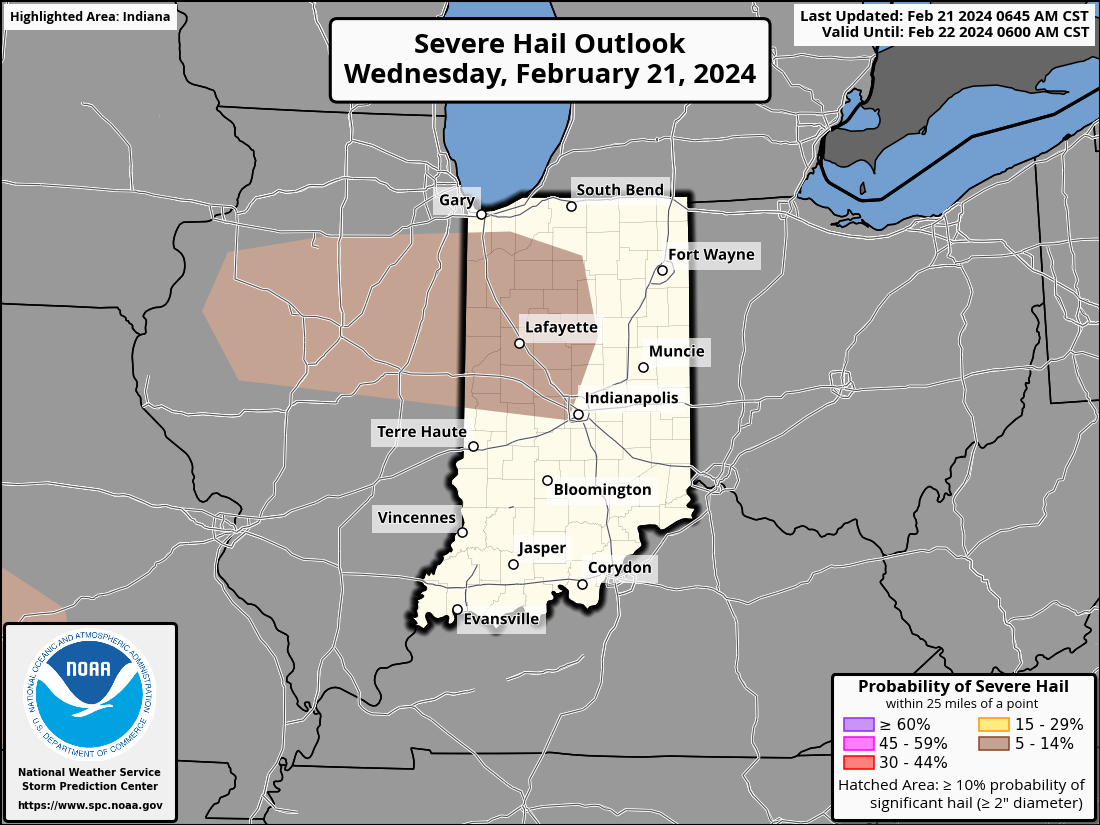
Winter whiplash! By late Friday night a dusting of snow is possible. Tonight thunder is possible, with a large hail risk north and northwest of Indy.
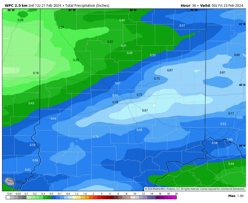
Rain’s the main thing tomorrow, with rain heavy at times, especially east and south of Indy, where totals will be highest.
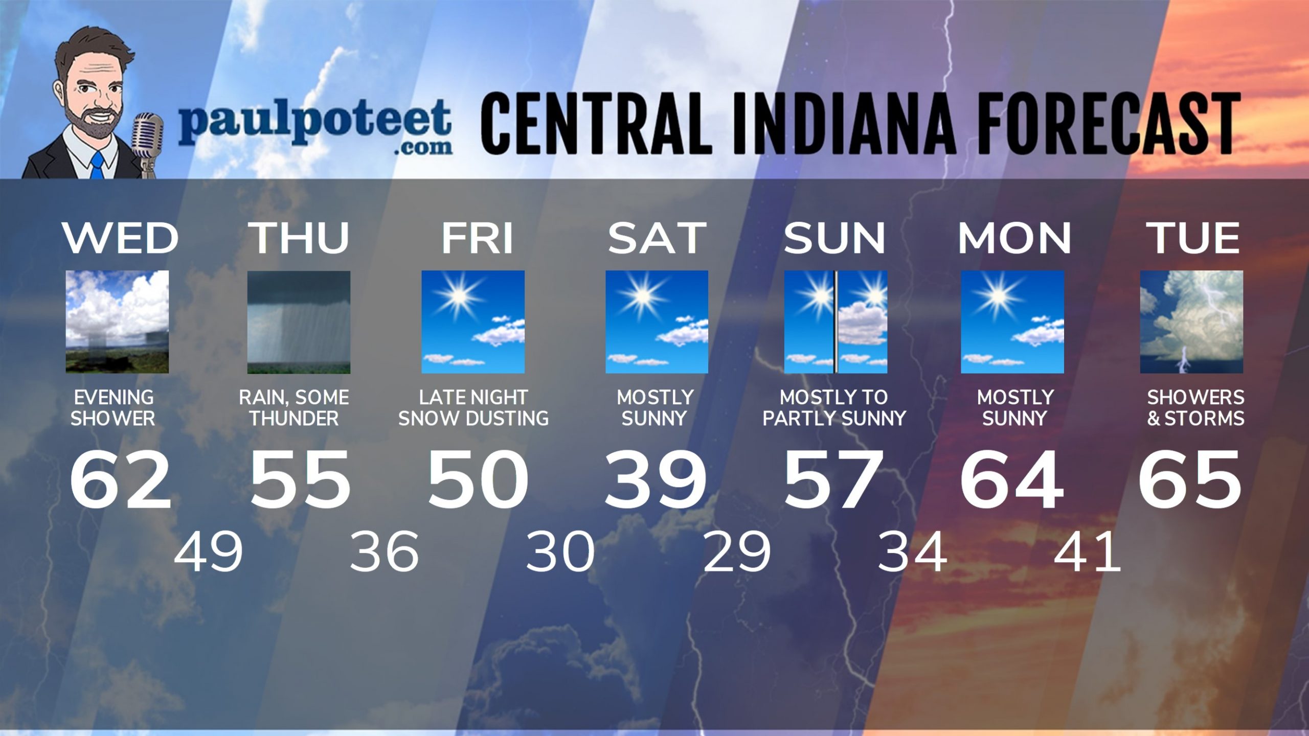
INDY SEVEN DAY FORECAST
Today: Partly to mostly sunny. Wind gusting to 25 mph. High 62.
Tonight: Cloudy, breezy, with scattered showers. Slight storm chance. Low 49.
Thursday: Periods of rain. Thunder possible. High 55.
Thursday Night: Showers end early. Partly cloudy. Low 36.
Friday: Mostly sunny. High 50.
Friday Night: Clouding up. Snow showers overnight, with a dusting possible. Low 30.
Saturday: Becoming mostly sunny. High 39.
Saturday Night: Mostly clear. Low 29.
Sunday: Mostly sunny morning. Partly sunny afternoon. High 57.
Sunday Night: Mostly clear. Low 34.
Monday: Mostly sunny. High 64.
Monday Night: Clouding up. Scattered showers. Low 41.
Tuesday: Showers and storms. High 65.
Never miss me! Subscribe for free. My Huge Radar has real-time weather tracking, current temperatures, and severe weather watches and warnings. Get detailed Indiana conditions by clicking here. Click here to see my central Indiana 7-Day Forecast. Follow these links to get my forecasts for Lafayette, Muncie, Hendricks County, and Hamilton County. Need a second opinion? Click here for central Indiana National Weather Service forecasts. (Some charts via WeatherBELL.)


