Even with almost four inches of snow Friday the season-to-date total is only 8.1 inches. The average would be 20.4 inches at this point. Interestingly enough we are right in line with last season’s total at this point, which is 8.5 inches.
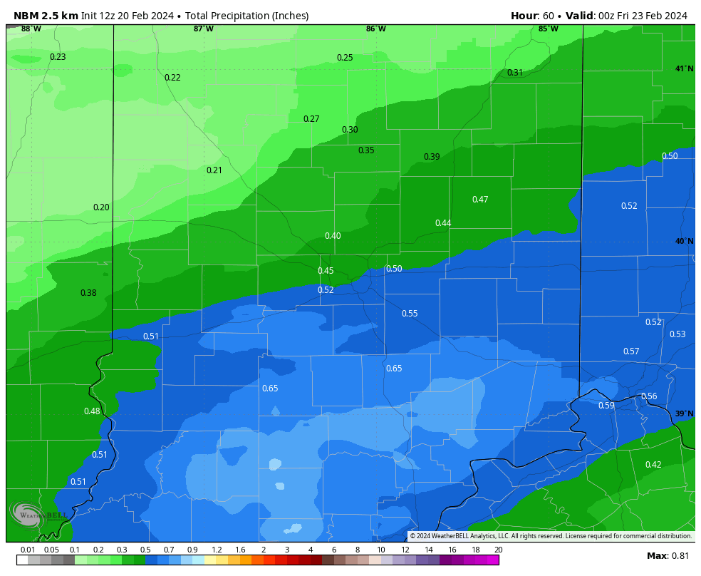
A quarter to a half-inch of rain is likely Thursday. The heaviest/steadiest rain is likely in the midday and afternoon. Thunder is also possible!
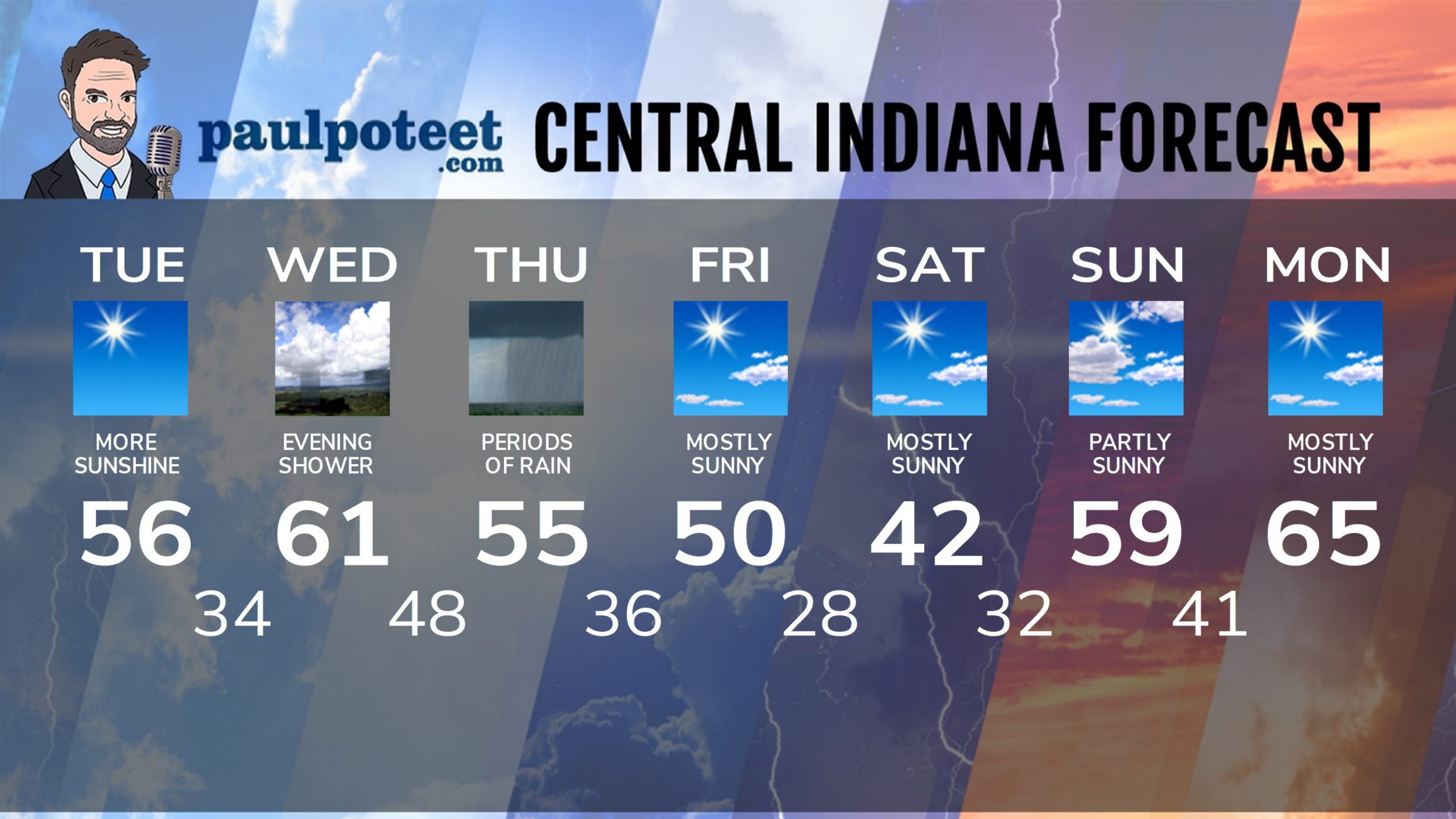
INDY SEVEN DAY FORECAST
Today: Sunny and warmer. High 56.
Tonight: Mostly clear. Low 34.
Wednesday: Mostly to partly sunny. High 61.
Wednesday Night: Clouding up. Spotty shower possible. Low 48.
Thursday: Periods of rain. Thunder possible. High 55.
Thursday Night: Showers end early. Partly cloudy. Low 36.
Friday: Mostly sunny. High 50.
Friday Night: Mostly clear. Low 28.
Saturday: Mostly sunny. High 42.
Saturday Night: Mostly clear. Low 32.
Sunday: Partly sunny. Breezy. High 59.
Sunday Night: Mostly clear. Low 41.
Monday: Mostly sunny. High 65.
Never miss me! Subscribe for free. My Huge Radar has real-time weather tracking, current temperatures, and severe weather watches and warnings. Get detailed Indiana conditions by clicking here. Click here to see my central Indiana 7-Day Forecast. Follow these links to get my forecasts for Lafayette, Muncie, Hendricks County, and Hamilton County. Need a second opinion? Click here for central Indiana National Weather Service forecasts. (Some charts via WeatherBELL.)


