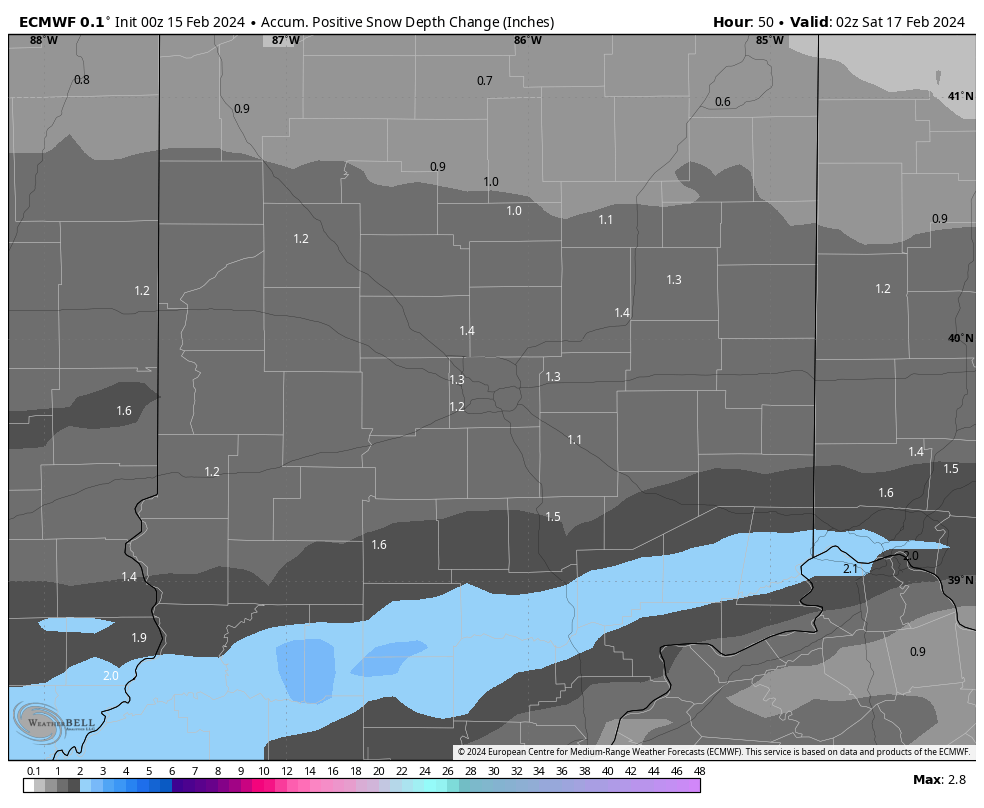
On with the show, this is it! The last mild day! Well, until we go back above average Sunday. A few showers Thursday morning, then a break, then full-on Winter Friday and Saturday. Tomorrow’s snow should amount to an inch…maybe a little more on some surfaces, mainly in the afternoon and evening.
INDY SEVEN DAY FORECAST
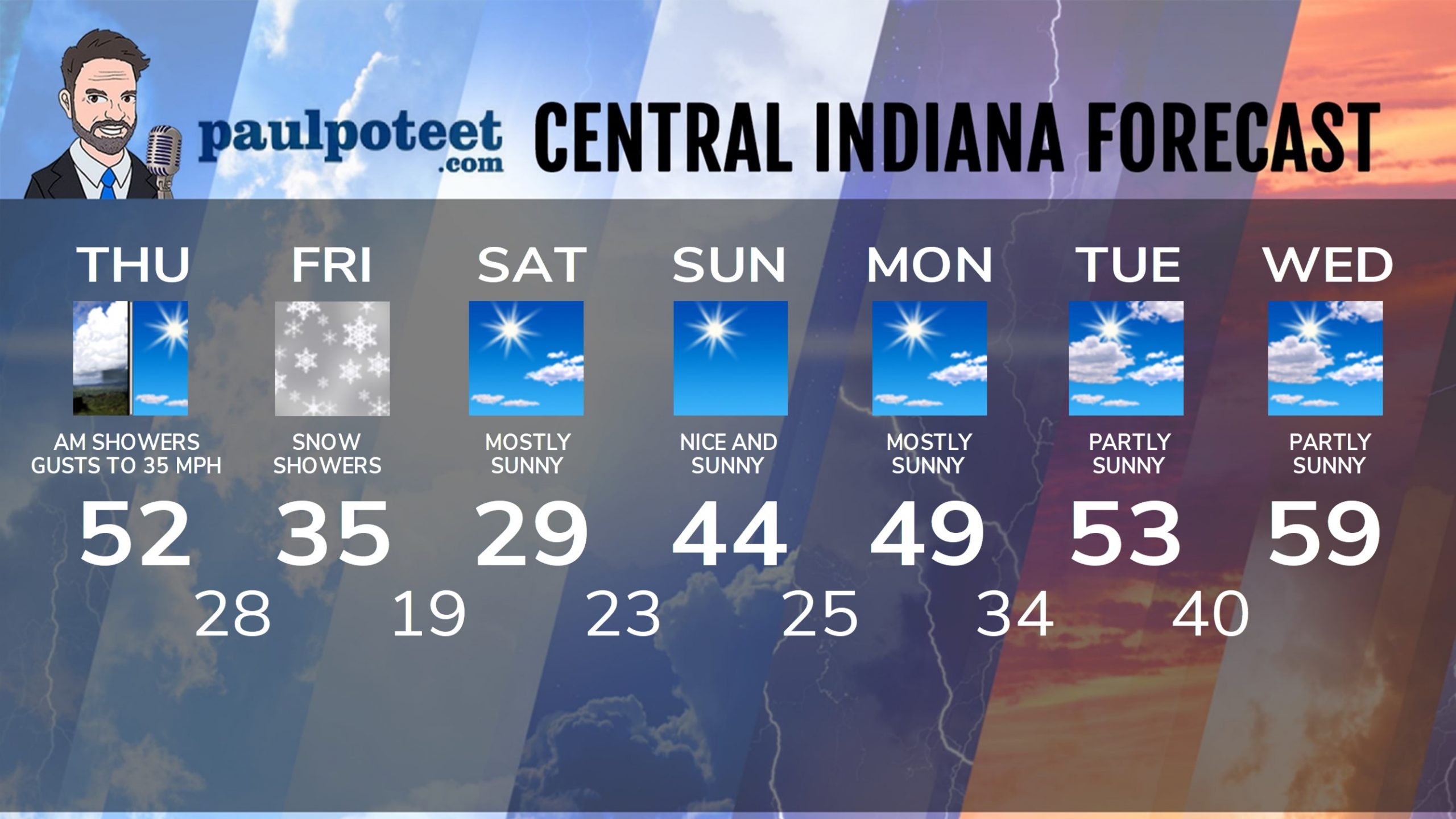
Today: Scattered morning showers. Sun returns by afternoon. Wind gusts to 35 mph. High 52.
Tonight: Partly cloudy. Low 28.
Friday: Snow showers, especially in the afternoon. Much colder. Chills in the 20s. High 35.
Friday Night: Snow showers ending by late evening. Final totals around an inch. Chills in the teens. Low 19.
Saturday: Mostly sunny. Wind gusts to 25 mph. Chills in the TEENS. High 29.
Saturday Night: Mostly clear. Wind gusts to 25 mph. Low 23.
Sunday: Sunny. Still a little breezy. High 44.
Sunday Night: Clear. Low 25.
Monday: Sunny morning. Mostly sunny afternoon. High 49.
Monday Night: Partly cloudy. Low 34.
Tuesday: Partly sunny. High 53.
Tuesday Night: Partly cloudy. Low 40.
Wednesday: Partly sunny. High 59.
Never miss me! Subscribe for free. My Huge Radar has real-time weather tracking, current temperatures, and severe weather watches and warnings. Get detailed Indiana conditions by clicking here. Click here to see my central Indiana 7-Day Forecast. Follow these links to get my forecasts for Lafayette, Muncie, Hendricks County, and Hamilton County. Need a second opinion? Click here for central Indiana National Weather Service forecasts. (Some charts via WeatherBELL.)


