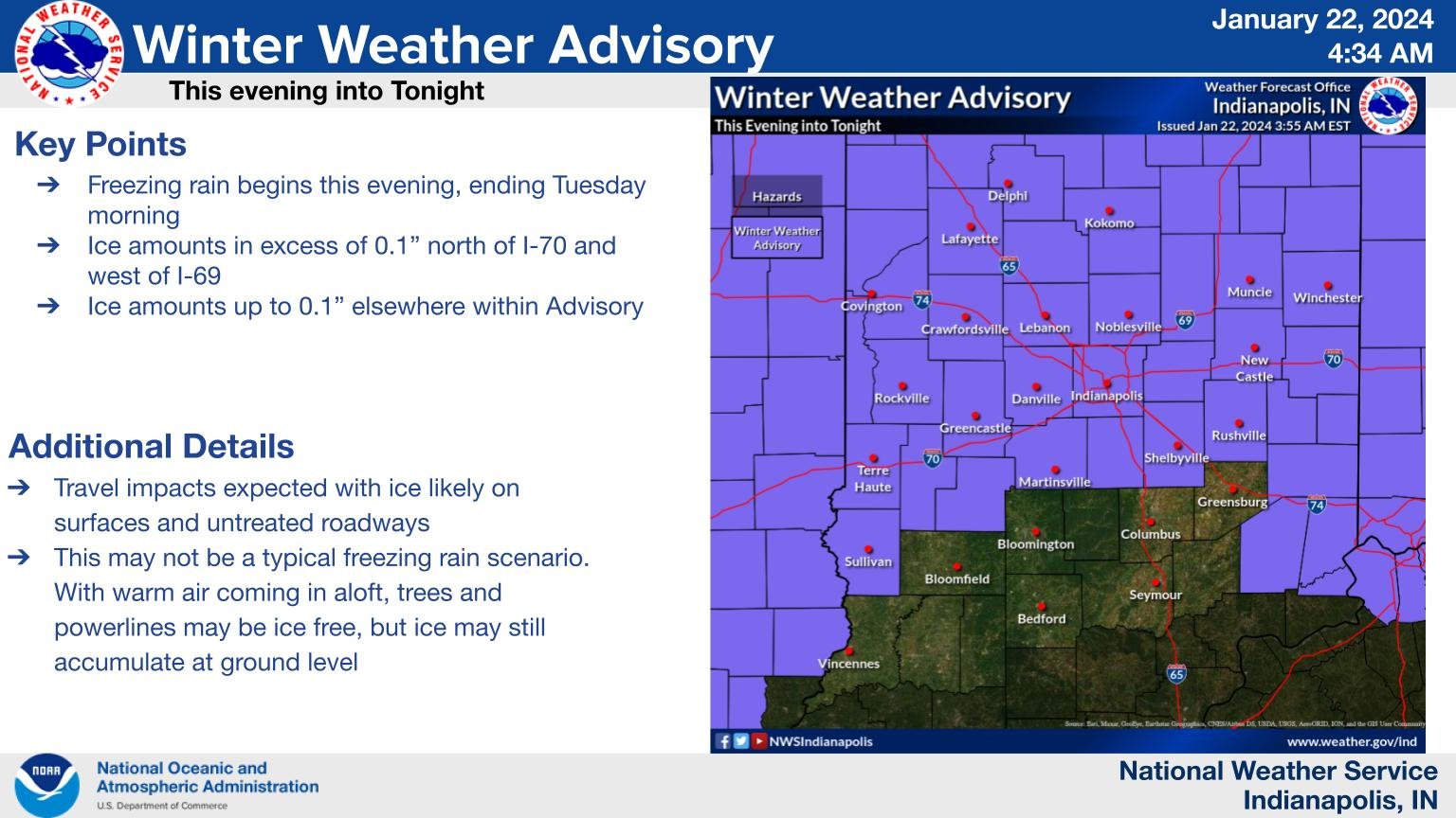
Air temperatures (the ones we speak of all the time) are measured about six feet above the surface, so although those air temps will be right around freezing or only slightly below it tonight… the actual temperatures at the surface may lag a few degrees, given the recent sub-zero chill and snow pack. So the Winter Weather Advisory is “grounded,” if you will, in that possibility. This shouldn’t be a threat to power lines and trees higher up, but any un-treated surface, such as sidewalks, parking lots, and minor roads, could ice up overnight into Tuesday morning. Road temperature models don’t show temps much below freezing, so main/treated roads probably won’t be a huge problem. Freezing rain will arrive across northwestern Indiana first this evening with additional ice accumulations expected through the night. So: heads up first around Lafayette, then the rest of central Indiana after about 10pm tonight. Freezing rain will then transition to rain through mid to late Tuesday morning.
INDY SEVEN DAY FORECAST
Today: Mostly cloudy. Not as cold. High 34.
Tonight: WINTER WEATHER ADVISORY. Scattered showers of rain and/or freezing rain. Low 31.
Tuesday: WINTER WEATHER ADVISORY THROUGH MORNING DRIVE. Early morning mix changes to rain by midday. High 40.
Tuesday Night: Rainy. Low 37.
Wednesday: Rainy. High 48.
Wednesday Night: Rainy. Low 45.
Thursday: More rain. High 54.
Thursday Night: Scattered showers. Low 39.
Friday: Mostly cloudy. High 45.
Friday Night: Mostly cloudy. Low 36.
Saturday: Scattered showers return. High 42.
Saturday Night: Scattered showers of rain, possibly mixed with snow. Low 33.
Sunday: Mostly cloudy. High 39.

Never miss me! Subscribe for free. My Huge Radar has real-time weather tracking, current temperatures, and severe weather watches and warnings. Get detailed Indiana conditions by clicking here. Click here to see my central Indiana 7-Day Forecast. Follow these links to get my forecasts for Lafayette, Muncie, Hendricks County, and Hamilton County. Need a second opinion? Click here for central Indiana National Weather Service forecasts. (Some charts via WeatherBELL.)


