In general it looks like about two inches of snow fell across most of central Indiana overnight and early this morning. The snow (especially later on) is dry and powderly, and is being blown about by nasty northwesterly winds that have driven chills back into single digits.
INDY SEVEN DAY FORECAST
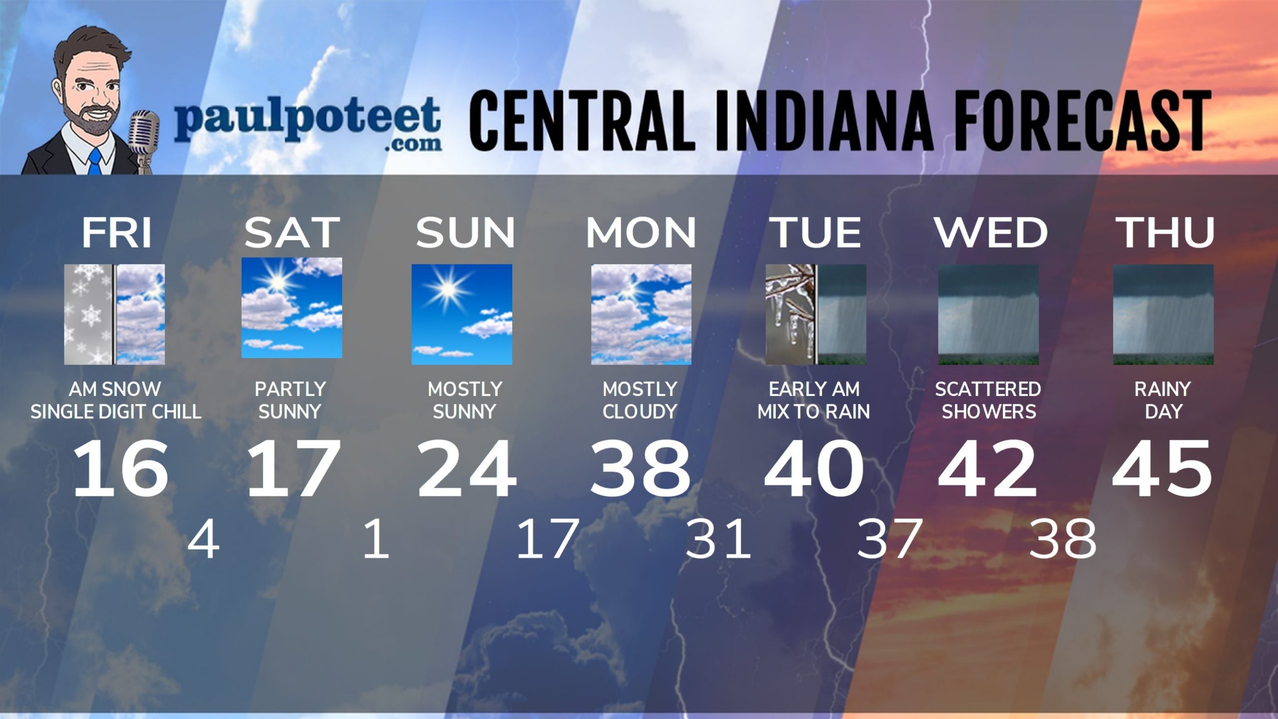
Today: Morning snow diminishes to scattered snow showers. Breezy northwest wind produces blowing snow and single digit wind chills! Final storm totals as little as 1 or as much as 3 inches. Winter Weather Advisory ends at 10am. Temps fall into, and stay steady in the mid teens.
Tonight: Wind Chill Advisory begins at 7pm. Chills as low as -15. Mostly cloudy. Scattered snow showers or flurries. Low 4.
Saturday: Wind Chill Advisory ends at 10am. Partly sunny. High 17.
Saturday Night: Mostly clear. Low 1.
Sunday: Mostly sunny. High 24.
Sunday Night: Partly cloudy. Low 17.
Monday: Mostly cloudy. High 38.
Monday Night: Mostly cloudy. Scattered showers of rain and/or freezing rain after midnight. Low 31.
Tuesday: Early morning mix changes to rain. High 40.
Tuesday Night: Rainy. Low 37.
Wednesday: Scattered showers. High 42.
Wednesday Night: Scattered showers. Low 38.
Thursday: Rainy. High 45.
Never miss me! Subscribe for free. My Huge Radar has real-time weather tracking, current temperatures, and severe weather watches and warnings. Get detailed Indiana conditions by clicking here. Click here to see my central Indiana 7-Day Forecast. Follow these links to get my forecasts for Lafayette, Muncie, Hendricks County, and Hamilton County. Need a second opinion? Click here for central Indiana National Weather Service forecasts. (Some charts via WeatherBELL.)


