Hope you enjoyed White-Week-Before-Christmas yesterday! The next chance of snow doesn’t come until next Thursday. The sky is brighter and the wind lighter today. A little rain will be around Friday afternoon through Saturday morning. A *lot* of rain is possible starting Christmas Day. Here’s the blend of several different computer models for precipitation in that period.
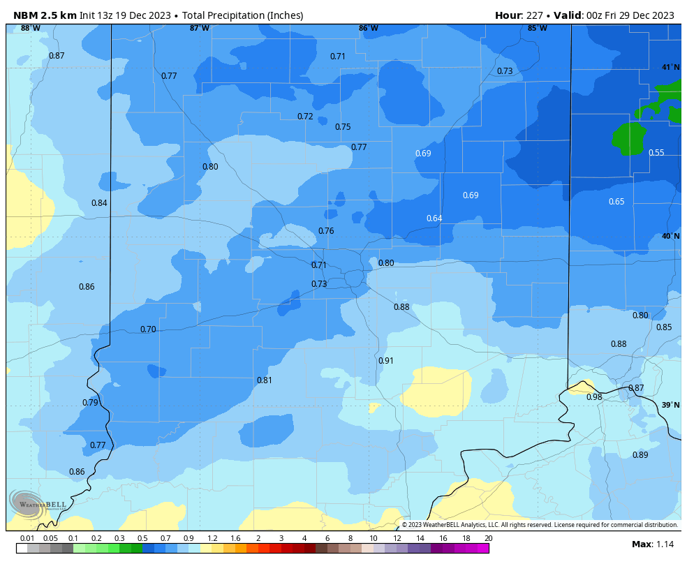
Some individual computer modeling has the totals exceeding two inches. We need every drop.
Never miss me! Subscribe for free. My Huge Radar has real-time weather tracking, current temperatures, and severe weather watches and warnings. Get detailed Indiana conditions by clicking here. Click here to see my central Indiana 7-Day Forecast. Follow these links to get my forecasts for Lafayette, Muncie, Hendricks County, and Hamilton County. Need a second opinion? Click here for central Indiana National Weather Service forecasts. (Some charts via WeatherBELL.)
INDY SEVEN DAY FORECAST
Today: Sunny morning. Mostly sunny afternoon. Still cold, but not windy. High 35.
Tonight: Partly cloudy. Low 27.
Wednesday: Mostly sunny. High 47.
Wednesday Night: Clouds thicken. Low 32.
Thursday: Mostly cloudy. High 49.
Thursday Night: Mostly cloudy. Low 37.
Friday: Scattered showers, mainly in the afternoon. High 50.
Friday Night: Scattered showers. Low 43.
Saturday: Scattered showers, mainly in the morning. High 50.
Saturday Night: Scattered showers. Low 44.
Sunday: Mostly cloudy. High 54.
Christmas Eve: Showers after midnight. Low 48.
Christmas Day: Rainy. High 57.

Never miss me! Subscribe for free. My Huge Radar has real-time weather tracking, current temperatures, and severe weather watches and warnings. Get detailed Indiana conditions by clicking here. Click here to see my central Indiana 7-Day Forecast. Follow these links to get my forecasts for Lafayette, Muncie, Hendricks County, and Hamilton County. Need a second opinion? Click here for central Indiana National Weather Service forecasts. (Some charts via WeatherBELL.)


