Indy is running a big 5.7 degrees above average for the month of December so far. We are in the other direction with precipitation, with only 40% of what we should have had so far. About one-half to three-quarters of an inch of rainfall could fall Saturday night into Sunday morning.
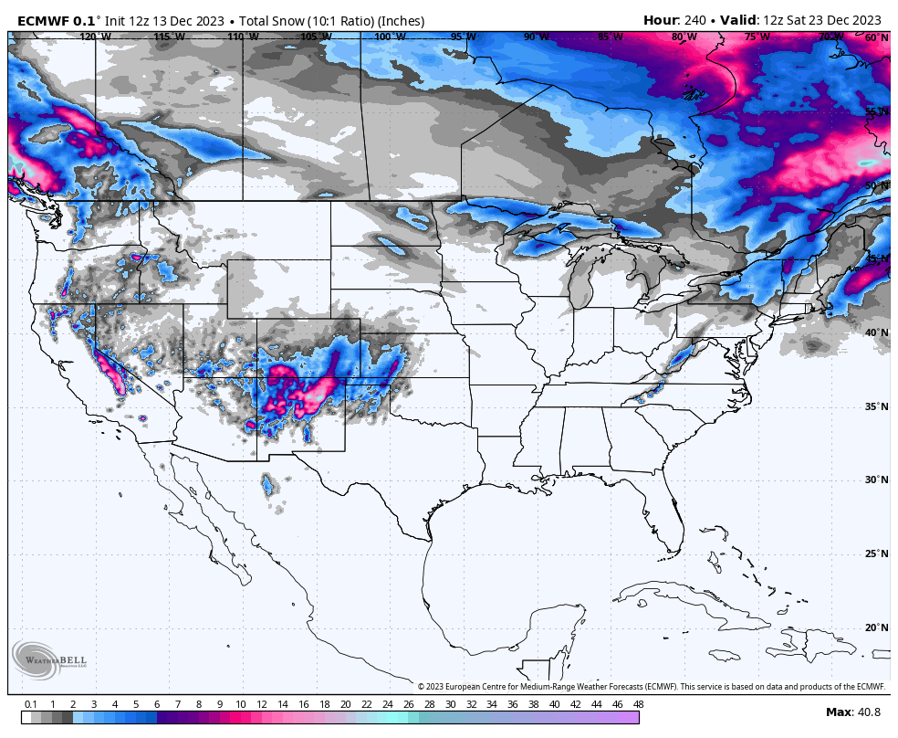
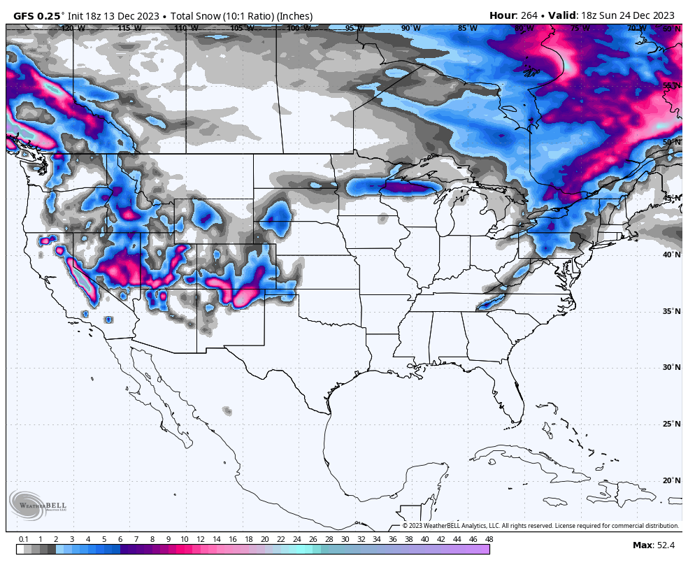
Precipitation looks to be all liquid. Snow is unlikely for the next week-plus, from both major medium-range computer models. These charts show accumulated snowfall for the period.
Never miss me! Subscribe for free. My Huge Radar has real-time weather tracking, current temperatures, and severe weather watches and warnings. Get detailed Indiana conditions by clicking here. Click here to see my central Indiana 7-Day Forecast. Follow these links to get my forecasts for Lafayette, Muncie, Hendricks County, and Hamilton County. Need a second opinion? Click here for central Indiana National Weather Service forecasts. (Some charts via WeatherBELL.)
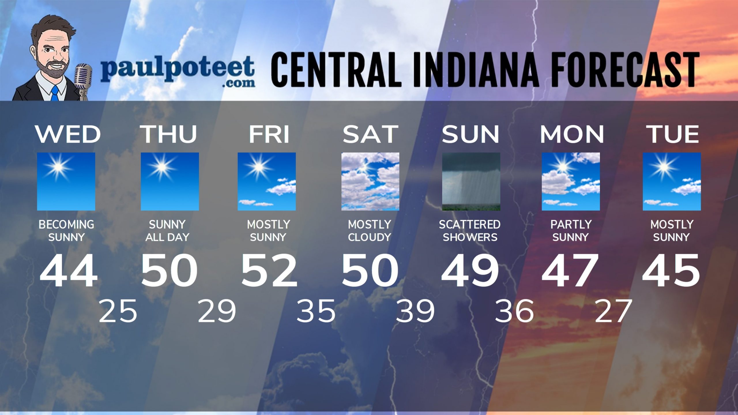
INDY SEVEN DAY FORECAST
Today: Sunny. High 51.
Tonight: Clear. Low 29.
Friday: Mostly sunny. High 53.
Friday Night: Clouding up. Low 36.
Saturday: Mostly cloudy. High 50.
Saturday Night: Cloudy. Scattered showers. Low 40.
Sunday: Mostly cloudy. Scattered showers, especially in the morning. High 48.
Sunday Night: Partly cloudy. Low 37.
Monday: Partly sunny. High 44.
Monday Night: Mostly clear. Low 24.
Tuesday: Mostly sunny. High 42.
Tuesday Night: Partly cloudy. Low 28.
Wednesday: Partly sunny. High 46.
Never miss me! Subscribe for free. My Huge Radar has real-time weather tracking, current temperatures, and severe weather watches and warnings. Get detailed Indiana conditions by clicking here. Click here to see my central Indiana 7-Day Forecast. Follow these links to get my forecasts for Lafayette, Muncie, Hendricks County, and Hamilton County. Need a second opinion? Click here for central Indiana National Weather Service forecasts. (Some charts via WeatherBELL.)


