Cold chills in the 20s Monday morning, just 48 hours after a record-tying 65 degrees at Noon Saturday. That’s 23 degrees above average. We will get back to around 50 by Friday. Overall the temperature trend is a bit above average through Christmas Day, not that I’m trying to crush your dreams. The long-range trend through March is above average. (Thanks El-Nino.) Not that every day will be warm, and that it won’t snow—just less chill and less white than averag.e

Never miss me! Subscribe for free. My Huge Radar has real-time weather tracking, current temperatures, and severe weather watches and warnings. Get detailed Indiana conditions by clicking here. Click here to see my central Indiana 7-Day Forecast. Follow these links to get my forecasts for Lafayette, Muncie, Hendricks County, and Hamilton County. Need a second opinion? Click here for central Indiana National Weather Service forecasts. (Some charts via WeatherBELL.)
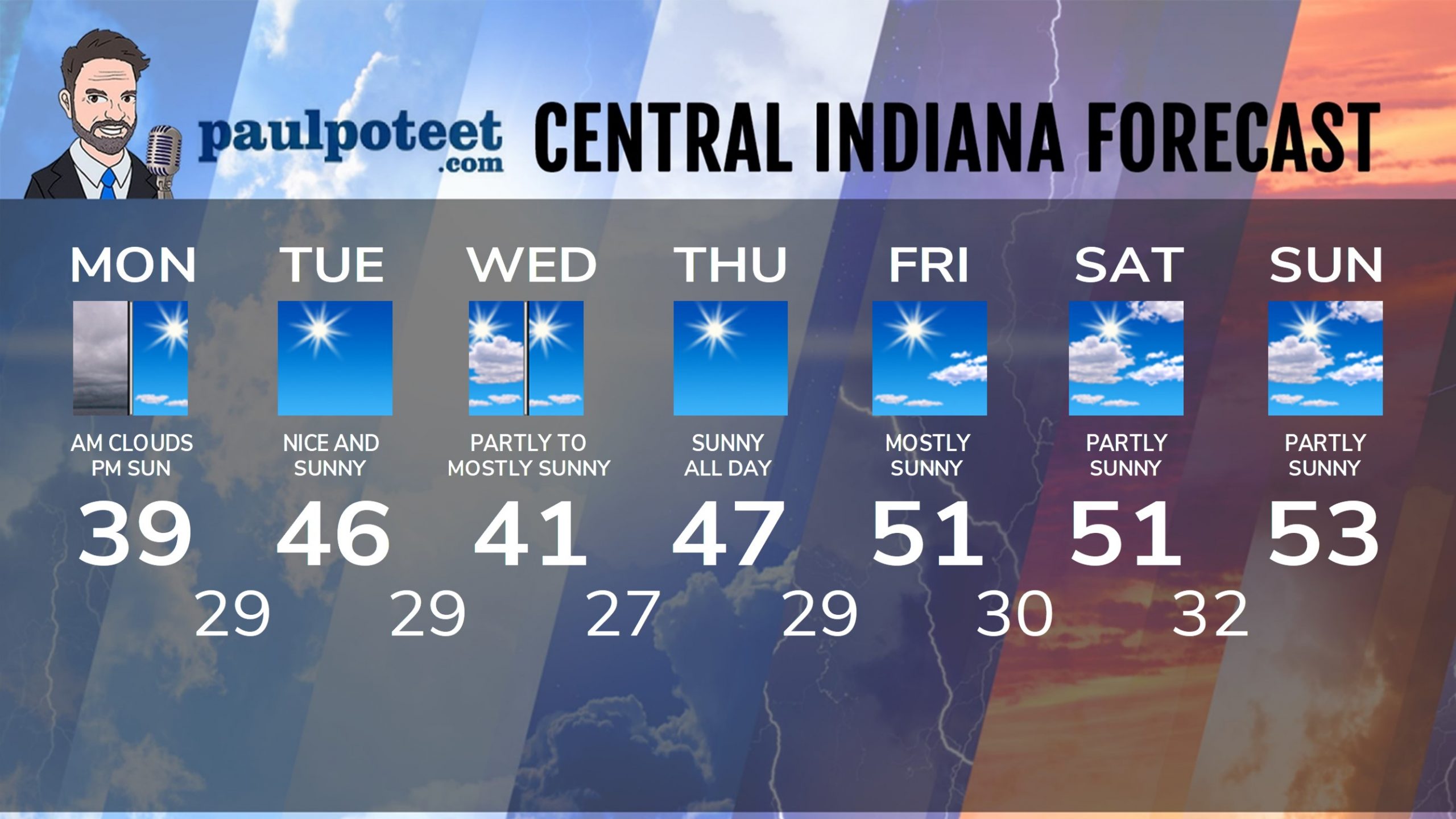
INDY SEVEN DAY FORECAST
Today: Cloudy start. Sunny by afternoon. High 39.
Tonight: Clear. Low 29.
Tuesday: Sunny. High 46.
Tuesday Night: Partly cloudy. Low 29.
Wednesday: Partly to mostly sunny. High 41.
Wednesday Night: Mostly clear. Low 27.
Thursday: Sunny. High 47.
Thursday Night: Clear. Low 29.
Friday: Mostly sunny. High 51.
Friday Night: Partly cloudy. Low 30.
Saturday: Partly sunny. High 51.
Saturday Night: Partly cloudy. Low 32.
Sunday: Partly sunny. High 53.
Never miss me! Subscribe for free. My Huge Radar has real-time weather tracking, current temperatures, and severe weather watches and warnings. Get detailed Indiana conditions by clicking here. Click here to see my central Indiana 7-Day Forecast. Follow these links to get my forecasts for Lafayette, Muncie, Hendricks County, and Hamilton County. Need a second opinion? Click here for central Indiana National Weather Service forecasts. (Some charts via WeatherBELL.)


