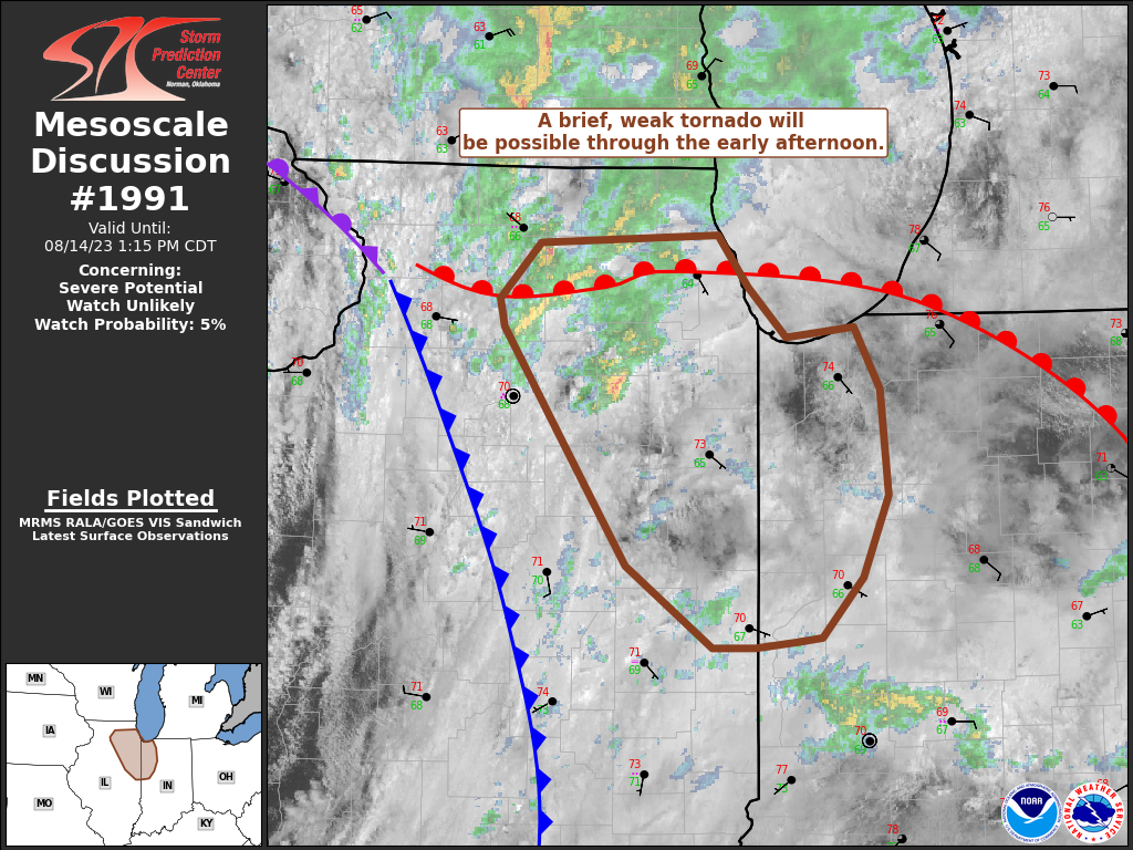
A deep area of low pressure is moving eastward this afternoon. It is centered around northern Illinois and Iowa, and in the area where near that, and where three fronts meet is the most likely spot for a brief tornado to spin up.

As of 2pm there’s been 0.37″ of rain at Indy, and 0.60″ in Muncie. Only a couple hundredths of an inch has fallen in Lafayette and the Haute.
Never miss me! Subscribe for free. My Huge Radar has real-time weather tracking, current temperatures, and severe weather watches and warnings. Get detailed Indiana conditions by clicking here. Click here to see my central Indiana 7-Day Forecast. Follow these links to get my forecasts for Lafayette, Muncie, Hendricks County, and Hamilton County. Need a second opinion? Click here for central Indiana National Weather Service forecasts. (Some charts via WeatherBELL.)
INDY SEVEN DAY FORECAST
Today: Periods of showers in the morning. Showers and storms that could become severe in the mid to late afternoon. High 78.
Tonight: Evening showers and storms that could be severe. Partly cloudy after midnight. Low 61.
Tuesday: Mostly cloudy morning. Partly sunny, with an isolated afternoon shower possible. High 74.
Tuesday Night: Clouds decrease. Low 56.
Wednesday: Mostly sunny. High 79.
Wednesday Night: Clear. Low 60.
Thursday: Morning sun. Scattered late afternoon showers and storms. High 82.
Thursday Night: Scattered early evening shower or storm, then clearing. Low 59.
Friday: Sunny. High 81.
Friday Night: Clear. Low 57.
Saturday: Sunny. High 86.
Saturday Night: Clear. Low 64.
Sunday: Mostly sunny. Hot and humid. High 89.
Never miss me! Subscribe for free. My Huge Radar has real-time weather tracking, current temperatures, and severe weather watches and warnings. Get detailed Indiana conditions by clicking here. Click here to see my central Indiana 7-Day Forecast. Follow these links to get my forecasts for Lafayette, Muncie, Hendricks County, and Hamilton County. Need a second opinion? Click here for central Indiana National Weather Service forecasts. (Some charts via WeatherBELL.)


