Behold! I bring you tidings of good weather news. Relief from tick haze, big heat, and ongoing drought.
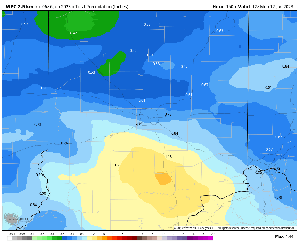
The smoke should finally thin tomorrow. The highs tomorrow through Friday will be back to average. And you’ll get a little dry-weather relief this evening, but the biggest punch of precipitation will arrive Sunday. Could reach an inch of rainfall in some parts of the state! Say a prayer and do a dance.
Never miss me! Subscribe for free. My Huge Radar has real-time weather tracking, current temperatures, and severe weather watches and warnings. Get detailed Indiana conditions by clicking here. Click here to see my central Indiana 7-Day Forecast. Follow these links to get my forecasts for Lafayette, Muncie, Hendricks County, and Hamilton County. Need a second opinion? Click here for central Indiana National Weather Service forecasts. (Some charts via WeatherBELL.)
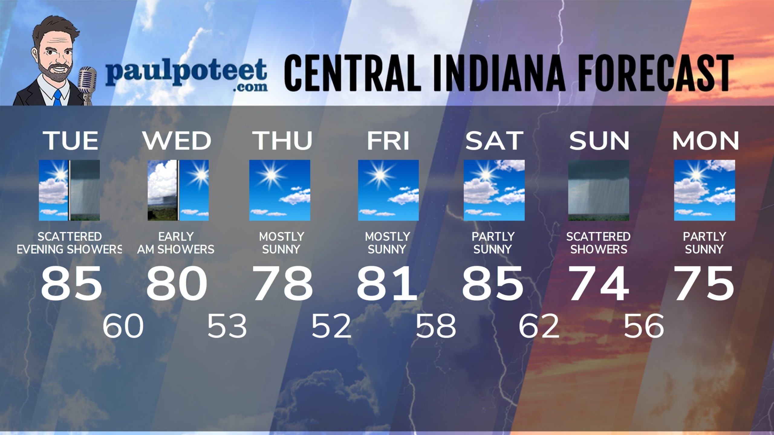
INDY SEVEN DAY FORECAST
Today: Hazy morning sunshine, then clouds increase for the afternoon. High 85.
Tonight: Scattered showers. Low 60.
Wednesday: A few early morning showers, then sunny. High 80.
Wednesday Night: Clear. Low 53.
Thursday: Mostly sunny. High 78.
Thursday Night: Mostly clear. Low 52.
Friday: Mostly sunny. High 81.
Friday Night: Mostly clear. Low 58.
Saturday: Partly sunny. High 85.
Saturday Night: Partly cloudy. Low 62.
Sunday: Mostly cloudy. Scattered showers. Thunder possible. High 74.
Sunday Night: Spotty evening showers, then partly cloudy. Low 56.
Monday: Partly sunny. High 75.
Never miss me! Subscribe for free. My Huge Radar has real-time weather tracking, current temperatures, and severe weather watches and warnings. Get detailed Indiana conditions by clicking here. Click here to see my central Indiana 7-Day Forecast. Follow these links to get my forecasts for Lafayette, Muncie, Hendricks County, and Hamilton County. Need a second opinion? Click here for central Indiana National Weather Service forecasts. (Some charts via WeatherBELL.)


