A cold front is coming Wednesday night, but it still looks no moisture is available. The wind will get gusty Wednesday night into Thursday, and high temperatures will drip back below average Thursday.
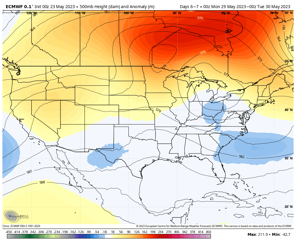
The weekend wild card is low pressure that will come together near the East Coast.

It will be reflected in the upper atmosphere also.
If things wiggle a little more westward there *could* be a small chance for showers. Race fans needn’t worry too much, but it’s a possibility. Humidity will remain comfortable through Memorial Day.
Never miss me! Subscribe for free. My Huge Radar has real-time weather tracking, current temperatures, and severe weather watches and warnings. Get detailed Indiana conditions by clicking here. Click here to see my central Indiana 7-Day Forecast. Follow these links to get my forecasts for Lafayette, Muncie, Hendricks County, and Hamilton County. Need a second opinion? Click here for central Indiana National Weather Service forecasts. (Some charts via WeatherBELL.)
INDY SEVEN DAY FORECAST
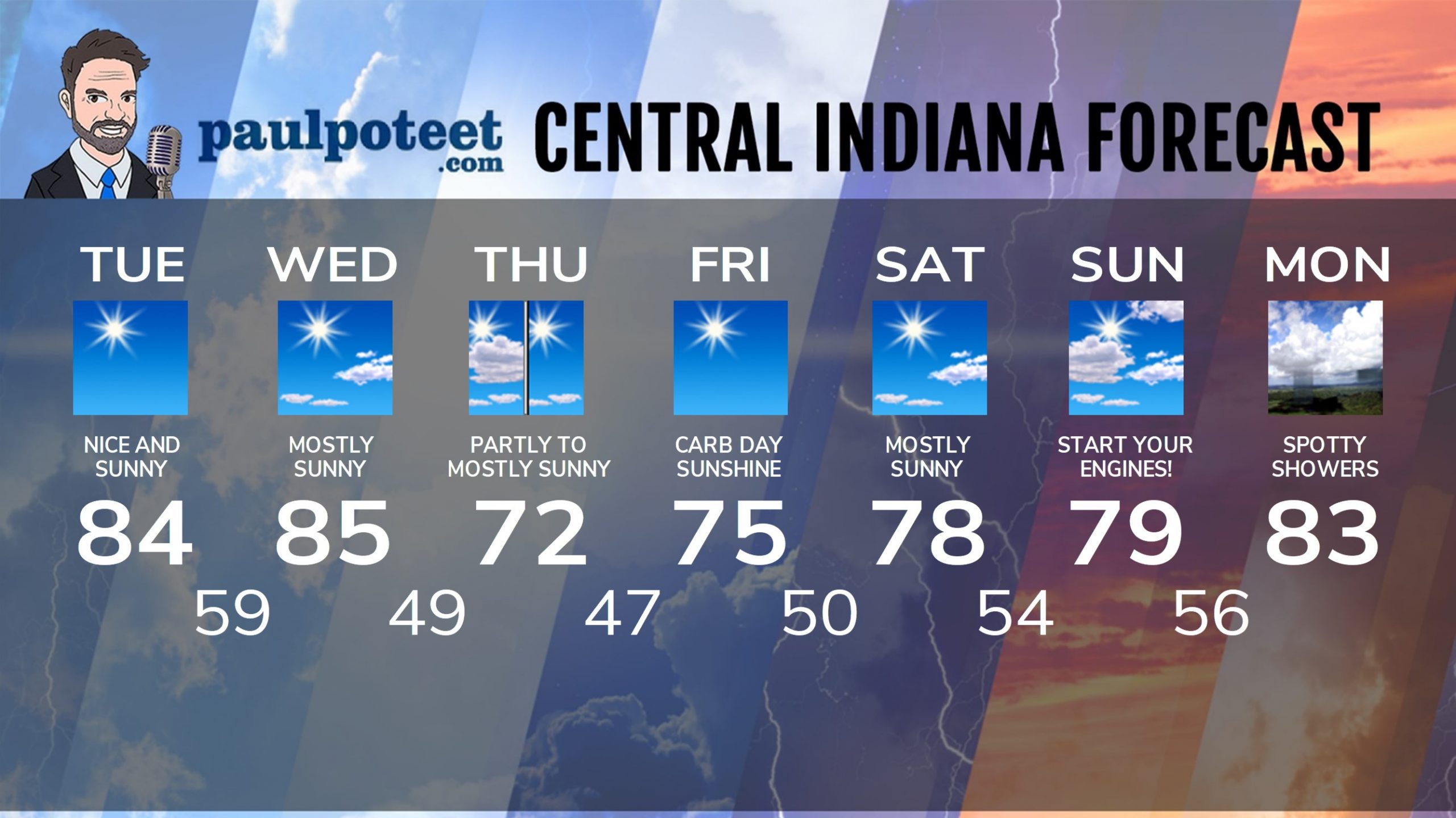
Today: Sunny! High 84.
Tonight: Clear. Low 59.
Wednesday: Mostly sunny. High 85.
Wednesday Night: Partly cloudy. Wind gusts to 30 mph. Low 49.
Thursday: Partly sunny morning. Mostly sunny afternoon. A little breezy. High 72.
Thursday Night: Clear. Low 47.
Carb Day: Sunny. High 75.
Friday Night: Mostly clear. Low 50.
Saturday: Mostly sunny. High 78.
Saturday Night: Mostly clear. Low 54.
Race Day: Partly sunny. High 79.
Sunday Night: Partly cloudy. Spotty showers. Low 56.
Memorial Day: Partly sunny. Spotty showers. High 83.
Never miss me! Subscribe for free. My Huge Radar has real-time weather tracking, current temperatures, and severe weather watches and warnings. Get detailed Indiana conditions by clicking here. Click here to see my central Indiana 7-Day Forecast. Follow these links to get my forecasts for Lafayette, Muncie, Hendricks County, and Hamilton County. Need a second opinion? Click here for central Indiana National Weather Service forecasts. (Some charts via WeatherBELL.)


