(Via @NWSIndianapolis.) 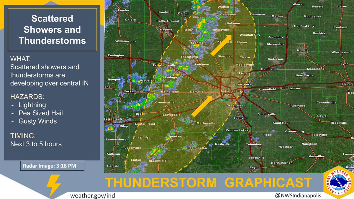 Line of showers and thunderstorms developing over central IN. This will continue over the next several hours. Most showers/storms should remain weak, but isolated gusts up to 45 MPH, and small hail will be possible. As with any thunderstorm, lightning will be a hazard. #INwx https://t.co/jCPSc4cK3M
My Huge Radar has real-time weather tracking, current temperatures, and severe weather watches and warnings. Get detailed Indiana conditions by clicking here. Follow these links to get my forecasts for Lafayette, Muncie, Hendricks County, and Hamilton County. Need a second opinion? Click here for central Indiana National Weather Service forecasts.
Never miss me! Subscribe for free. My Huge Radar has real-time weather tracking, current temperatures, and severe weather watches and warnings. Get detailed Indiana conditions by clicking here. Click here to see my central Indiana 7-Day Forecast. Follow these links to get my forecasts for Lafayette, Muncie, Hendricks County, and Hamilton County. Need a second opinion? Click here for central Indiana National Weather Service forecasts. (Some charts via WeatherBELL.)


