Here’s a graphic you like to see.
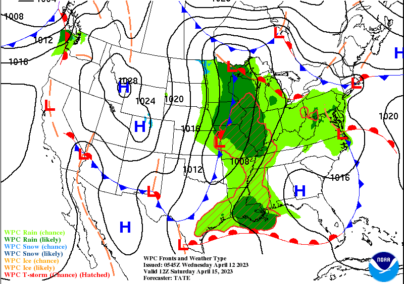
That will change as we finish the work week, and head toward the weekend. Here’s the storm system at the surface early Saturday.
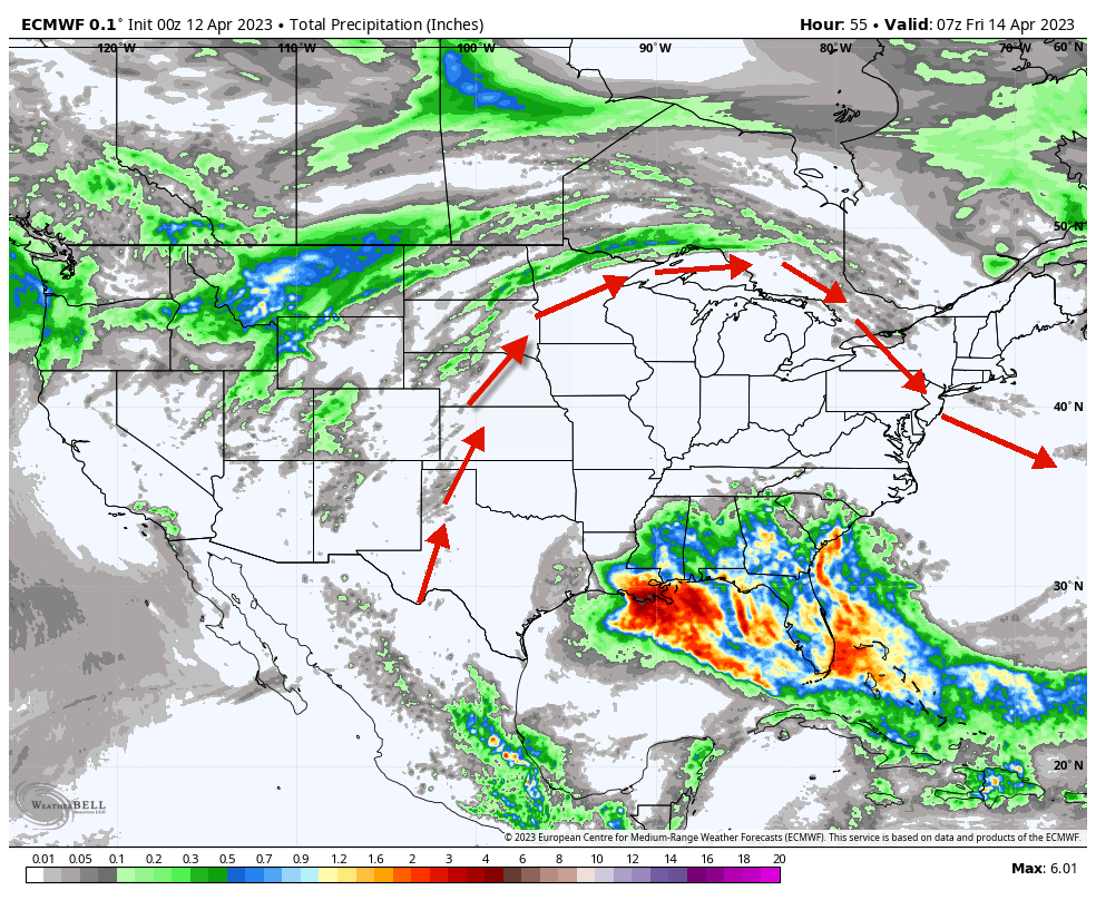
It will arrive only after the breakdown of an upper air ridge that is clearly shown by expected precipitation amounts through Friday.
Never miss me! Subscribe for free. My Huge Radar has real-time weather tracking, current temperatures, and severe weather watches and warnings. Get detailed Indiana conditions by clicking here. Click here to see my central Indiana 7-Day Forecast. Follow these links to get my forecasts for Lafayette, Muncie, Hendricks County, and Hamilton County. Need a second opinion? Click here for central Indiana National Weather Service forecasts. (Some charts via WeatherBELL.)
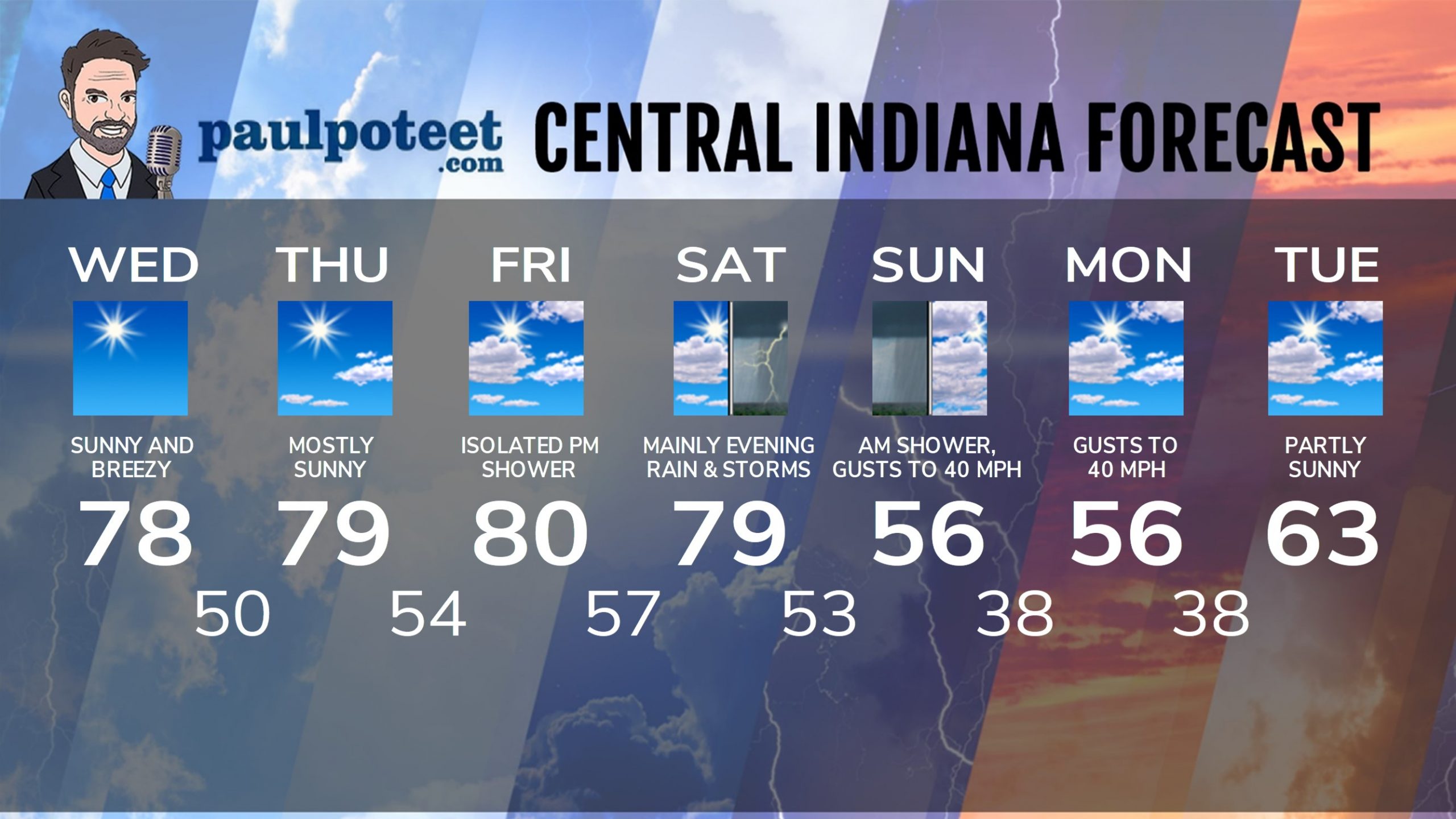
INDY SEVEN DAY FORECAST
Today: Sunny and breezy. High 78.
Tonight: Clear. Low 50.
Thursday: Mostly sunny. High 79.
Thursday Night: Mostly clear. Low 54.
Friday: Partly sunny. Isolated afternoon shower possible. High 80.
Friday Night: Partly cloudy. Low 57.
Saturday: Partly sunny and breezy. Isolated afternoon shower or storm possible. High 79.
Saturday Night: Showers and storms. Low 53.
Sunday: Lingering morning showers possible. Partly to mostly cloudy. Much cooler, with wind gusting to 40 mph. High 56.
Sunday Night: Partly cloudy. Low 38.
Monday: Partly sunny. Wind gusting to 40 mph. High 56.
Monday Night: Partly cloudy. Low 38.
Tuesday: Partly sunny. High 63.
Never miss me! Subscribe for free. My Huge Radar has real-time weather tracking, current temperatures, and severe weather watches and warnings. Get detailed Indiana conditions by clicking here. Click here to see my central Indiana 7-Day Forecast. Follow these links to get my forecasts for Lafayette, Muncie, Hendricks County, and Hamilton County. Need a second opinion? Click here for central Indiana National Weather Service forecasts. (Some charts via WeatherBELL.)


