This is not one of those days where the severe weather waits until afternoon. It is possible any time today in Indiana. Chances will fade quickly in the late afternoon. Click here for the latest radar and warnings.

BTW, it appears the number of tornadoes last Friday has now exceeded two dozen across Indiana, as damage surveys continue. Pray for a quieter-than-expected day today, and then you can let your weather guard down for quite some time!
Never miss me! Subscribe for free. My Huge Radar has real-time weather tracking, current temperatures, and severe weather watches and warnings. Get detailed Indiana conditions by clicking here. Click here to see my central Indiana 7-Day Forecast. Follow these links to get my forecasts for Lafayette, Muncie, Hendricks County, and Hamilton County. Need a second opinion? Click here for central Indiana National Weather Service forecasts. (Some charts via WeatherBELL.)
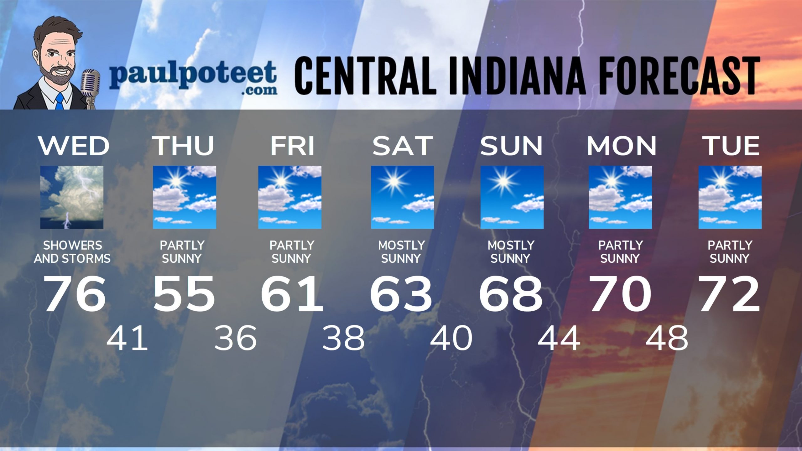
INDY SEVEN DAY FORECAST
Today: Showers and storms. Some storms will be severe. Temps fall into the 60s in the afternoon. WIND ADVISORY from 8am-8pm for gusts to 45 mph. High 76.
Tonight: Early evening shower chance. Becoming partly cloudy. Low 41.
Thursday: Partly sunny. High 55.
Thursday Night: Partly cloudy. Low 36.
Friday: Partly sunny. High 61.
Friday Night: Partly cloudy. Low 38.
Saturday: Mostly sunny. High 63.
Saturday Night: Mostly clear. Low 40.
Sunday: Mostly sunny. High 68.
Sunday Night: Mostly clear. Low 44.
Monday: Partly sunny. High 70.
Monday Night: Partly cloudy. Low 48.
Tuesday: Partly sunny. High 72.
Never miss me! Subscribe for free. My Huge Radar has real-time weather tracking, current temperatures, and severe weather watches and warnings. Get detailed Indiana conditions by clicking here. Click here to see my central Indiana 7-Day Forecast. Follow these links to get my forecasts for Lafayette, Muncie, Hendricks County, and Hamilton County. Need a second opinion? Click here for central Indiana National Weather Service forecasts. (Some charts via WeatherBELL.)


