(Via @NWSIndianapolis.) 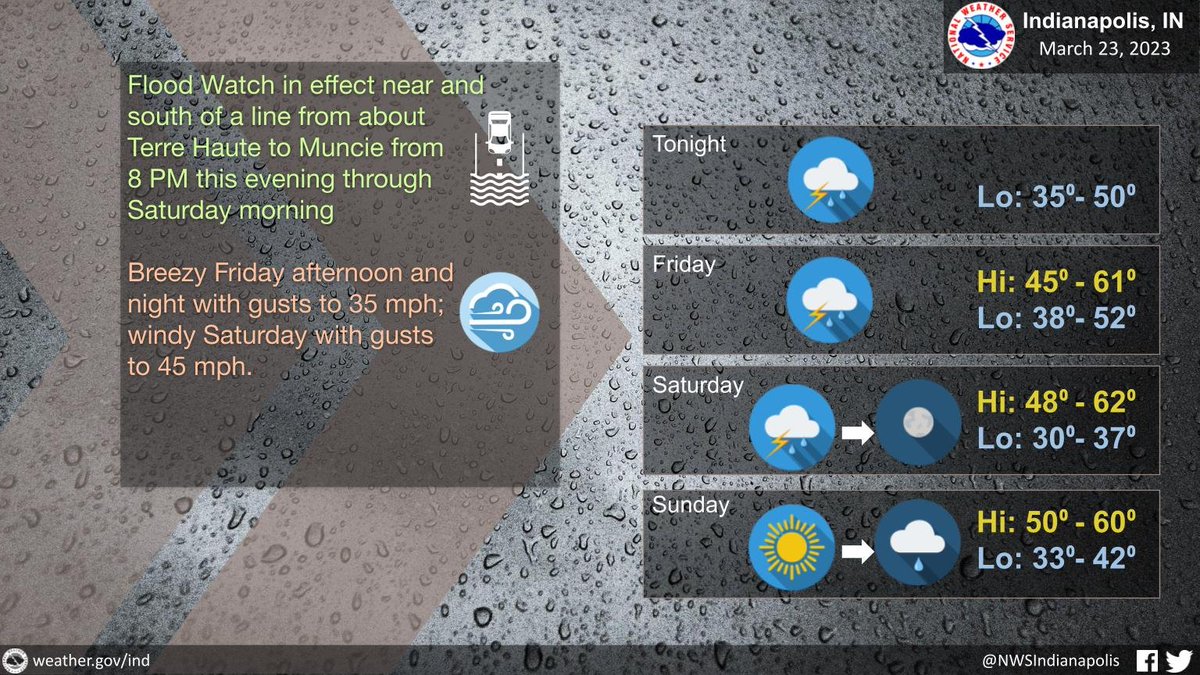 Periods of showers and t-storms thru Sat morn. Rain will be heavy at times and t-storms may become strong. Flood watch 8 PM tonight thru Sat morn. Wind gusts to 35 mph Fri and Fri night, to 45 mph Sat. Thru Sunday night high temps 45-62, lows 30-52. #INwx #nwsind https://t.co/XsycJBEZkw
My Huge Radar has real-time weather tracking, current temperatures, and severe weather watches and warnings. Get detailed Indiana conditions by clicking here. Follow these links to get my forecasts for Lafayette, Muncie, Hendricks County, and Hamilton County. Need a second opinion? Click here for central Indiana National Weather Service forecasts.
Never miss me! Subscribe for free. My Huge Radar has real-time weather tracking, current temperatures, and severe weather watches and warnings. Get detailed Indiana conditions by clicking here. Click here to see my central Indiana 7-Day Forecast. Follow these links to get my forecasts for Lafayette, Muncie, Hendricks County, and Hamilton County. Need a second opinion? Click here for central Indiana National Weather Service forecasts. (Some charts via WeatherBELL.)


