(Via @NWSIndianapolis.) 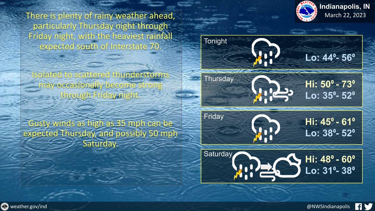 Cloudy, rainy thru Sat morn then clearing. Occasionally strong t-storms possible. Flood watch 8 PM Thu to 8 AM Sat along & south of I-70. Wind gusts to 35 mph Thursday and 50 Sat. High temps 45-73°, warmest Thu. Lows 31-56, warmest tonight, coldest Sat night. #INwx #nwsind https://t.co/TnN08Phpo2
My Huge Radar has real-time weather tracking, current temperatures, and severe weather watches and warnings. Get detailed Indiana conditions by clicking here. Follow these links to get my forecasts for Lafayette, Muncie, Hendricks County, and Hamilton County. Need a second opinion? Click here for central Indiana National Weather Service forecasts.
Never miss me! Subscribe for free. My Huge Radar has real-time weather tracking, current temperatures, and severe weather watches and warnings. Get detailed Indiana conditions by clicking here. Click here to see my central Indiana 7-Day Forecast. Follow these links to get my forecasts for Lafayette, Muncie, Hendricks County, and Hamilton County. Need a second opinion? Click here for central Indiana National Weather Service forecasts. (Some charts via WeatherBELL.)


