A little rain this morning, and a lot Wednesday night into Thursday morning, when amounts could approach one inch.
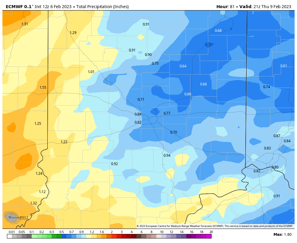
There could also be thunder late Wednesday night into Thursday morning, as low pressure drags a cold front across the state. Even outside of storms: winds Thursday could gust to 50 mph!

Never miss me! Subscribe for free. My Huge Radar has real-time weather tracking, current temperatures, and severe weather watches and warnings. Get detailed Indiana conditions by clicking here. Click here to see my central Indiana 7-Day Forecast. Follow these links to get my forecasts for Lafayette, Muncie, Hendricks County, and Hamilton County. Need a second opinion? Click here for central Indiana National Weather Service forecasts. (Some charts via WeatherBELL.)
INDY SEVEN DAY FORECAST
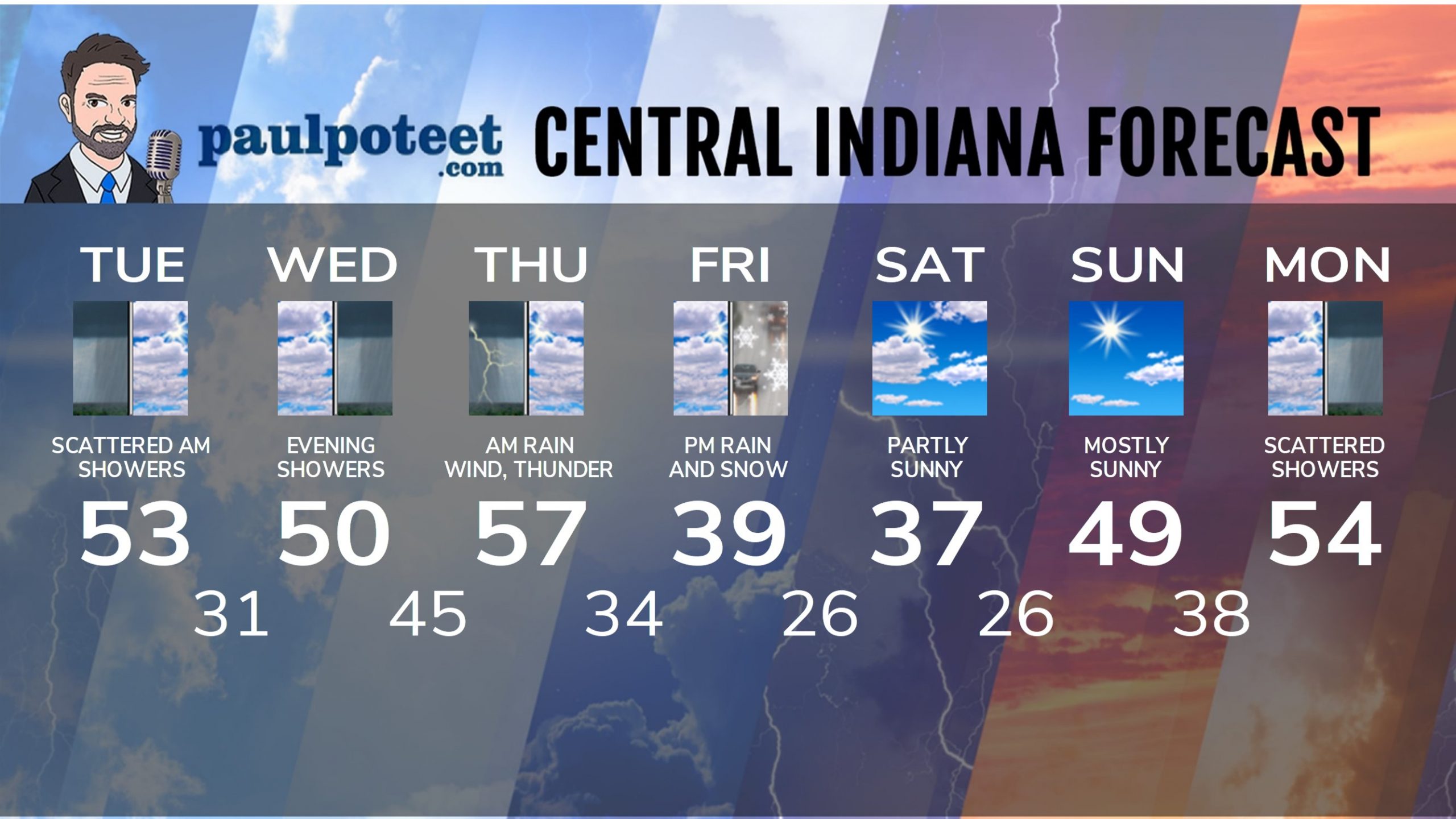
Today: Mostly cloudy. Scattered showers and a gusty wind to 30 mph in the morning. Early afternoon shower possible south/southeast of Indy. High 53.
Tonight: Mostly cloudy. Low 31.
Wednesday: Mostly cloudy. Isolated shower possible. High 50.
Wednesday Night: Showers. Breezy. Some thunder possible. Low 45.
Thursday: Morning showers and storms. Wind gusting to 50 mph! Moslty cloudy afternoon, with temps falling into the 40s. High 57.
Thursday Night: Mostly cloudy. Low 34.
Friday: Mostly cloudy. Afternoon rain and snow showers. High 39.
Friday Night: Evening snow showers. Partial clearing after midnight. Low 26.
Saturday: Partly sunny. High 37.
Saturday Night: Mostly clear. Low 26.
Sunday: Mostly sunny. High 49.
Sunday Night: Partly to mostly cloudy. Low 38.
Monday: Mostly cloudy, with scattered showers. High 54.
Never miss me! Subscribe for free. My Huge Radar has real-time weather tracking, current temperatures, and severe weather watches and warnings. Get detailed Indiana conditions by clicking here. Click here to see my central Indiana 7-Day Forecast. Follow these links to get my forecasts for Lafayette, Muncie, Hendricks County, and Hamilton County. Need a second opinion? Click here for central Indiana National Weather Service forecasts. (Some charts via WeatherBELL.)


