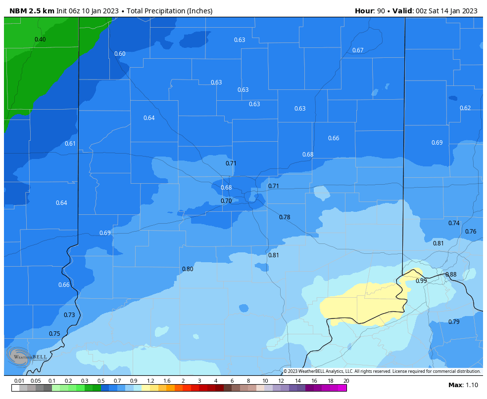
Milder and cloudier today, but nothing big on the weather horizon until Thursday. Expect up to around three-quarters of an inch of rainfall.
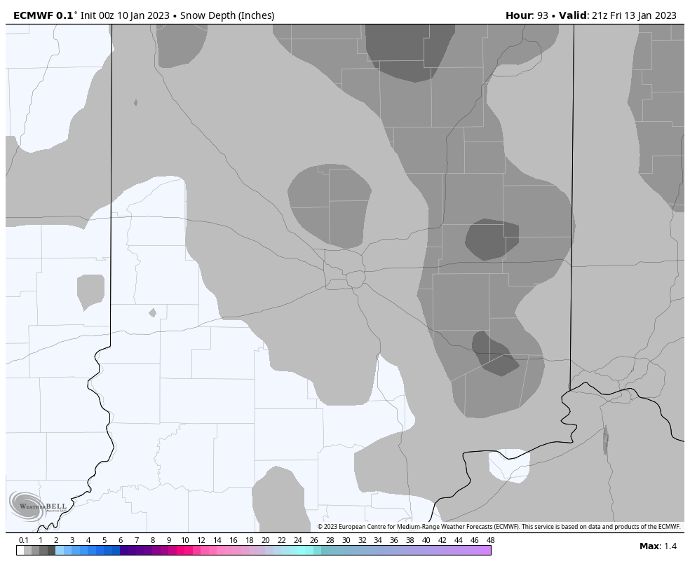
Thunder is possible Thursday, and then temps tank late Thursday night into Friday. Might get a dusting of snow along with the colder air.
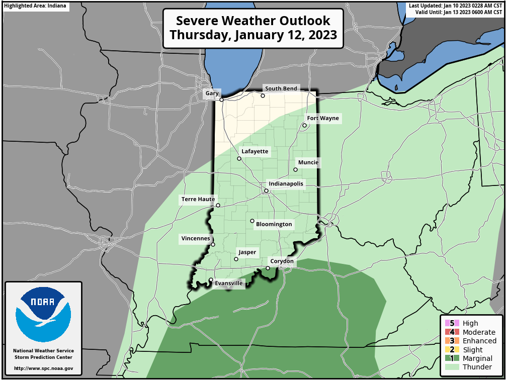
Severe weather is possible along and south of the Indiana southern border Thursday.
Never miss me! Subscribe for free. My Huge Radar has real-time weather tracking, current temperatures, and severe weather watches and warnings. Get detailed Indiana conditions by clicking here. Click here to see my central Indiana 7-Day Forecast. Follow these links to get my forecasts for Lafayette, Muncie, Hendricks County, and Hamilton County. Need a second opinion? Click here for central Indiana National Weather Service forecasts. (Some charts via WeatherBELL.)
INDY SEVEN DAY FORECAST
Today: Mostly cloudy early to mid morning. Partly sunny by afternoon. High 48.
Tonight: Mostly cloudy. Low 36.
Wednesday: Cloudy. A few spotty showers, mainly in the morning. High 51.
Wednesday Night: Mostly cloudy. A few spotty showers. Low 49.
Thursday: Rain and some thunder. Breezy. High 52.
Thursday Night: Rain and snow showers. Low 31.
Friday: Cloudy. Flurries and/or snow showers. A dusting to an inch is possible on some surfaces. High 34.
Friday Night: Partly cloudy. Low 26.
Saturday: Partly sunny. High 37.
Saturday Night: Partly cloudy. Low 27.
Sunday: Partly sunny. High 44.
Sunday Night: Mostly cloudy. Low 37.
Monday: Scattered showers. High 51.

Never miss me! Subscribe for free. My Huge Radar has real-time weather tracking, current temperatures, and severe weather watches and warnings. Get detailed Indiana conditions by clicking here. Click here to see my central Indiana 7-Day Forecast. Follow these links to get my forecasts for Lafayette, Muncie, Hendricks County, and Hamilton County. Need a second opinion? Click here for central Indiana National Weather Service forecasts. (Some charts via WeatherBELL.)


