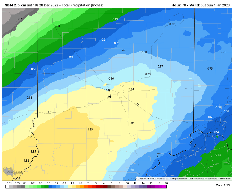
A little drizzle today, a lot of rain tomorrow, and lingering showers Saturday. Rain should have stopped falling by the time the Ball is falling in Times Square. First round of rain could bring up to an inch of precipitation from Indy southward.
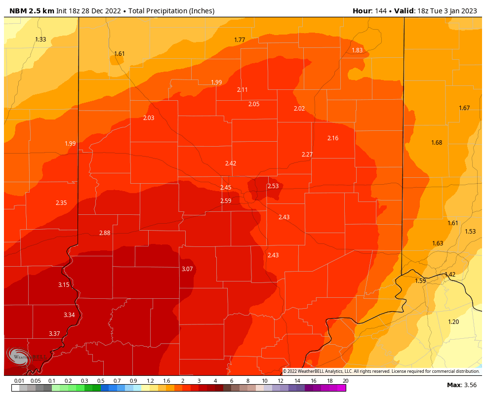
The next wave into central Indiana brings rain and thunder Monday night and Tuesday morning. Another inch-plus is possible, yielding a total of more than two inches over the next seven days.
Never miss me! Subscribe for free. My Huge Radar has real-time weather tracking, current temperatures, and severe weather watches and warnings. Get detailed Indiana conditions by clicking here. Click here to see my central Indiana 7-Day Forecast. Follow these links to get my forecasts for Lafayette, Muncie, Hendricks County, and Hamilton County. Need a second opinion? Click here for central Indiana National Weather Service forecasts. (Some charts via WeatherBELL.)
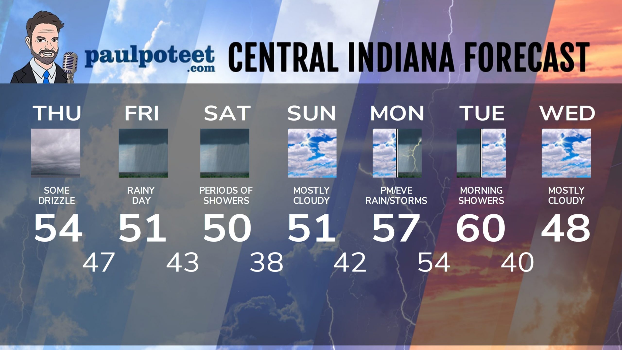
INDY SEVEN DAY FORECAST
Today: Cloudy. Drizzle possible. Wind gusting to 30 mph. High 54.
Tonight: Evening drizzle. Showers overnight. Wind gusts to 30 mph. Low 47.
Friday: Rainy. High 51.
Friday Night; Rainy. Low 43.
Saturday: Periods of showers. High 50.
New Years Eve: Spotty showers in the evening. Mostly cloudy overnight. Low 38.
New Years Day: Mostly cloudy. High 51.
Sunday Night: Mostly cloudy. Low 42.
Monday: Mostly cloudy. Showers return in the late afternoon. High 57.
Monday Night: Showers and storms. Low 54.
Tuesday: Morning showers. Mostly cloudy afternoon. High 60.
Tuesday Night: Mostly cloudy. Low 40.
Wednesday: Mostly cloudy. High 48.
Never miss me! Subscribe for free. My Huge Radar has real-time weather tracking, current temperatures, and severe weather watches and warnings. Get detailed Indiana conditions by clicking here. Click here to see my central Indiana 7-Day Forecast. Follow these links to get my forecasts for Lafayette, Muncie, Hendricks County, and Hamilton County. Need a second opinion? Click here for central Indiana National Weather Service forecasts. (Some charts via WeatherBELL.)


