‘Twas the storm before Christmas, and blizzard or near-blizzard conditions are possible with it. The big deal with this storm will be the big breezes. Look at that deep low pressure system (Surface map for Friday morning.)
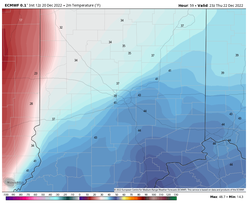
Here are some modeled surface temperatures…first at 6pm Thursday:
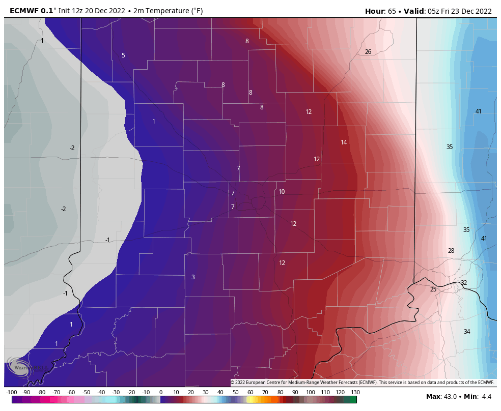
Look what happens by midnight Friday morning!:
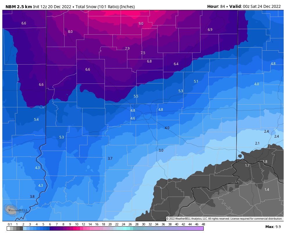
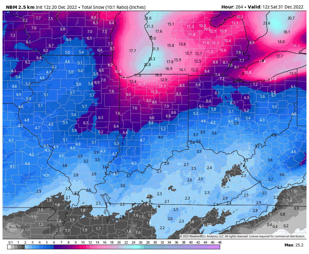
The bulk of accumulating snow will fall overnight into early to mid-morning Friday. Here again are some computer modeled totals, which look fine to me. I am expecting as little as three, and as much as six inches for much of Central Indiana, with 4-8 inches possible for my friends and listeners around Lafayette.
Never miss me! Subscribe for free. My Huge Radar has real-time weather tracking, current temperatures, and severe weather watches and warnings. Get detailed Indiana conditions by clicking here. Click here to see my central Indiana 7-Day Forecast. Follow these links to get my forecasts for Lafayette, Muncie, Hendricks County, and Hamilton County. Need a second opinion? Click here for central Indiana National Weather Service forecasts. (Some charts via WeatherBELL.)
INDY SEVEN DAY FORECAST
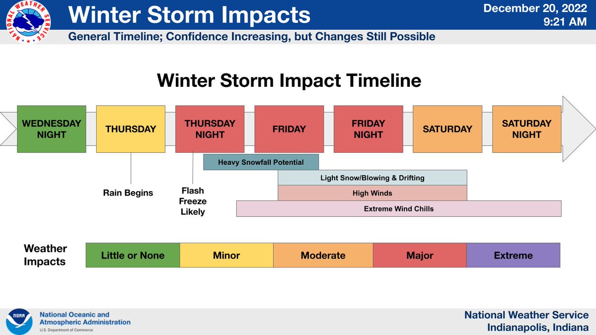
**WINTER STORM WATCH THURSDAY EVENING THROUGH SATURDAY MORNING**
Today: Mostly cloudy morning, partly cloudy afternoon. High 41.
Tonight: Partly cloudy evening. Mostly cloudy overnight. Low 22.
Wednesday: Mostly cloudy. High 41.
Wednesday Night: Cloudy. Snow and rain showers late. No accumulations. Low 33.
Thursday: Periods of rain, maybe mixed with a little snow in the morning. High 41.
Thursday Night: Rain mixes with and changes to snow by mid to late evening. Temperatures drop fast! Blowing snow by daybreak. Low -3.
Friday: Snow and blowing snow. Wind gusting to 50mph. Dangerous chill! High 2.
Friday Night: Snow and blowing snow. Wind gusting to 50mph. Dangerous chill. Snow totals of 3-6 inches. Low -1.
Saturday: Mostly cloudy. Wind gusting to 40 mph. High 8.
Christmas Eve: Partly cloudy. Wind gusting to 25 mph. Low -1.
Christmas Day: Partly sunny. Not as windy. High 12.
Sunday Night: Mostly cloudy. Low 5.
Monday: Mostly cloudy, with a few snow showers. High 26.

Never miss me! Subscribe for free. My Huge Radar has real-time weather tracking, current temperatures, and severe weather watches and warnings. Get detailed Indiana conditions by clicking here. Click here to see my central Indiana 7-Day Forecast. Follow these links to get my forecasts for Lafayette, Muncie, Hendricks County, and Hamilton County. Need a second opinion? Click here for central Indiana National Weather Service forecasts. (Some charts via WeatherBELL.)


