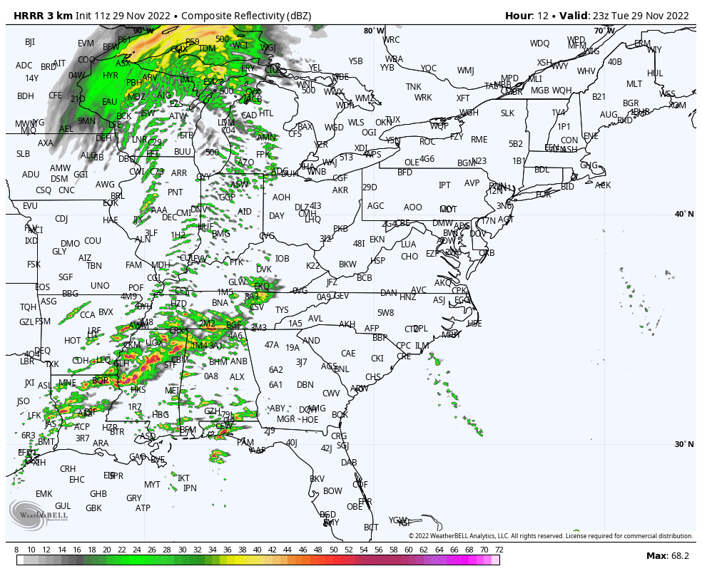
Full weather plate! A powerful storm system brings us much warmer air today, showers and storms this evening (and a possible tornado outbreak to the South), and chills in the teens all day tomorrow! All the while winds will whip: gusting to 35 mph this afternoon through Wednesday. Here’s the map for this evening.

Scattered showers are possible by late afternoon.
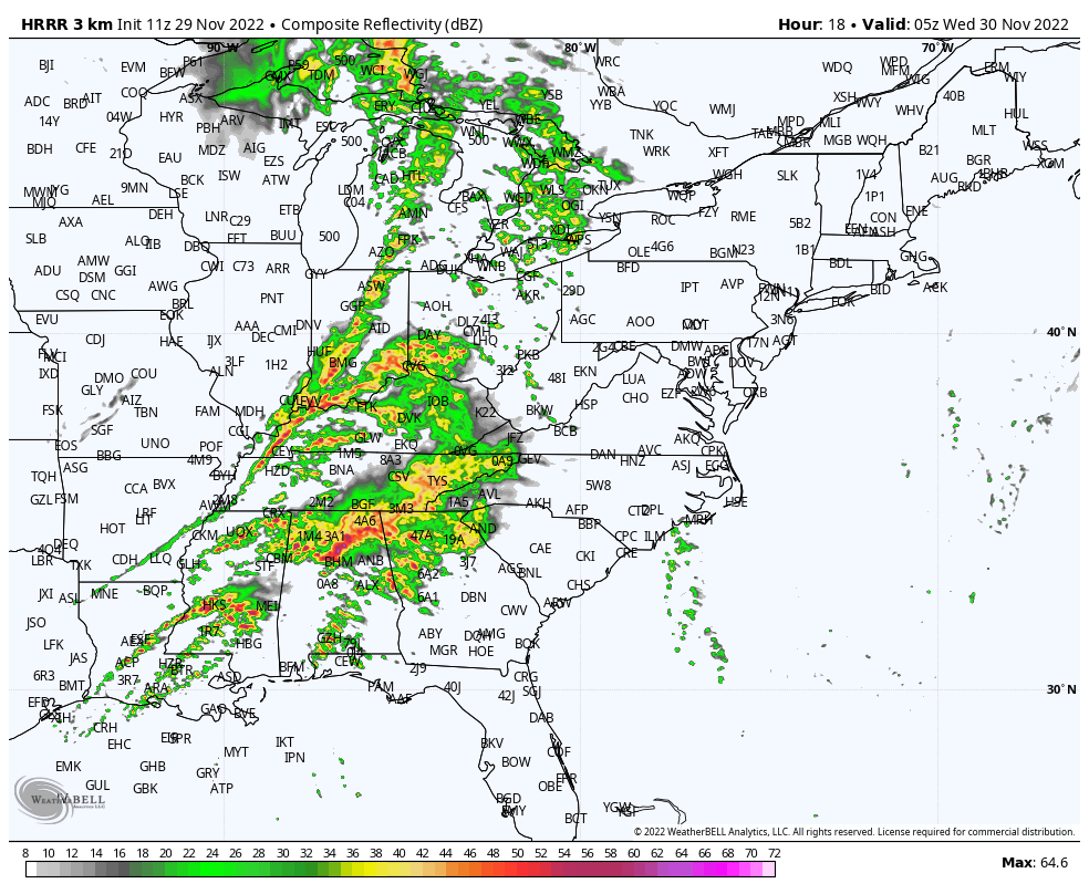
A line of showers and storms will accompany the passage of a strong cold front around midnight.
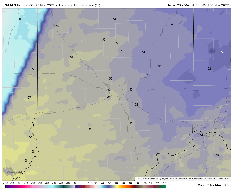
This is computer modeling of wind chills from midnight to 7pm Wednesday. Falls from the 50s to the teens much of the day!
Never miss me! Subscribe for free. My Huge Radar has real-time weather tracking, current temperatures, and severe weather watches and warnings. Get detailed Indiana conditions by clicking here. Click here to see my central Indiana 7-Day Forecast. Follow these links to get my forecasts for Lafayette, Muncie, Hendricks County, and Hamilton County. Need a second opinion? Click here for central Indiana National Weather Service forecasts. (Some charts via WeatherBELL.)
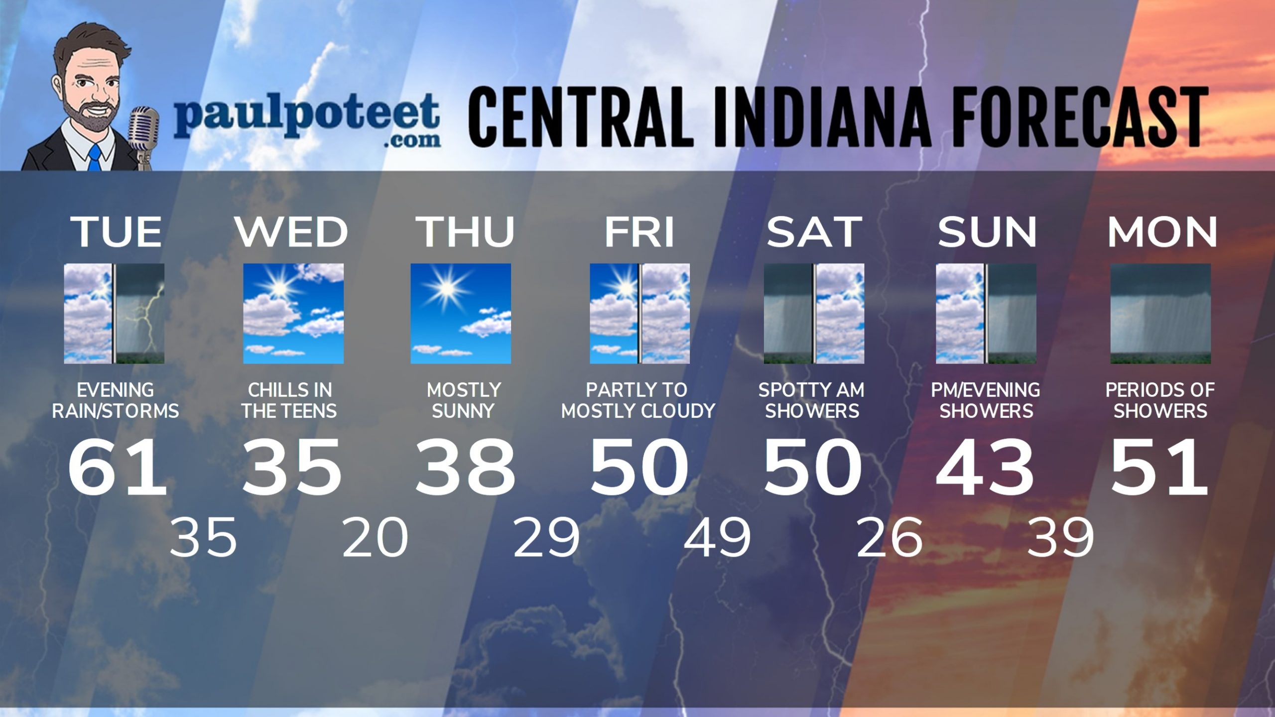
INDY SEVEN DAY FORECAST
Today: Mostly to partly cloudy. Wind gusting to 35 mph by afternoon. Scattered late afternoon shower possible. High 61.
Tonight: Showers and storms. Wind gusting to 35 mph. Small risk of severe storms. Low 35.
Wednesday: Partly sunny. Wind gusting to 35 mph. Chills in the teens all day! High 35.
Wednesday Night: Clear and cold. Wind gusting to 25 mph. Low 20.
Thursday: Mostly sunny. High 38.
Thursday Night: Partly cloudy. Low 29.
Friday: Partly to mostly cloudy. High 50.
Friday Night: Cloudy. Spotty shower possible. Low 49.
Saturday: Mostly cloudy. Spotty showers. Temps fall in the afternoon. High 50.
Saturday Night: Partly cloudy. Low 26.
Sunday: Mostly cloudy. Scattered afternoon showers. High 43.
Sunday Night: Showers. Low 39.
Monday: Showers. High 51.
Never miss me! Subscribe for free. My Huge Radar has real-time weather tracking, current temperatures, and severe weather watches and warnings. Get detailed Indiana conditions by clicking here. Click here to see my central Indiana 7-Day Forecast. Follow these links to get my forecasts for Lafayette, Muncie, Hendricks County, and Hamilton County. Need a second opinion? Click here for central Indiana National Weather Service forecasts. (Some charts via WeatherBELL.)


