A dull and dreary day for central Indiana, but Ma Nature wakes up again tomorrow, with a sudden warm up, gusty winds, and nighttime showers and thunderstorms. Parts of the state even have a risk for severe storms. There may be a tornado outbreak in parts of Arkansas, Louisiana, and Mississippi on Tuesday.

WEEKEND RAINFALL
.99″ INDY
.89″ LAFAYETTE
.78″ BLOOMINGTON
.72″ TERRE HAUTE
.58″ MUNCIE
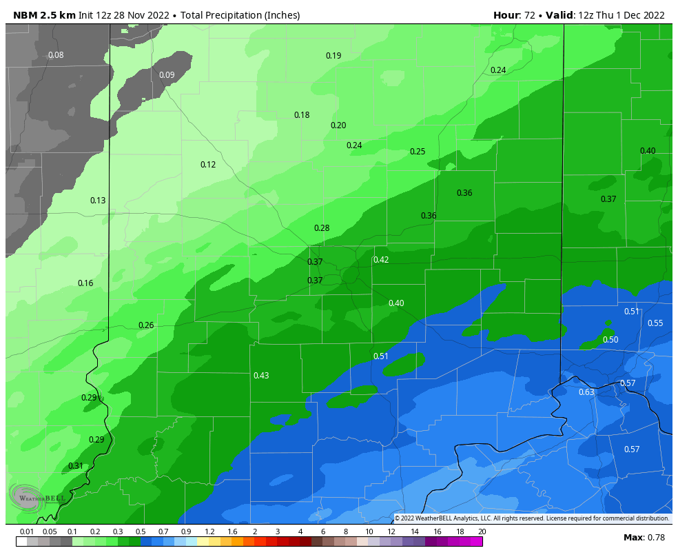
It was definitely a good soaker. This next batch won’t be as heavy, with anywhere from one-tenth to one-half-inch of precip. across central Indiana.
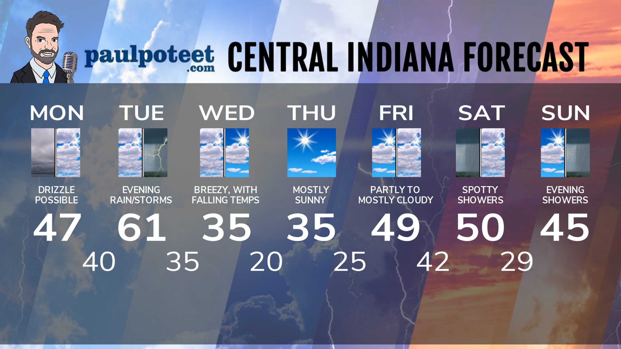
INDY SEVEN DAY FORECAST
Today: Cloudy to mostly cloudy. Patchy drizzle is possible. High 47.
Tonight: Mostly cloudy. Low 40.
Tuesday: Mostly cloudy and warmer. Wind gusting to 35 mph. High 61.
Tuesday Night: Showers and storms. Wind gusting to 35 mph. Small risk of severe storms. Low 35.
Wednesday: Early morning showers diminish. Partly sunny by afternoon. Wind gusting to 40 mph. Temps steady in the mid to low 30s! High 35.
Wednesday Night: Mostly clear. Low 20.
Thursday: Mostly sunny. High 35.
Thursday Night: Partly cloud. Low 25.
Friday: Partly to mostly cloudy. High 49.
Friday Night: Mostly cloudy. Low 42.
Saturday: Mostly cloudy. Spotty showers. High 50.
Saturday Night: Mostly cloudy. Low 29.
Sunday: Partly sunny. High 45.
Never miss me! Subscribe for free. My Huge Radar has real-time weather tracking, current temperatures, and severe weather watches and warnings. Get detailed Indiana conditions by clicking here. Click here to see my central Indiana 7-Day Forecast. Follow these links to get my forecasts for Lafayette, Muncie, Hendricks County, and Hamilton County. Need a second opinion? Click here for central Indiana National Weather Service forecasts. (Some charts via WeatherBELL.)


