Another cold day, with morning chills in the teens, and afternoon chills in the 20s. Indy notched another tenth-of-an-inch of snow Wednesday, and we’re likely to get a bit more this evening with the arrival of an Arctic cold front.

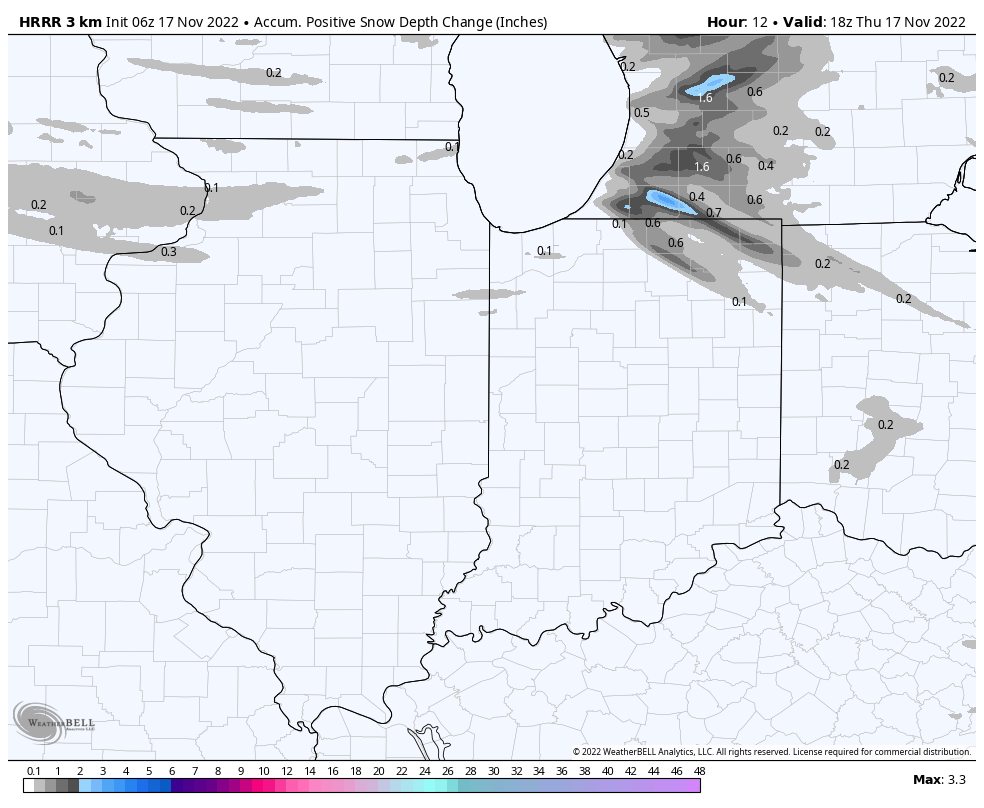
Expect snow showers around in the early to mid evening hours, after the rush hours. Travel later this evening could be slowed a little by slippery streets, or sudden changes in visibility. The worst is over with by Friday morning drive, but flurries and snow showers could linger into Friday morning. The wind will let up Sunday, but it will be frigid through the weekend. Here’s the short-term radar modeling today through Friday. Check out that lake effect in Michigan.
Never miss me! Subscribe for free. My Huge Radar has real-time weather tracking, current temperatures, and severe weather watches and warnings. Get detailed Indiana conditions by clicking here. Click here to see my central Indiana 7-Day Forecast. Follow these links to get my forecasts for Lafayette, Muncie, Hendricks County, and Hamilton County. Need a second opinion? Click here for central Indiana National Weather Service forecasts. (Some charts via WeatherBELL.)
INDY SEVEN DAY FORECAST
Today: Mostly cloudy, with a few flurries possible. Wind gusting to 25 mph. High 36.
Tonight: Snow showers, with less than an inch accumulation. Wind gusting to 20 mph. Low 23.
Friday: Mostly cloudy, with a few flurries and snow showers or the morning. Little or no additional accumulation. Wind gusting to 25 mph. High 30.
Friday Night: Partly cloudy. Wind gusting to 20 mph. Low 17.
Saturday: Single digit chills in the morning. Mostly sunny, with a few afternoon clouds. Wind gusting to 30 mph. High 35.
Saturday Night: Partly cloudy evening. Mostly clear overnight. Low 14.
Sunday: Sunny. High 32.
Sunday Night: Clear. Low 22.
Monday: Sunny. High 45.
Monday Night: Clear. Low 28.
Tuesday: Mostly sunny. High 50.
Tuesday Night: Partly cloudy. Low 32.
Wednesday: Partly sunny. High 52.

Never miss me! Subscribe for free. My Huge Radar has real-time weather tracking, current temperatures, and severe weather watches and warnings. Get detailed Indiana conditions by clicking here. Click here to see my central Indiana 7-Day Forecast. Follow these links to get my forecasts for Lafayette, Muncie, Hendricks County, and Hamilton County. Need a second opinion? Click here for central Indiana National Weather Service forecasts. (Some charts via WeatherBELL.)


