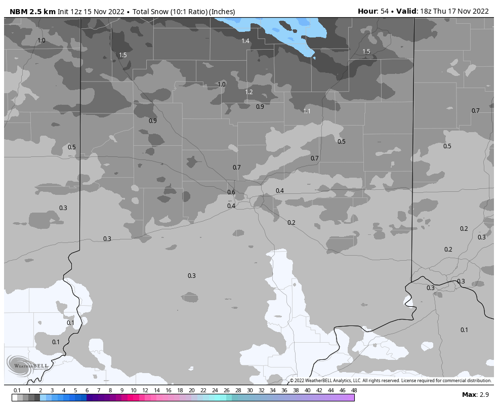
The best chance of any (light) snow accumulation today is from the Haute over to Crawfordsville, and up to Lafayette.

Indiana's Weather Update:
(Via @NWSIndianapolis.) Traffic cams in Crawfordsville show a light dusting of snow this morning. Areas further east will still see…https://t.co/RcwAg3UgSM pic.twitter.com/szGojwmqsK— Paul Poteet Dot Com 🇺🇸 (@PaulPoteet) November 15, 2022
Slightly better snow chances are still on the table Wednesday afternoon and evening, but the totals aren’t likely to exceed an inch.
Never miss me! Subscribe for free. My Huge Radar has real-time weather tracking, current temperatures, and severe weather watches and warnings. Get detailed Indiana conditions by clicking here. Click here to see my central Indiana 7-Day Forecast. Follow these links to get my forecasts for Lafayette, Muncie, Hendricks County, and Hamilton County. Need a second opinion? Click here for central Indiana National Weather Service forecasts. (Some charts via WeatherBELL.)
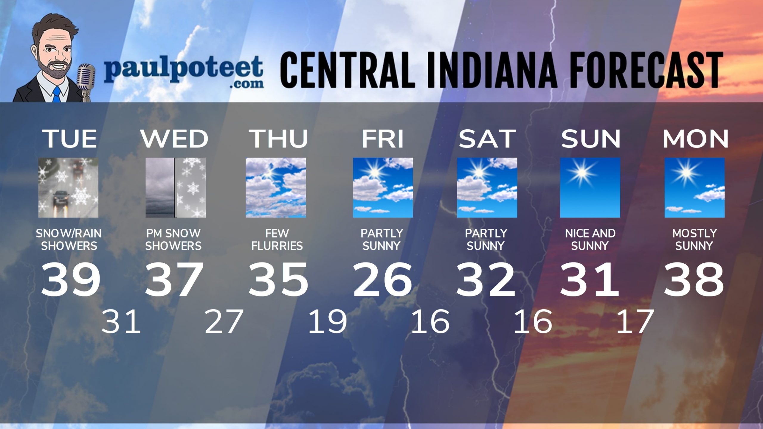
INDY SEVEN DAY FORECAST
Today: Snow and rain showers. Little or no accumulation. High 39.
Tonight: Cloudy, with a few flurries or snow showers. Little or no accumulation. Low 31.
Wednesday: Cloudy. Snow showers in the afternoon. Little or no accumulation. High 37.
Wednesday Night: Snow showers, with less than an inch accumulation. Low 27.
Thursday: Mostly cloudy, with flurries and a few snow showers. High 35.
Thursday Night: Partly cloudy. Low 19.
Friday: Partly sunny. High 26.
Friday Night: Partly cloudy. Low 16.
Saturday: Partly sunny. High 32.
Saturday Night: Mostly clear. Low 16.
Sunday: Sunny. High 31.
Sunday Night: Mostly clear. Low 17.
Monday: Mostly sunny. High 38.
Never miss me! Subscribe for free. My Huge Radar has real-time weather tracking, current temperatures, and severe weather watches and warnings. Get detailed Indiana conditions by clicking here. Click here to see my central Indiana 7-Day Forecast. Follow these links to get my forecasts for Lafayette, Muncie, Hendricks County, and Hamilton County. Need a second opinion? Click here for central Indiana National Weather Service forecasts. (Some charts via WeatherBELL.)


