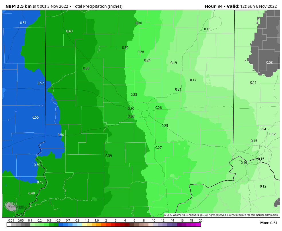
Big storm system percolating in the Plains through Saturday. Could be some severe weather today and tomorrow in the middle of the country. The energy will quickly shift northeastward Saturday, and at the surface a cold front will move through the Midwest, including central Indiana.

The resulting rain will range from nearly a quarter-inch in the east to nearly a half-inch in the west.
Never miss me! Subscribe for free. My Huge Radar has real-time weather tracking, current temperatures, and severe weather watches and warnings. Get detailed Indiana conditions by clicking here. Click here to see my central Indiana 7-Day Forecast. Follow these links to get my forecasts for Lafayette, Muncie, Hendricks County, and Hamilton County. Need a second opinion? Click here for central Indiana National Weather Service forecasts. (Some charts via WeatherBELL.)
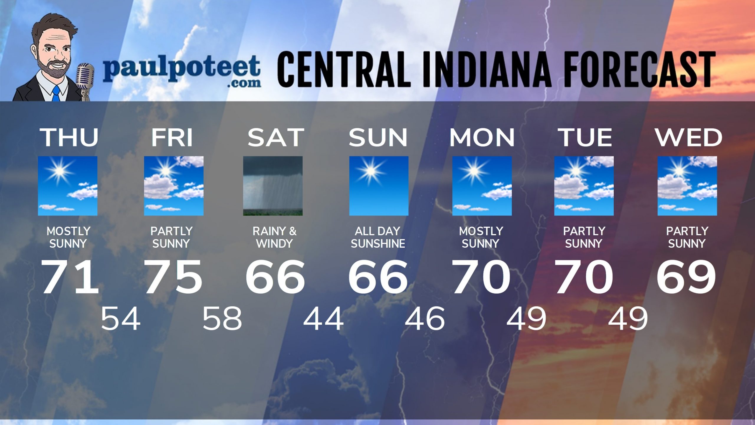
INDY SEVEN DAY FORECAST
Today: Mostly sunny. High 71.
Tonight: Partly cloudy. Low 54.
Friday: Partly sunny. High 75.
Friday Night: Mostly cloudy. Low 58.
Saturday: Rainy and windy. Gusts to 40 mph. High 68.
Saturday Night: Periods of showers in the early evening east of Indy, then clearing. Low 44.
Sunday: Sunny. High 66.
Sunday Night: Mostly clear. Low 46.
Monday: Mostly sunny. High 70.
Monday Night: Mostly clear. Low 49.
Tuesday: Partly sunny. High 70.
Tuesday Night: Partly cloudy. Low 49.
Wednesday: Partly sunny. High 69.
Never miss me! Subscribe for free. My Huge Radar has real-time weather tracking, current temperatures, and severe weather watches and warnings. Get detailed Indiana conditions by clicking here. Click here to see my central Indiana 7-Day Forecast. Follow these links to get my forecasts for Lafayette, Muncie, Hendricks County, and Hamilton County. Need a second opinion? Click here for central Indiana National Weather Service forecasts. (Some charts via WeatherBELL.)


