A cold front working through later today will bring scattered showers and some thunderstorms.
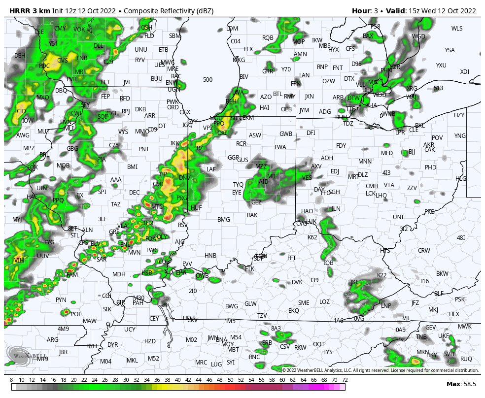
Not expecting lots of rain with this, but localized downpours are possible.

Never miss me! Subscribe for free. My Huge Radar has real-time weather tracking, current temperatures, and severe weather watches and warnings. Get detailed Indiana conditions by clicking here. Click here to see my central Indiana 7-Day Forecast. Follow these links to get my forecasts for Lafayette, Muncie, Hendricks County, and Hamilton County. Need a second opinion? Click here for central Indiana National Weather Service forecasts. (Some charts via WeatherBELL.)
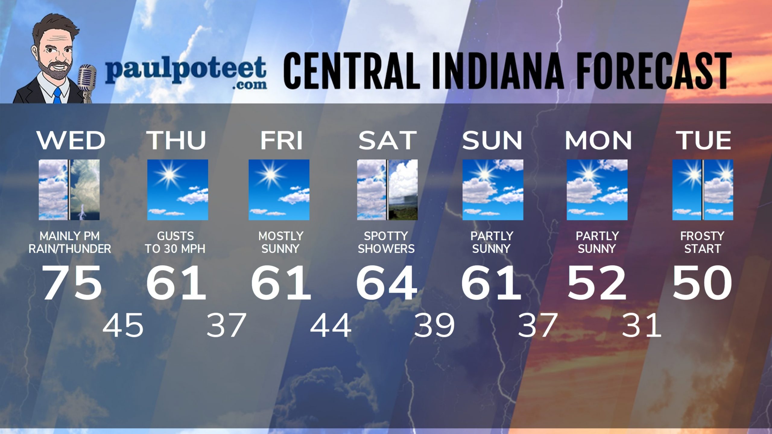
INDY SEVEN DAY FORECAST
Today: Scattered morning showers. Showers and some thunderstorms in the afternoon. Wind gusts to 40 mph. High 75.
Tonight: Evening showers. Thunder possible. Partly cloudy later. Wind gusting to 30 mph. Low 45.
Thursday: Mostly sunny. Wind gusts to 30 mph. High 61.
Thursday Night: Mostly clear. Low 37.
Friday: Mostly sunny. High 61.
Friday Night: Partly cloudy evening. Mostly cloudy after midnight. Low 44.
Saturday: Mostly cloudy, with spotty showers possible, especially in the afternoon. High 64.
Saturday Night: Spotty shower possible in the evening, then partly cloudy. Low 39.
Sunday: Partly sunny. High 61.
Sunday Night: Partly cloudy. Low 37.
Monday: Partly sunny. High 52.
Monday Night: Mostly clear. Widespread frost toward daybreak. Low 31.
Tuesday: Mostly to partly sunny. High 50.
Never miss me! Subscribe for free. My Huge Radar has real-time weather tracking, current temperatures, and severe weather watches and warnings. Get detailed Indiana conditions by clicking here. Click here to see my central Indiana 7-Day Forecast. Follow these links to get my forecasts for Lafayette, Muncie, Hendricks County, and Hamilton County. Need a second opinion? Click here for central Indiana National Weather Service forecasts. (Some charts via WeatherBELL.)


