Clouds are coming this afternoon, with scattered showers in the western third of Indiana. One more above-average day tomorrow, ending with afternoon and evening showers and storms that could be severe.
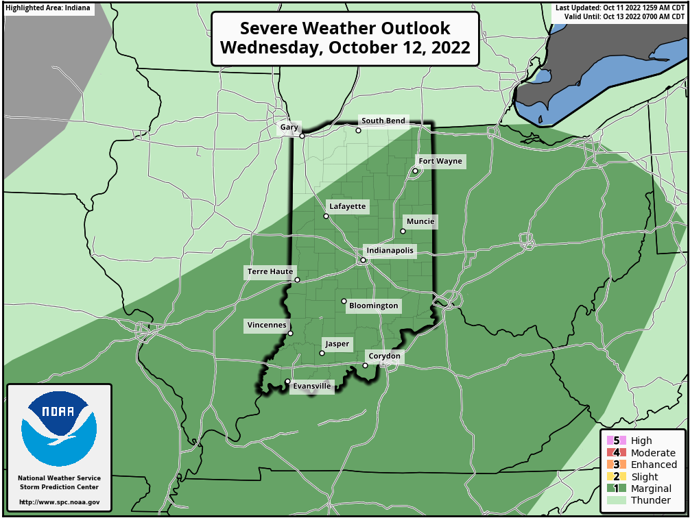
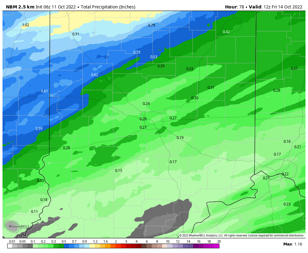
The biggest threat is from damaging wind gusts, but south east of Indy the threats also include large hail and even a brief tornado. Rain amounts could reach a quarter of an inch. We need it! There’s only been a trace of precipitation in Indy this month so far.
Never miss me! Subscribe for free. My Huge Radar has real-time weather tracking, current temperatures, and severe weather watches and warnings. Get detailed Indiana conditions by clicking here. Click here to see my central Indiana 7-Day Forecast. Follow these links to get my forecasts for Lafayette, Muncie, Hendricks County, and Hamilton County. Need a second opinion? Click here for central Indiana National Weather Service forecasts. (Some charts via WeatherBELL.)
INDY SEVEN DAY FORECAST
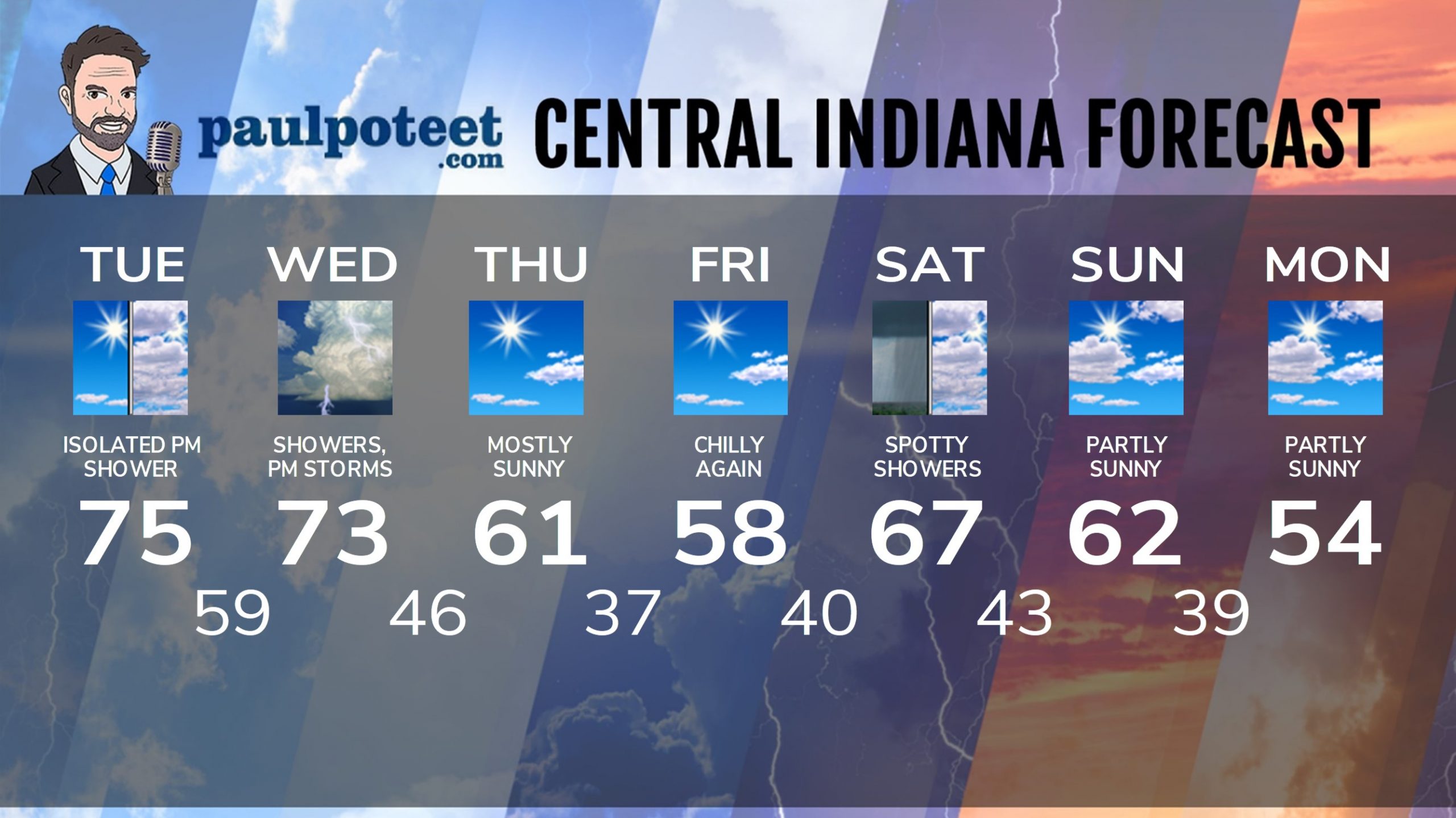
Today: Mostly sunny morning. Clouds increase by afternoon, with wind gusts to 25 mph. An isolated afternoon shower is possible. High 75.
Tonight: Mostly cloudy. Isolated showers possible. Wind gusts to 20 mph. Low 59.
Wednesday: Periods of showers. Afternoon thunderstorms that could be severe. Wind gusts to 35 mph. High 73.
Wednesday Night: Evening showers and storms. Partly cloudy later. Low 46.
Thursday: Mostly sunny. Wind gusts to 30 mph. High 61.
Thursday Night: Mostly clear. Low 37.
Friday: Mostly sunny. High 58.
Friday Night: Mostly clear evening. Partly cloudy after midnight. Low 40.
Saturday: Mostly cloudy, with spotty showers possible. High 67.
Saturday Night: Partly cloudy. Low 43.
Sunday: Partly sunny. High 62.
Sunday Night: Partly cloudy. Low 39.
Monday: Partly sunny. High 54.
Never miss me! Subscribe for free. My Huge Radar has real-time weather tracking, current temperatures, and severe weather watches and warnings. Get detailed Indiana conditions by clicking here. Click here to see my central Indiana 7-Day Forecast. Follow these links to get my forecasts for Lafayette, Muncie, Hendricks County, and Hamilton County. Need a second opinion? Click here for central Indiana National Weather Service forecasts. (Some charts via WeatherBELL.)


