Fall brought a fall in temps that lasts all week. Breezy today and tomorrow. The remnants of Hurricane Ian won’t have much impact on Indiana, but showers are possible by Saturday, mainly into the eastern half of the state.
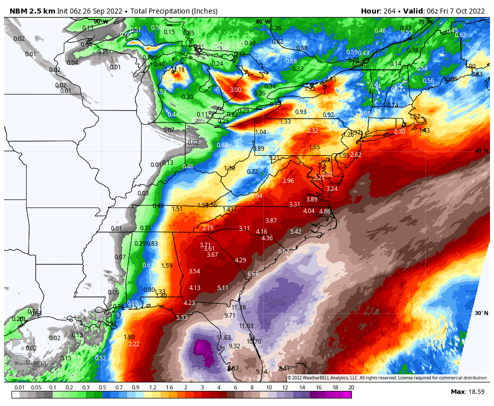
The storm today will produce heavy rainfall over Jamaica and Cuba. Storm surge and hurricane-force winds are a threat later today. Ian could be a major hurricane by the time it reaches western Cuba. It will be a major hurricane in the middle of the week, threatening the west coast and panhandle of Florida. Click here for the latest.
Never miss me! Subscribe for free. My Huge Radar has real-time weather tracking, current temperatures, and severe weather watches and warnings. Get detailed Indiana conditions by clicking here. Click here to see my central Indiana 7-Day Forecast. Follow these links to get my forecasts for Lafayette, Muncie, Hendricks County, and Hamilton County. Need a second opinion? Click here for central Indiana National Weather Service forecasts. (Some charts via WeatherBELL.)
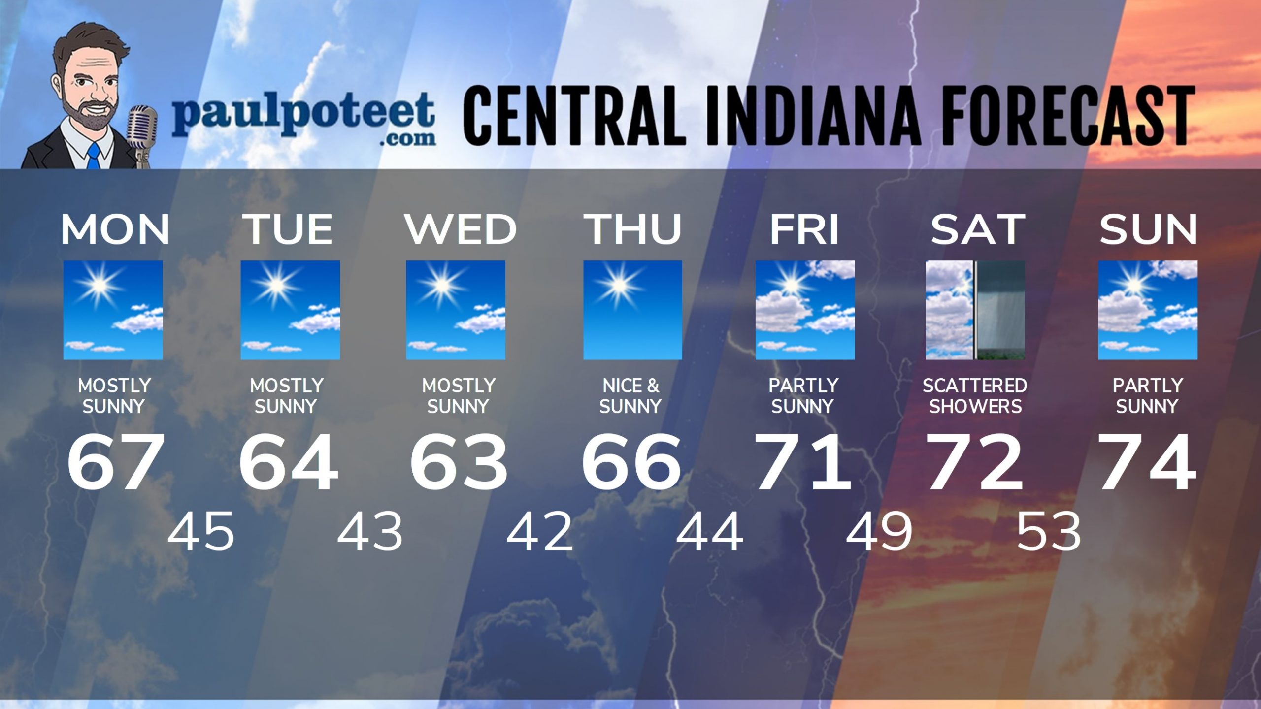
INDY SEVEN DAY FORECAST
Today: Sunny morning. Mostly sunny afternoon. High 67.
Tonight: Partly cloudy evening. Clear overnight. Low 45.
Tuesday: Mostly sunny. High 64.
Tuesday Night: Clear. Low 43.
Wednesday: Mostly sunny. High 63.
Wednesday Night: Clear. Low 42.
Thursday: Sunny. High 66.
Thursday Night: Clear. Low 44.
Friday: Partly sunny. High 71.
Friday Night: Partly cloudy. Low 49.
Saturday: Partly to mostly cloudy. Scattered showers possible. High 72.
Saturday Night: Scattered evening showers, then partly cloudy. Low 53.
Sunday: Partly sunny. High 74.
Never miss me! Subscribe for free. My Huge Radar has real-time weather tracking, current temperatures, and severe weather watches and warnings. Get detailed Indiana conditions by clicking here. Click here to see my central Indiana 7-Day Forecast. Follow these links to get my forecasts for Lafayette, Muncie, Hendricks County, and Hamilton County. Need a second opinion? Click here for central Indiana National Weather Service forecasts. (Some charts via WeatherBELL.)


