Expect a 25 degree difference from yesterday’s torrid temperatures! Here are the highs from Wednesday:
96 Bloomington
95 Terre Haute, Shelbyville
94 Muncie
93 Indianapolis
91 Lafayette
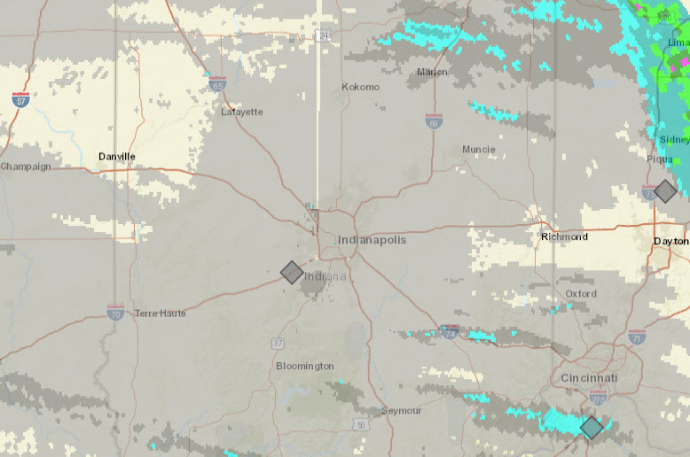
Swing and a miss (for most) as far as rainfall with the cold front.
High pressure takes over for awhile. A warm front arrives for Saturday, and a cold front Sunday. Clouds may result in the very early morning hours both days, and there could be a few random showers, but overall a nice…Fall weekend ahead.

Never miss me! Subscribe for free. My Huge Radar has real-time weather tracking, current temperatures, and severe weather watches and warnings. Get detailed Indiana conditions by clicking here. Click here to see my central Indiana 7-Day Forecast. Follow these links to get my forecasts for Lafayette, Muncie, Hendricks County, and Hamilton County. Need a second opinion? Click here for central Indiana National Weather Service forecasts. (Some charts via WeatherBELL.)
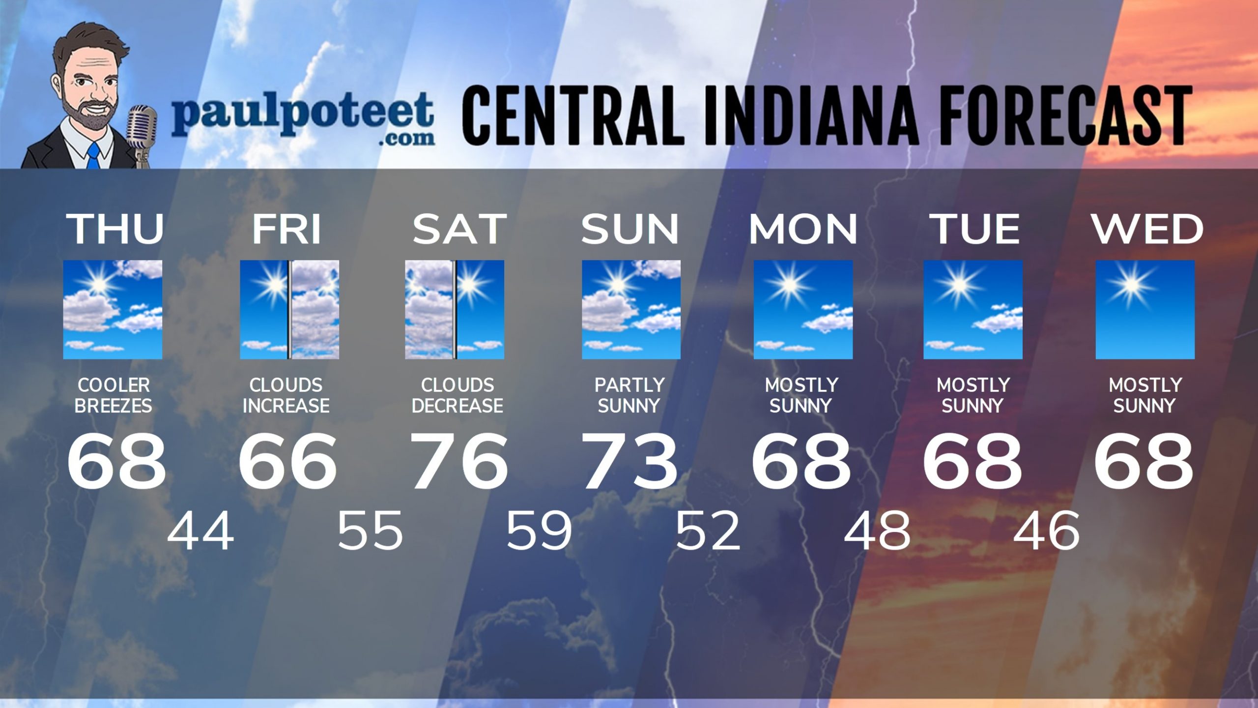
INDY SEVEN DAY FORECAST
Today: Partly sunny, and less humid. North wind gusting to 25 mph. High 68.
Tonight: Mostly clear and much cooler. Evening wind gusts to 20 mph. Low 44.
Friday: Mostly sunny morning. Clouds increase in the afternoon. High 66.
Friday Night: Cloudy, with a spotty shower possible overnight. Low 55.
Saturday: Clouds early, decreasing through the day. High 76.
Saturday Night: Partly cloudy evening. Spotty shower possible overnight. Low 59.
Sunday: Partly sunny. High 73.
Sunday Night: Partly cloudy. Low 52.
Monday: Mostly sunny. High 68.
Monday Night: Mostly clear. Low 48.
Tuesday: Mostly sunny. High 68.
Tuesday Night: Mostly clear. Low 46.
Wednesday: Mostly sunny. High 68.
Never miss me! Subscribe for free. My Huge Radar has real-time weather tracking, current temperatures, and severe weather watches and warnings. Get detailed Indiana conditions by clicking here. Click here to see my central Indiana 7-Day Forecast. Follow these links to get my forecasts for Lafayette, Muncie, Hendricks County, and Hamilton County. Need a second opinion? Click here for central Indiana National Weather Service forecasts. (Some charts via WeatherBELL.)


