It’s the middle of the month, and it’s also exactly one week away from Fall. Summer, however, hangs on and sprawls out in my forecast through the weekend. Humidity stays under control until next Monday, where there is now a chance of showers and storms.
We finally got back to the 80s yesterday after two days in the 60s. The average high today is 79, so we’re back into above-average territory for the next week.
Never miss me! Subscribe for free. My Huge Radar has real-time weather tracking, current temperatures, and severe weather watches and warnings. Get detailed Indiana conditions by clicking here. Click here to see my central Indiana 7-Day Forecast. Follow these links to get my forecasts for Lafayette, Muncie, Hendricks County, and Hamilton County. Need a second opinion? Click here for central Indiana National Weather Service forecasts. (Some charts via WeatherBELL.)
INDY SEVEN DAY FORECAST
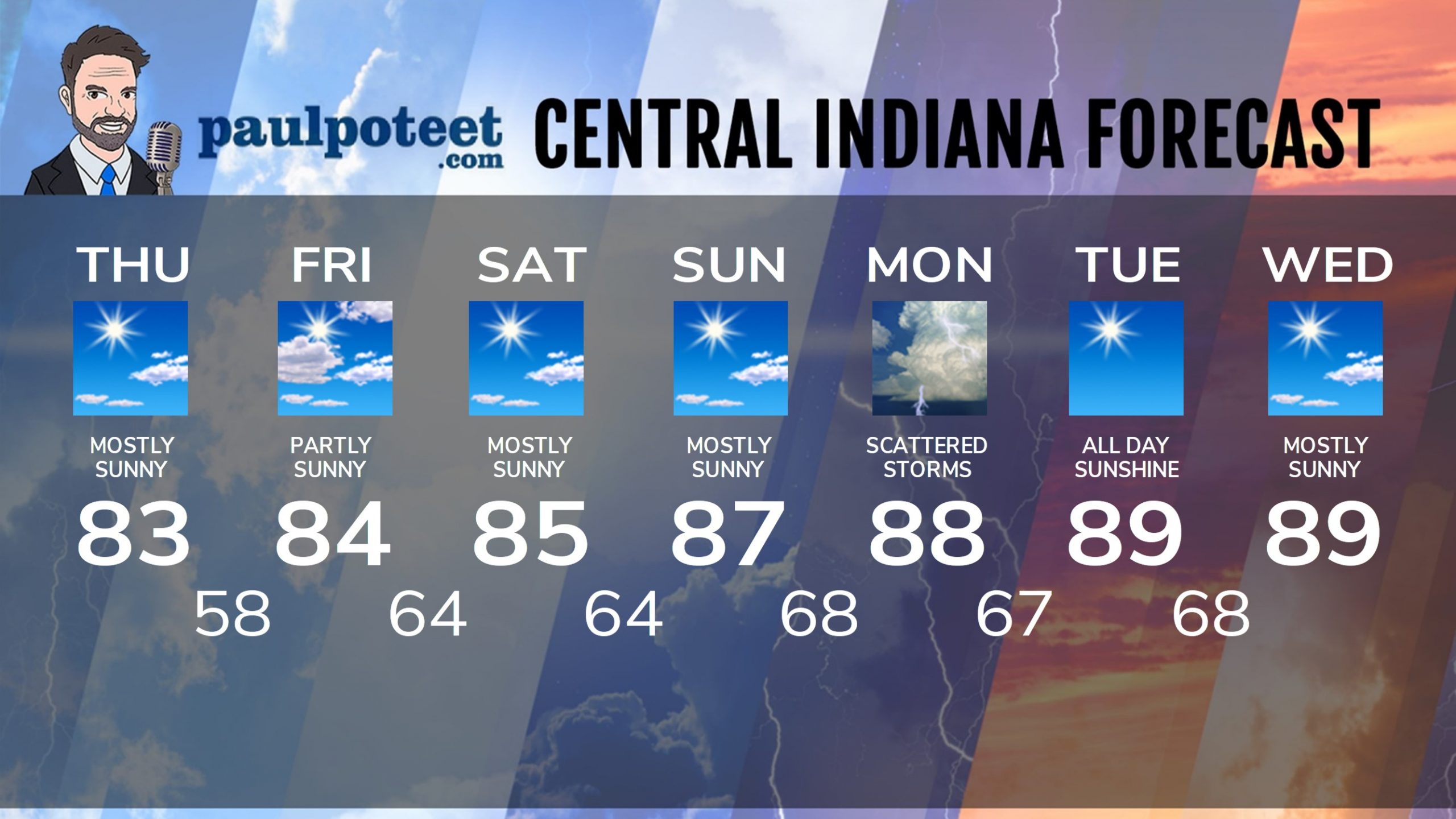
Today: Patchy early morning fog, then mostly sunny. High 83.
Tonight: Mostly clear. Low 58.
Friday: Partly sunny. High 84.
Friday Night: Partly cloudy. Low 64.
Saturday: Mostly sunny. High 85.
Saturday Night: Mostly clear. Low 64.
Sunday: Mostly sunny. High 87.
Sunday Night: Partly cloudy. Scattered showers and storms possible after midnight. Low 68.
Monday: Partly sunny and muggy, with scattered showers or storms. High 88.
Monday Night: Mostly clear and muggy. Low 67.
Tuesday: Sunny, hot and humid. High 89.
Tuesday Night: Mostly clear. Muggy. Low 68.
Wednesday: Mostly sunny. Humidity starts to fall again. High 89.
Never miss me! Subscribe for free. My Huge Radar has real-time weather tracking, current temperatures, and severe weather watches and warnings. Get detailed Indiana conditions by clicking here. Click here to see my central Indiana 7-Day Forecast. Follow these links to get my forecasts for Lafayette, Muncie, Hendricks County, and Hamilton County. Need a second opinion? Click here for central Indiana National Weather Service forecasts. (Some charts via WeatherBELL.)


