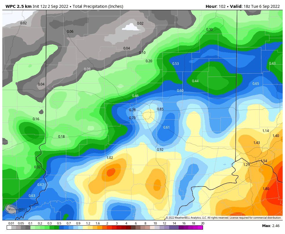
Unfortunately the biggest change to the forecast trend the last few days…is a wetter Labor Day weekend. Rainfall will be most likely Sunday and Monday. It could start by Saturday evening, especially from Indy southward. Totals by Tuesday will be highest east and south of Indianapolis.
Never miss me! Subscribe for free. My Huge Radar has real-time weather tracking, current temperatures, and severe weather watches and warnings. Get detailed Indiana conditions by clicking here. Click here to see my central Indiana 7-Day Forecast. Follow these links to get my forecasts for Lafayette, Muncie, Hendricks County, and Hamilton County. Need a second opinion? Click here for central Indiana National Weather Service forecasts. (Some charts via WeatherBELL.)
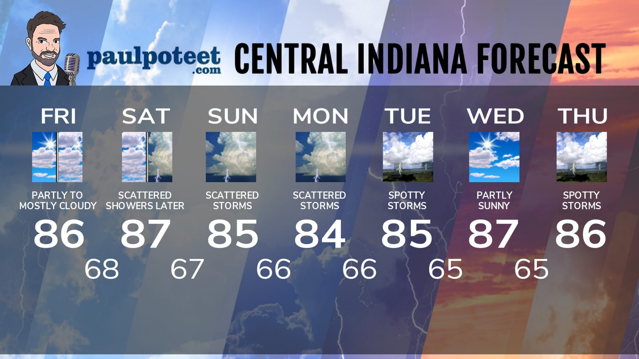
INDY SEVEN DAY FORECAST
Friday: Partly to mostly cloudy. High 86.
Tonight: Mostly cloudy. Low 68.
Saturday: Partly to mostly cloudy. High 87.
Saturday Night: Scattered showers and storms. Low 67.
Sunday: Partly to mostly cloudy. Muggy. Scattered showers and storms. High 85.
Sunday Night: Partly to mostly cloudy. Spotty showers and storms. Low 66.
Labor Day: Partly sunny. Muggy. Scattered showers and storms possible. High 84.
Monday Night: Partly cloudy. Low 66.
Tuesday: Partly sunny. Spotty showers and storms possible. High 85.
Tuesday Night: Partly cloudy. Low 65.
Wednesday: Partly sunny. High 87.
Wednesday Night: Partly cloudy. Low 65.
Thursday: Partly sunny. Spotty showers and storms. High 86.
Never miss me! Subscribe for free. My Huge Radar has real-time weather tracking, current temperatures, and severe weather watches and warnings. Get detailed Indiana conditions by clicking here. Click here to see my central Indiana 7-Day Forecast. Follow these links to get my forecasts for Lafayette, Muncie, Hendricks County, and Hamilton County. Need a second opinion? Click here for central Indiana National Weather Service forecasts. (Some charts via WeatherBELL.)


