(Via @NWSIndianapolis.) 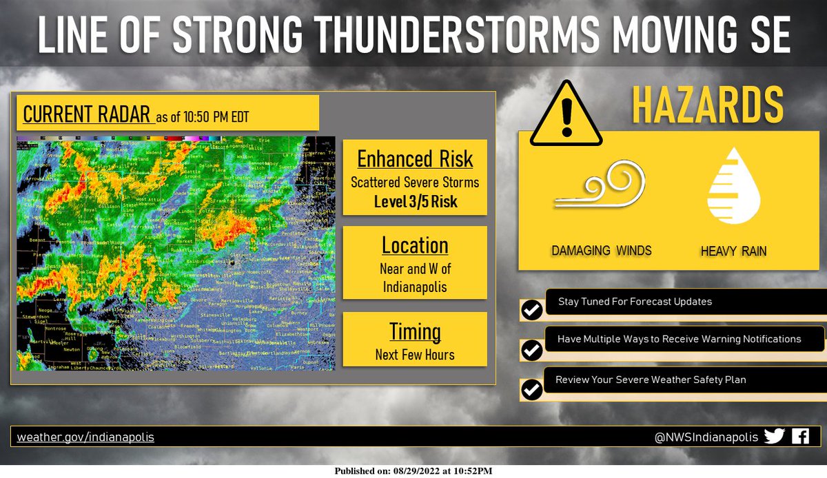 Scattered strong thunderstorms are moving southeast across portions of central Indiana, particularly near and west of Indianapolis. The strongest storms may produce wind gusts of 50-55 MPH at times and small hail, along with torrential rainfall and frequent lightning. #INwx https://t.co/vdtK2WomaA
My Huge Radar has real-time weather tracking, current temperatures, and severe weather watches and warnings. Get detailed Indiana conditions by clicking here. Follow these links to get my forecasts for Lafayette, Muncie, Hendricks County, and Hamilton County. Need a second opinion? Click here for central Indiana National Weather Service forecasts.
Never miss me! Subscribe for free. My Huge Radar has real-time weather tracking, current temperatures, and severe weather watches and warnings. Get detailed Indiana conditions by clicking here. Click here to see my central Indiana 7-Day Forecast. Follow these links to get my forecasts for Lafayette, Muncie, Hendricks County, and Hamilton County. Need a second opinion? Click here for central Indiana National Weather Service forecasts. (Some charts via WeatherBELL.)


