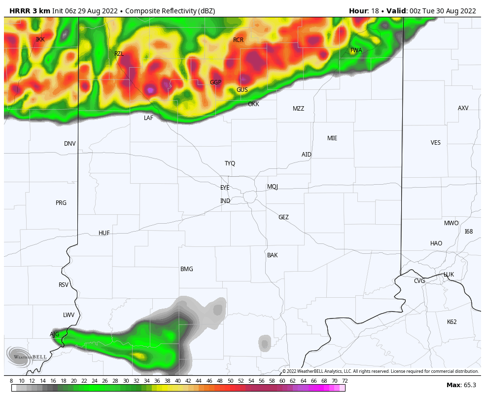
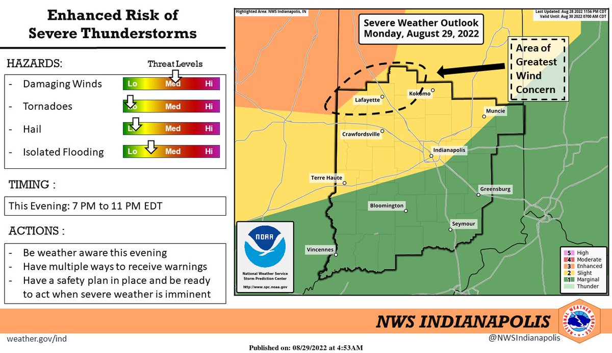
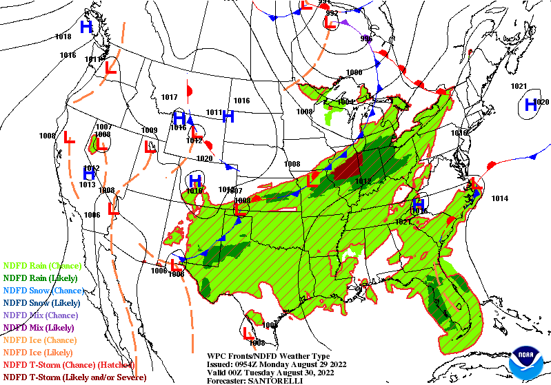
A complex of storms is likely to form in front of a cold front diving into Indiana tonight and tomorrow morning. The storms could hit the Lafayette area around sunset, and spread quickly into Indy and Muncie after 9pm, producing wind gusts that could reach severe levels.
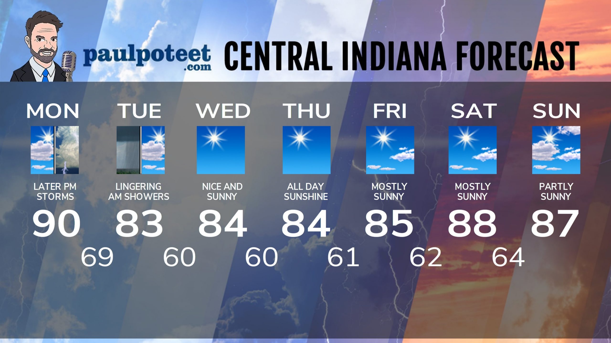
Behind the front Tuesday afternoon: drier air pours backs into the state. Wednesday through Friday look very comfortable. Labor Day weekend temps will be above average, but I don’t see any big storms or huge humidity.
Never miss me! Subscribe for free. My Huge Radar has real-time weather tracking, current temperatures, and severe weather watches and warnings. Get detailed Indiana conditions by clicking here. Click here to see my central Indiana 7-Day Forecast. Follow these links to get my forecasts for Lafayette, Muncie, Hendricks County, and Hamilton County. Need a second opinion? Click here for central Indiana National Weather Service forecasts. (Some charts via WeatherBELL.)
INDY SEVEN DAY FORECAST
Today: Partly sunny. Scattered afternoon showers or storms possible. High 90.
Tonight: Showers and storms. Some could be severe. Low 69.
Tuesday: Lingering early morning showers and storms. Clouds decrease in the afternoon. High 83.
Tuesday Night: Clear, cooler, and less humid. Low 60.
Wednesday: Sunny. High 84.
Wednesday Night: Clear. Low 60.
Thursday: Sunny. High 84.
Thursday Night: Mostly clear. Low 61.
Friday: Mostly sunny. High 85.
Friday Night: Mostly clear. Low 62.
Saturday: Mostly sunny. High 88.
Saturday Night: Mostly clear. Low 64.
Sunday: Partly sunny. High 87.
Never miss me! Subscribe for free. My Huge Radar has real-time weather tracking, current temperatures, and severe weather watches and warnings. Get detailed Indiana conditions by clicking here. Click here to see my central Indiana 7-Day Forecast. Follow these links to get my forecasts for Lafayette, Muncie, Hendricks County, and Hamilton County. Need a second opinion? Click here for central Indiana National Weather Service forecasts. (Some charts via WeatherBELL.)


