(Via @NWSIndianapolis.) 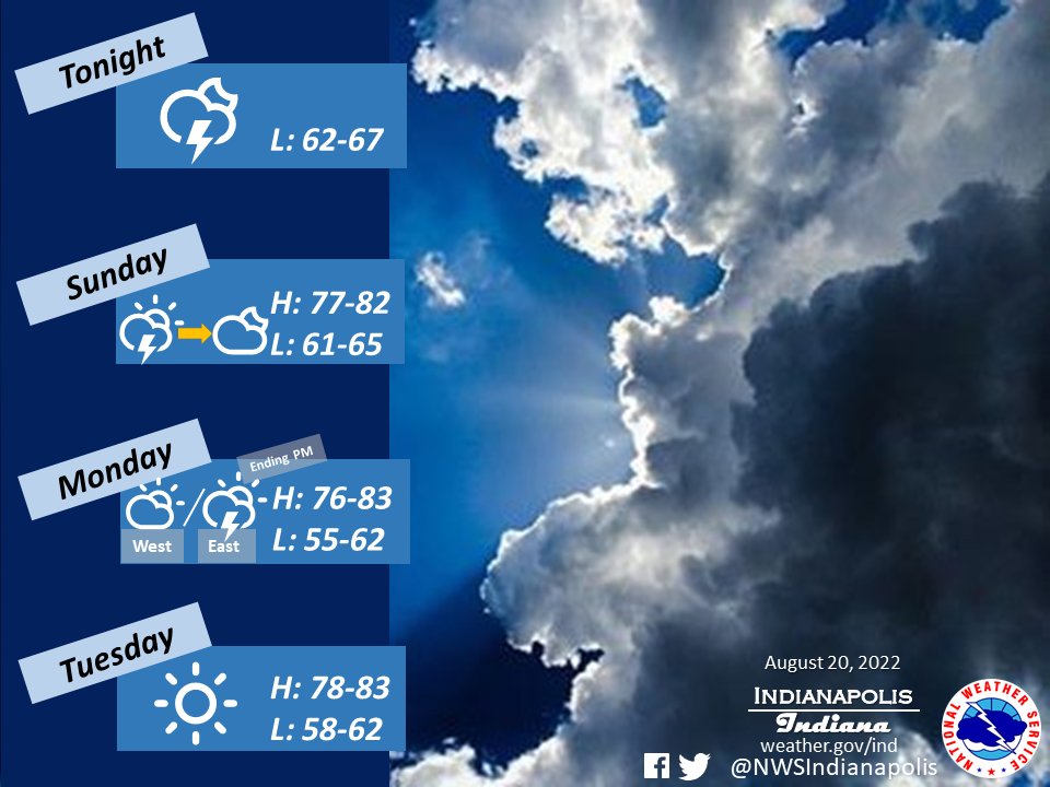 Scattered showers/t-storms increasing this eve & early overnight w/ potential for severe, especially E IN. Rain chances end late Sunday, a slight chance again Monday afternoon E 1/2 IN, otherwise clearing. Pleasant Tue. Thru Tue night, highs 76-83°, lows 55-67. #INwx #nwsind https://t.co/J3JlabsrRB
My Huge Radar has real-time weather tracking, current temperatures, and severe weather watches and warnings. Get detailed Indiana conditions by clicking here. Follow these links to get my forecasts for Lafayette, Muncie, Hendricks County, and Hamilton County. Need a second opinion? Click here for central Indiana National Weather Service forecasts.
Never miss me! Subscribe for free. My Huge Radar has real-time weather tracking, current temperatures, and severe weather watches and warnings. Get detailed Indiana conditions by clicking here. Click here to see my central Indiana 7-Day Forecast. Follow these links to get my forecasts for Lafayette, Muncie, Hendricks County, and Hamilton County. Need a second opinion? Click here for central Indiana National Weather Service forecasts. (Some charts via WeatherBELL.)


