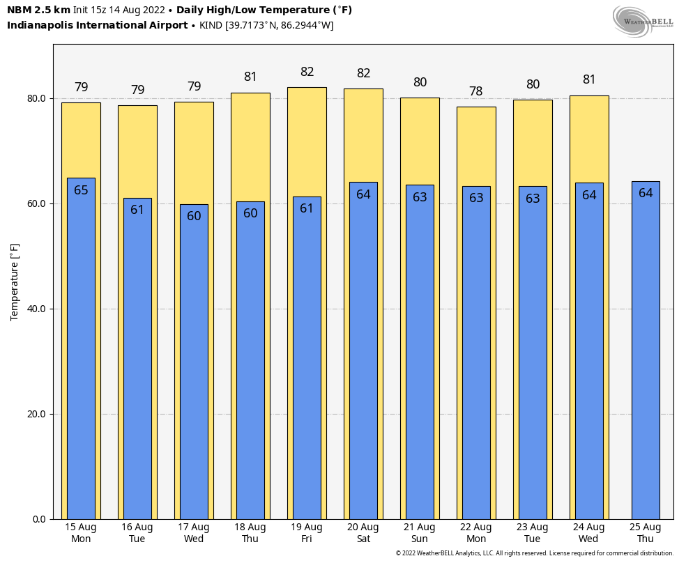
Clouds and humidity decrease today, and stay low the rest of the week. As this chart shows, highs will generally be in the lower 80s over the next ten days. That’s near or below average.
Precipitation looks low over that same ten-day period. There were some big rain totals Sunday:
0.85″ Lafayette
0.33″ Indianapolis
0.30″ Kokomo
0.20″ Terre haute
0.18″ Shelbyville
0.16″ Muncie
0.13″ Anderson
Never miss me! Subscribe for free. My Huge Radar has real-time weather tracking, current temperatures, and severe weather watches and warnings. Get detailed Indiana conditions by clicking here. Click here to see my central Indiana 7-Day Forecast. Follow these links to get my forecasts for Lafayette, Muncie, Hendricks County, and Hamilton County. Need a second opinion? Click here for central Indiana National Weather Service forecasts. (Some charts via WeatherBELL.)
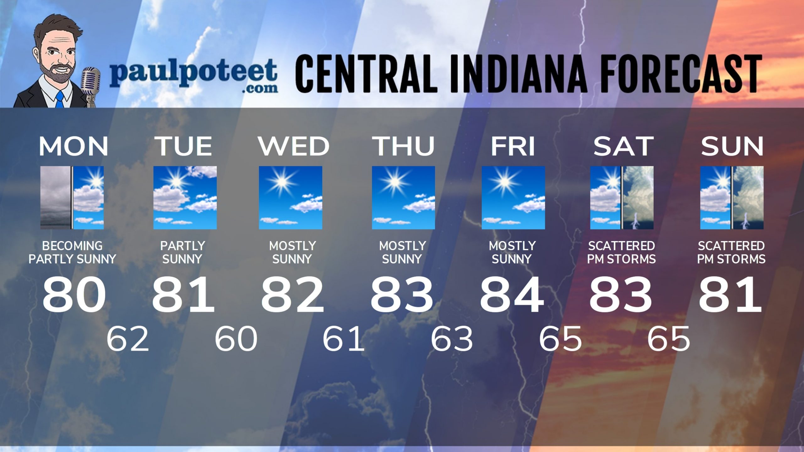
INDY SEVEN DAY FORECAST
Today: Cloudy morning. Becoming partly sunny. High 80.
Tonight: Partly cloudy. Low 62.
Tuesday: Partly sunny. High 81.
Tuesday Night: Mostly clear. Low 60.
Wednesday: Mostly sunny. High 82.
Wednesday Night: Mostly clear. Low 61.
Thursday: Mostly sunny. High 83.
Thursday Night: Mostly clear. Low 63.
Friday: Mostly sunny. High 84.
Friday Night: Partly cloudy. Low 65.
Saturday: Partly sunny. Scattered afternoon showers and storms. High 83.
Saturday Night: Spotty showers and storms. Low 65.
Sunday: Partly sunny. Scattered afternoon showers and storms. High 81.
Never miss me! Subscribe for free. My Huge Radar has real-time weather tracking, current temperatures, and severe weather watches and warnings. Get detailed Indiana conditions by clicking here. Click here to see my central Indiana 7-Day Forecast. Follow these links to get my forecasts for Lafayette, Muncie, Hendricks County, and Hamilton County. Need a second opinion? Click here for central Indiana National Weather Service forecasts. (Some charts via WeatherBELL.)


