What a weekend! Power outages in the northern third of the state from high winds Saturday morning, then four different reports of funnel clouds that prompted a burst of tornado warnings Sunday afternoon. Shhhhhhhh, Ma Nature takes a nap today, AND the humidity will be lower.
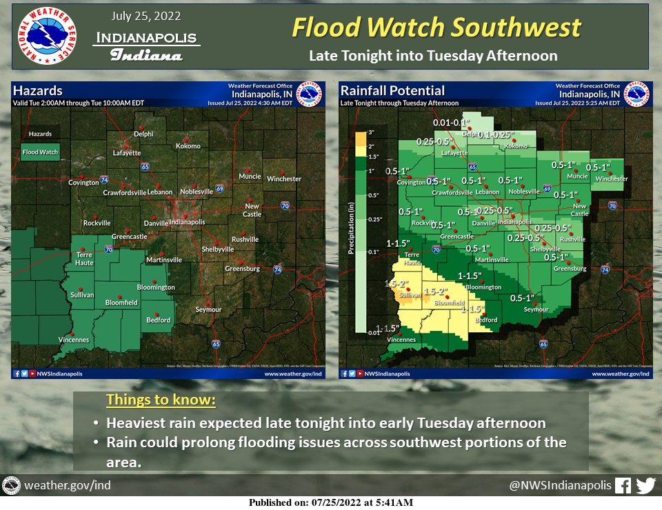
Rain returns late tonight, and into the morning and midday of Tuesday. The already-recently-battered southwest corner of the state could get a couple of inches from that.
Severe storms could return to central Indiana Wednesday and Thursday. Friday into NEXT weekend looks awesome!
Never miss me! Subscribe for free. My Huge Radar has real-time weather tracking, current temperatures, and severe weather watches and warnings. Get detailed Indiana conditions by clicking here. Click here to see my central Indiana 7-Day Forecast. Follow these links to get my forecasts for Lafayette, Muncie, Hendricks County, and Hamilton County. Need a second opinion? Click here for central Indiana National Weather Service forecasts. (Some charts via WeatherBELL.)
INDIANAPOLIS SEVEN DAY FORECAST
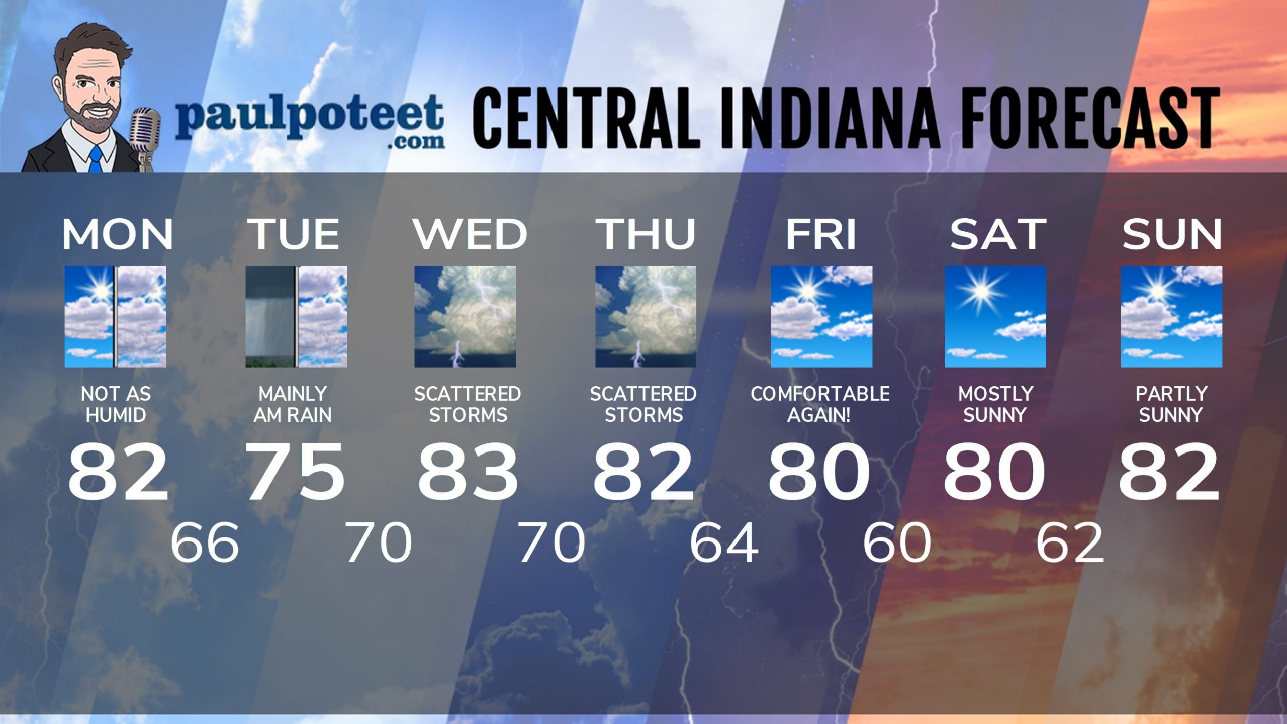
Today: Mostly to partly cloudy. Not as humid. High 82.
Tonight: Cloudy, with overnight showers. Low 66.
Tuesday: Morning rain, then mostly cloudy. High 75.
Tuesday Night: Humidity returns. Scattered shower or storms late. Low 70.
Wednesday: Scattered showers and storms. High 83.
Wednesday Night: Scattered showers and storms. Low 70.
Thursday: Scattered showers and storms. High 82.
Thursday: Spotty showers or storms. Low 64.
Friday: Partly sunny. Not as humid! High 80.
Friday Night: Partly cloudy. Low 60.
Saturday: Mostly sunny. High 80.
Saturday Night: Mostly clear. Low 62.
Sunday: Partly sunny. High 82.
Never miss me! Subscribe for free. My Huge Radar has real-time weather tracking, current temperatures, and severe weather watches and warnings. Get detailed Indiana conditions by clicking here. Click here to see my central Indiana 7-Day Forecast. Follow these links to get my forecasts for Lafayette, Muncie, Hendricks County, and Hamilton County. Need a second opinion? Click here for central Indiana National Weather Service forecasts. (Some charts via WeatherBELL.)


