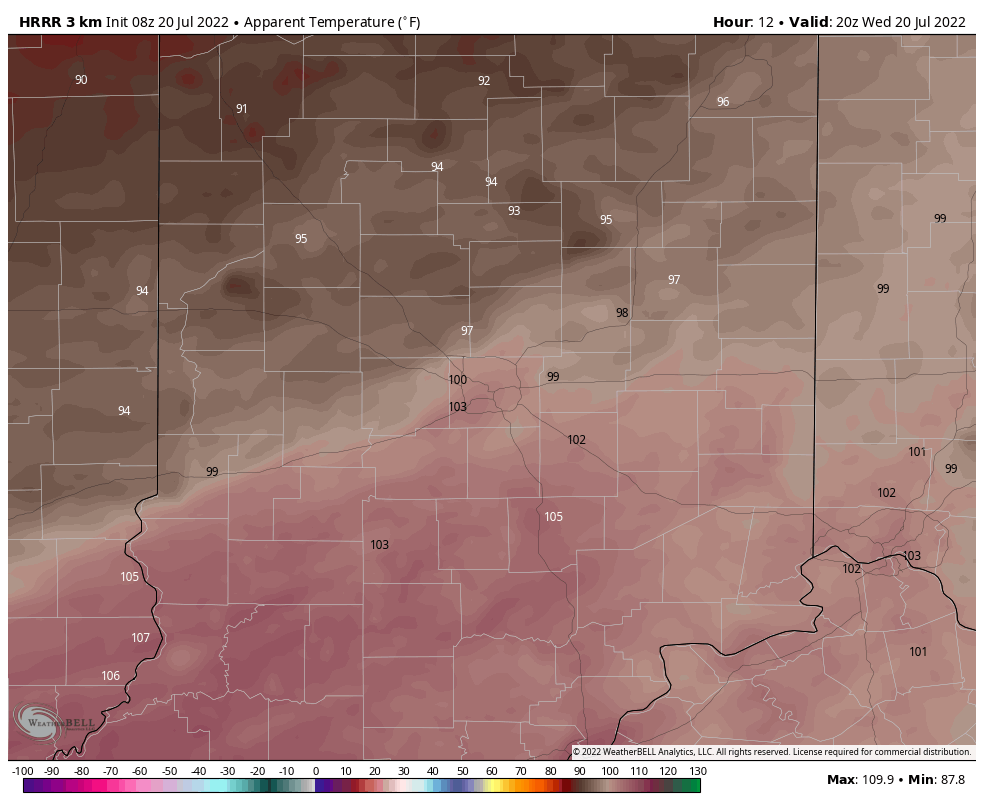
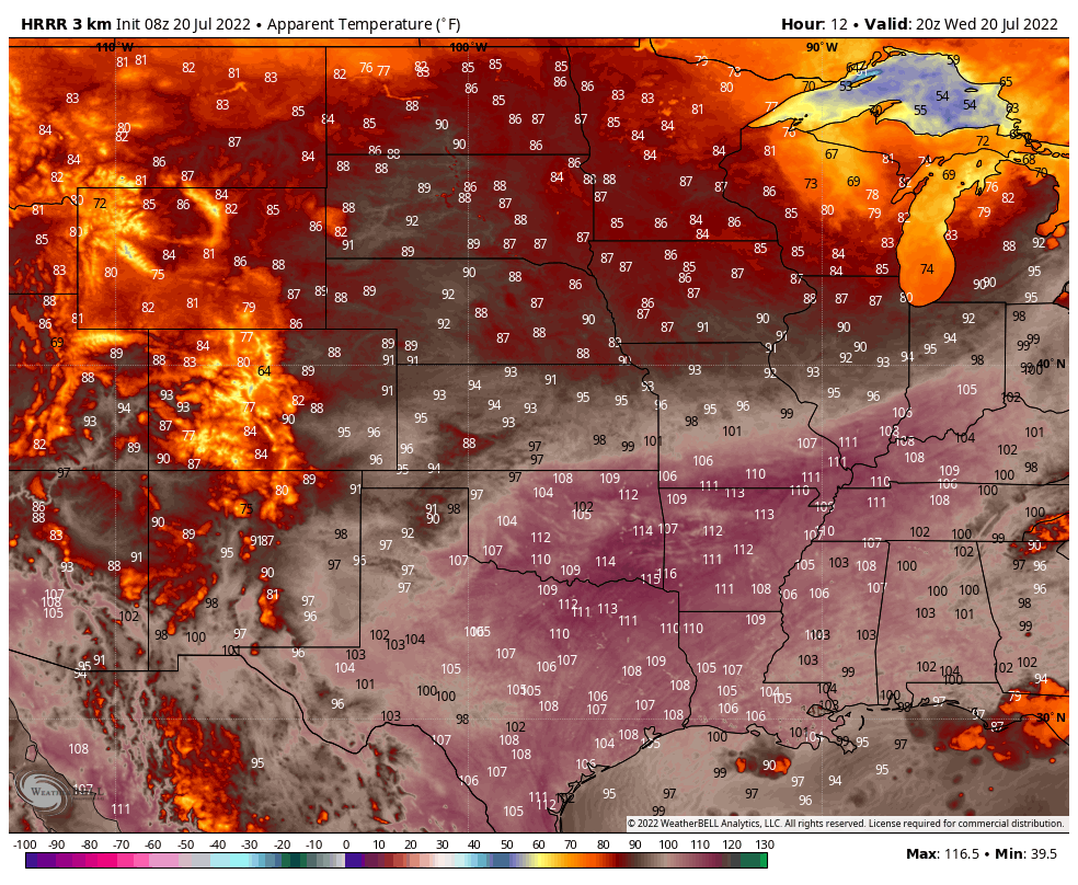
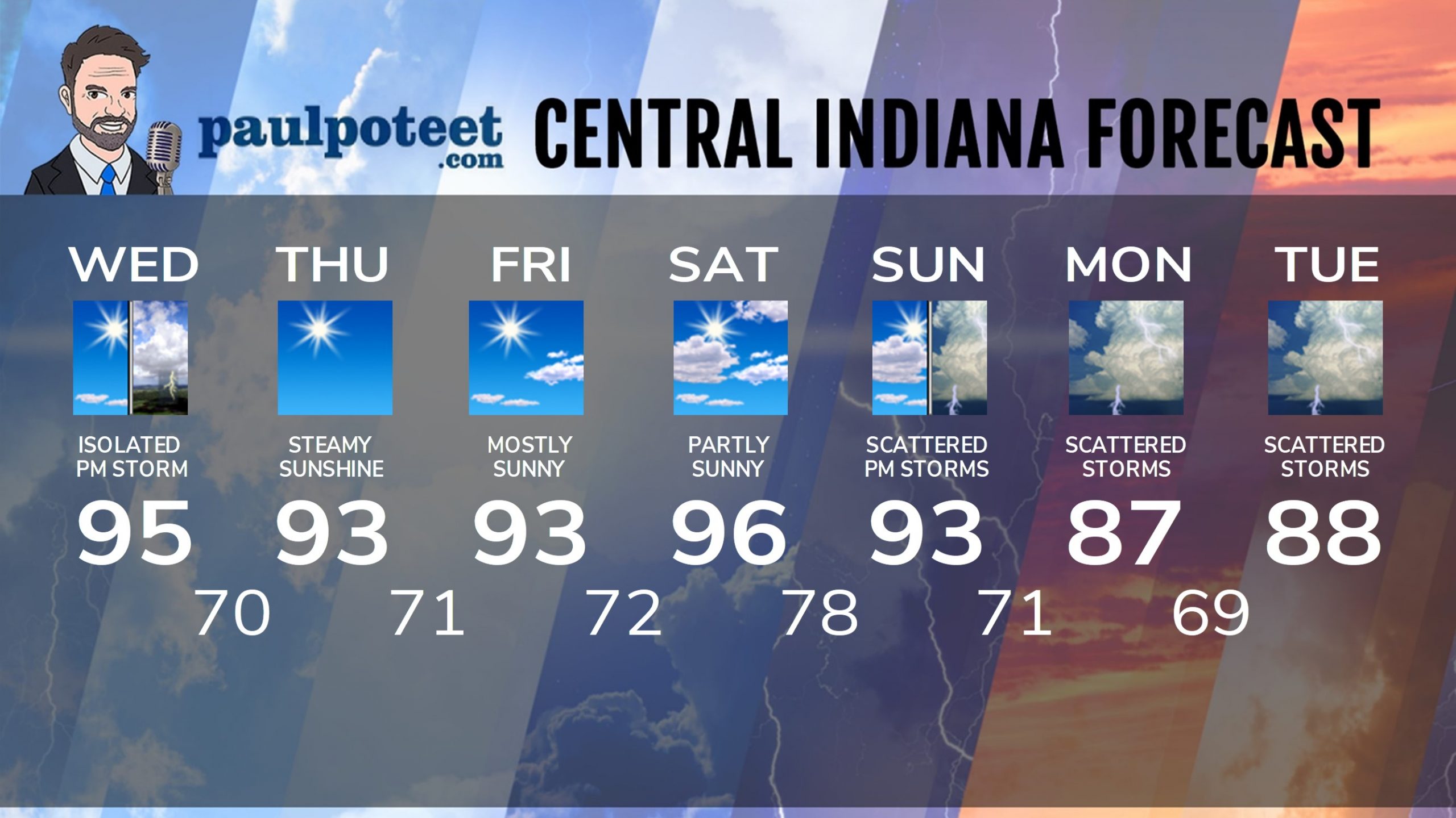
Afternoon heat index numbers nudge triple digits, especially south of I-70.
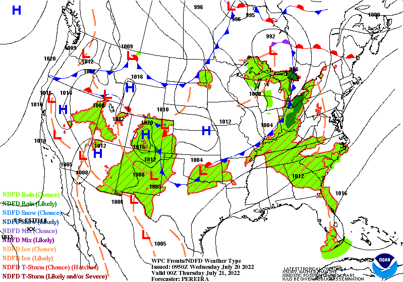
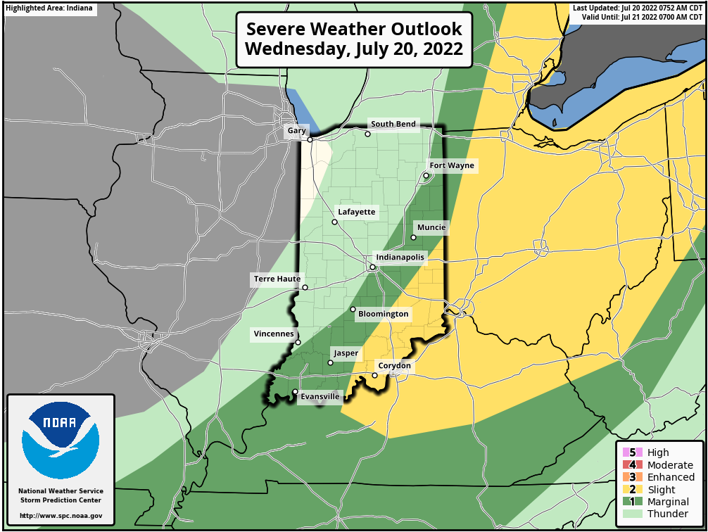
A cold front (it’s more of a wind shift line) moves through late this afternoon, and may spark a storm.
And if one sparks…it could be severe.
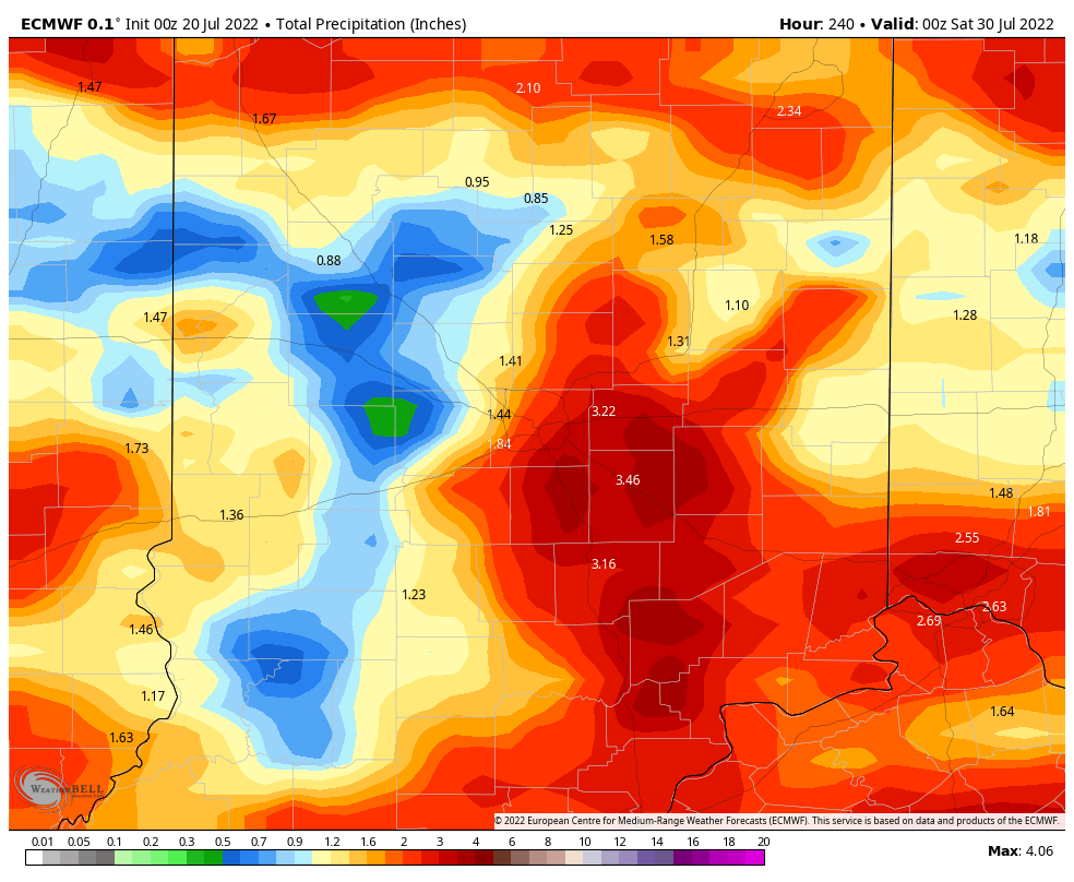
Might be some decent rain Monday and Tuesday.
Never miss me! Subscribe for free. My Huge Radar has real-time weather tracking, current temperatures, and severe weather watches and warnings. Get detailed Indiana conditions by clicking here. Click here to see my central Indiana 7-Day Forecast. Follow these links to get my forecasts for Lafayette, Muncie, Hendricks County, and Hamilton County. Need a second opinion? Click here for central Indiana National Weather Service forecasts. (Some charts via WeatherBELL.)
INDY SEVEN DAY FORECAST
Today: Mostly sunny. Afternoon heat index around, or just over 100. Isolated storm possible in the late afternoon. Any storm has the potential to be severe. High 95.
Tonight: Early evening isolated storm. Clearing late. Low 70.
Thursday: Sunny. High 93.
Thursday Night: Clear. Low 71.
Friday: Mostly sunny. High 93.
Friday Night: Partly cloudy. Low 72.
Saturday: Partly sunny. High 96.
Saturday Night; Partly cloudy. Low 78.
Sunday: Partly sunny. Scattered afternoon showers or storms. High 93.
Sunday Night: Partly cloudy. Scattered showers and storms. Low 71.
Monday: Mostly cloudy. Scattered showers and storms. High 87.
Monday Night: Scattered showers and storms. Low 69.
Tuesday: Mostly cloudy. Scattered showers and storms. High 88.
Never miss me! Subscribe for free. My Huge Radar has real-time weather tracking, current temperatures, and severe weather watches and warnings. Get detailed Indiana conditions by clicking here. Click here to see my central Indiana 7-Day Forecast. Follow these links to get my forecasts for Lafayette, Muncie, Hendricks County, and Hamilton County. Need a second opinion? Click here for central Indiana National Weather Service forecasts. (Some charts via WeatherBELL.)


