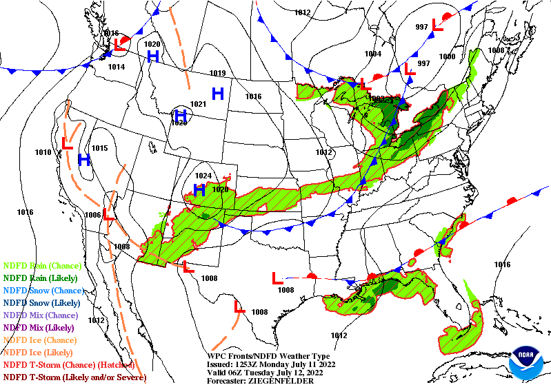
Another shot at showers and storms late tonight, and there is a level one or two (of five) risk of severe weather from the storms. All risks are possible, but the most likely trouble will be damaging straight-line wind gusts. Not much rainfall is expected tonight, or through the next week for that matter.

Here’s the front moving through overnight. On the other side of the cold front Tuesday: Humidity will go back down again.
Never miss me! Subscribe for free. My Huge Radar has real-time weather tracking, current temperatures, and severe weather watches and warnings. Get detailed Indiana conditions by clicking here. Click here to see my central Indiana 7-Day Forecast. Follow these links to get my forecasts for Lafayette, Muncie, Hendricks County, and Hamilton County. Need a second opinion? Click here for central Indiana National Weather Service forecasts. (Some charts via WeatherBELL.)
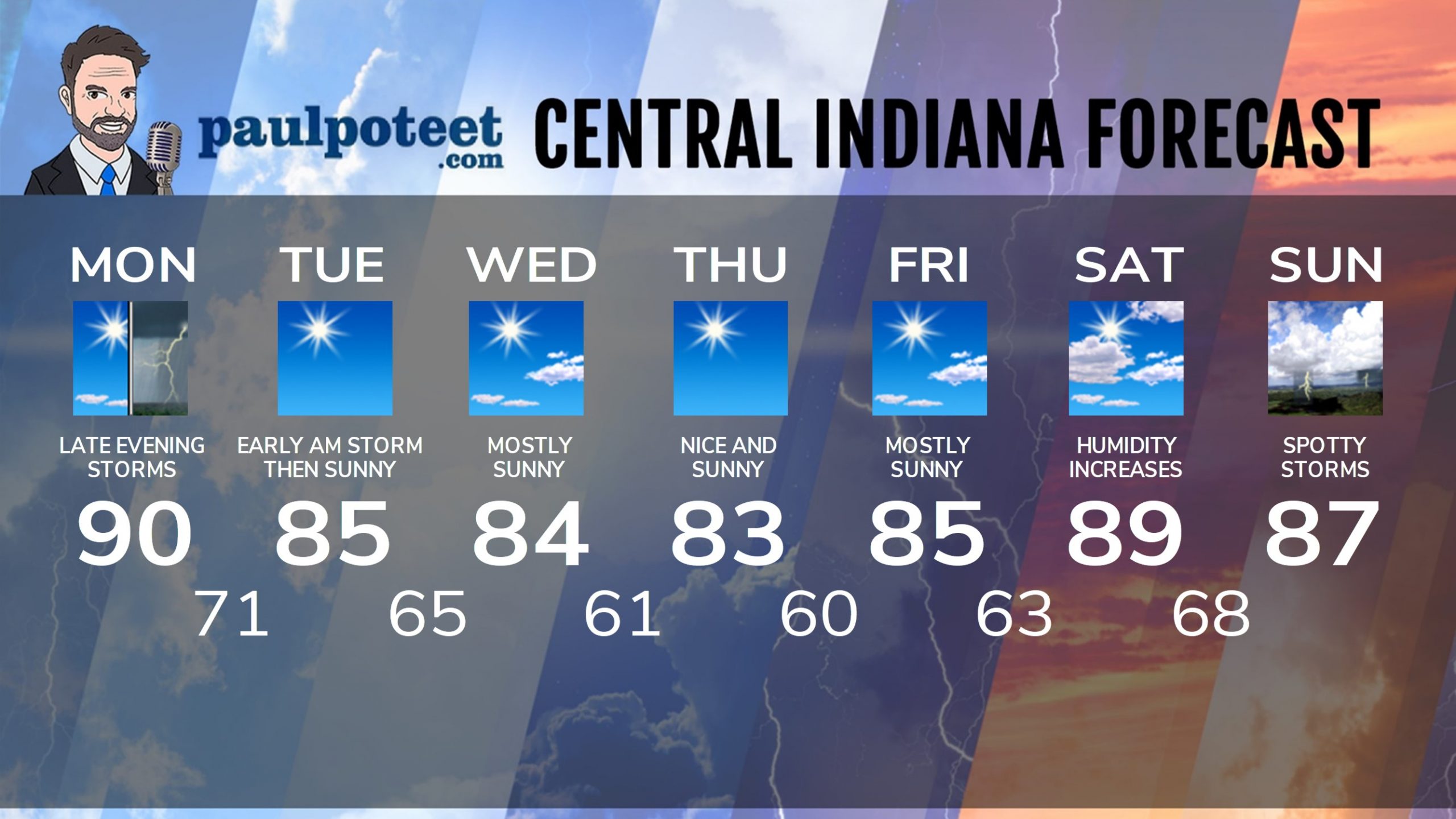
INDY SEVEN DAY FORECAST
Today: Sunny morning. Partly sunny afternoon. Humidity increases. High 90.
Tonight: Muggy, with scattered showers and storms, mainly late. Some storms could be severe. Low 71.
Tuesday: Early morning lingering shower or storm, then sunny. Humidity decreases. High 85.
Tuesday Night: Clear. Low 65.
Wednesday: Mostly sunny. High 84.
Wednesday Night: Clear. Low 61.
Thursday: Nice and sunny. High 83.
Thursday Night: Clear. Low 60.
Friday: Mostly sunny. High 85.
Friday Night: Mostly clear. Low 63.
Saturday: Partly sunny. Humidity increases. High 89.
Saturday Night: Partly cloudy. Scattered storms late. Low 68.
Sunday: Partly sunny. Spotty showers and storms. High 87.
Never miss me! Subscribe for free. My Huge Radar has real-time weather tracking, current temperatures, and severe weather watches and warnings. Get detailed Indiana conditions by clicking here. Click here to see my central Indiana 7-Day Forecast. Follow these links to get my forecasts for Lafayette, Muncie, Hendricks County, and Hamilton County. Need a second opinion? Click here for central Indiana National Weather Service forecasts. (Some charts via WeatherBELL.)


