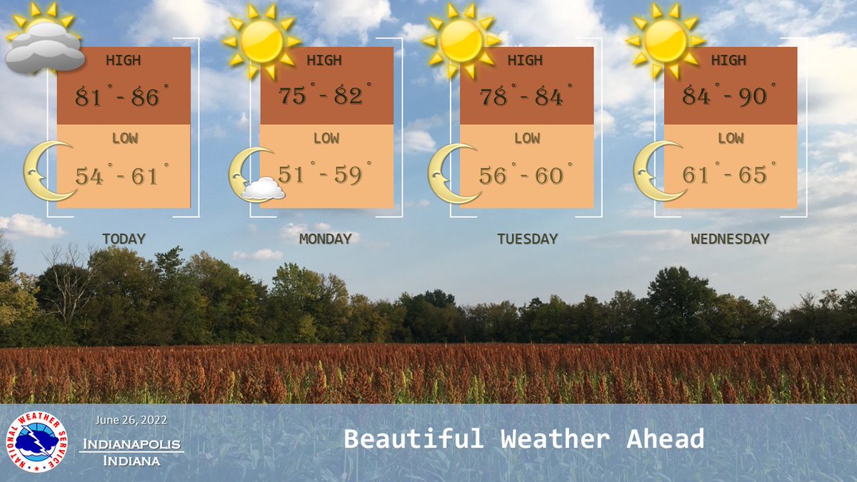
(Via @NWSIndianapolis.) Today, isolated showers/t-storms SE of SW to EC IN line, ending by mid-eve. Otherwise, dry thru Wed. High temps mid-70s to ~90, lows low 50s to mid-60s, warmest Wed. Decreasing humidity thru tonight, remaining comfortable Mon-Wed. Next rain chance Fri-Sat. #INwx #nwsind https://t.co/4vwWoBQXy3
My Huge Radar has real-time weather tracking, current temperatures, and severe weather watches and warnings. Get detailed Indiana conditions by clicking here. Follow these links to get my forecasts for Lafayette, Muncie, Hendricks County, and Hamilton County. Need a second opinion? Click here for central Indiana National Weather Service forecasts.
Never miss me! Subscribe for free. My Huge Radar has real-time weather tracking, current temperatures, and severe weather watches and warnings. Get detailed Indiana conditions by clicking here. Click here to see my central Indiana 7-Day Forecast. Follow these links to get my forecasts for Lafayette, Muncie, Hendricks County, and Hamilton County. Need a second opinion? Click here for central Indiana National Weather Service forecasts. (Some charts via WeatherBELL.)


