Two cold fronts play a role in Indiana weather the next few day. The one today may spark some showers and storms, but most places north and west of Indy won’t see anything. Sunday’s front should produce more widespread precipitation, mainly in the morning and midday.
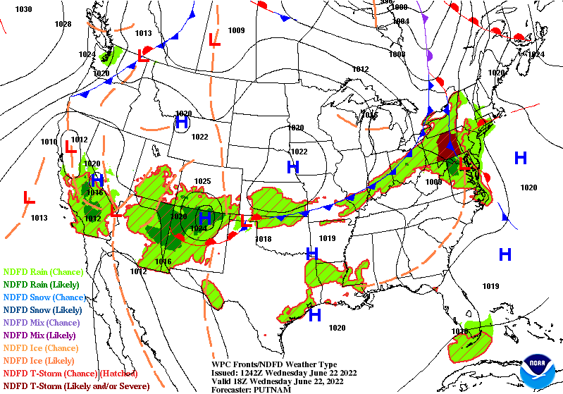
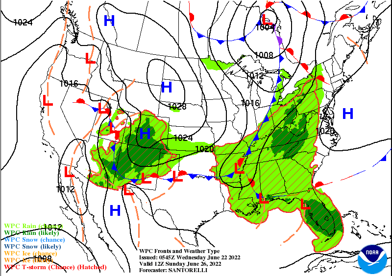
BOTH fronts will lower our humidity…so muggy today, not so bad Thursday and Friday…muggy weekend…not so humid next week.
Never miss me! Subscribe for free. My Huge Radar has real-time weather tracking, current temperatures, and severe weather watches and warnings. Get detailed Indiana conditions by clicking here. Click here to see my central Indiana 7-Day Forecast. Follow these links to get my forecasts for Lafayette, Muncie, Hendricks County, and Hamilton County. Need a second opinion? Click here for central Indiana National Weather Service forecasts. (Some charts via WeatherBELL.)
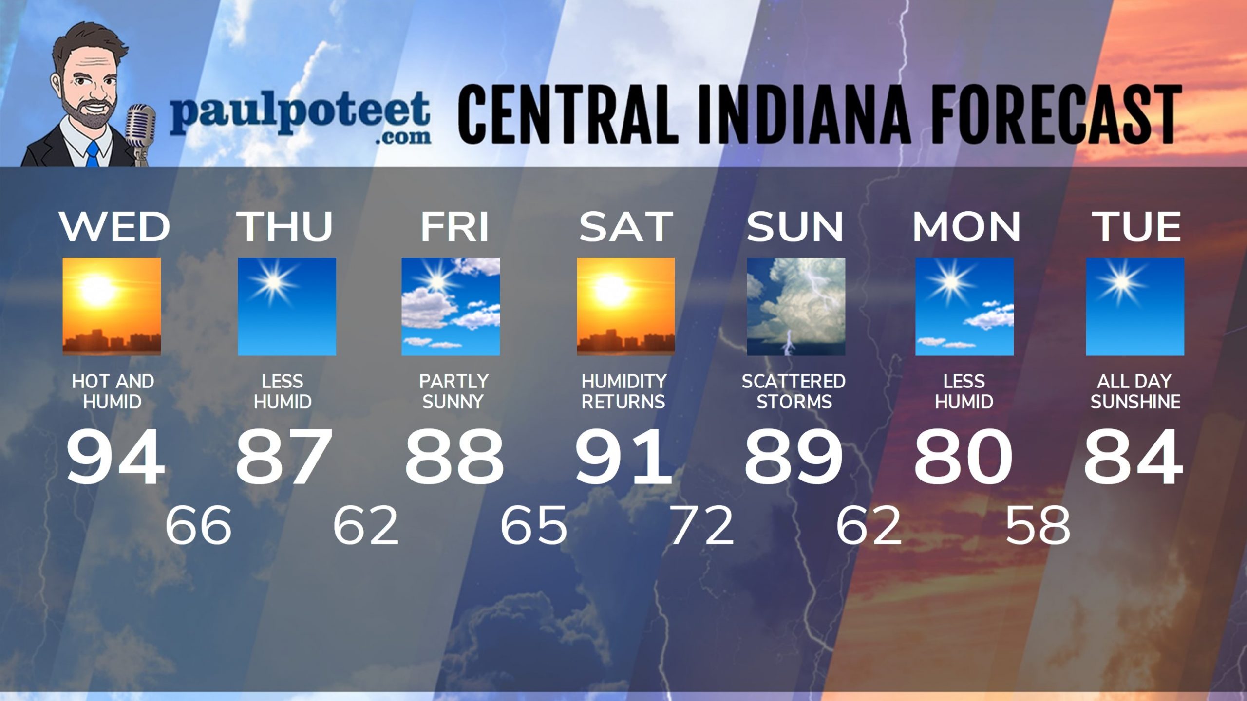
INDY SEVEN DAY FORECAST
Today: Mostly to partly sunny, hot and humid. Isolated shower or storm, especially south and east of Indy. High 94.
Tonight: Clouds and humidity decrease. Low 66.
Thursday: Sunny. Lower humidity again. High 87.
Thursday Night: Mostly clear. Low 62.
Friday: Partly sunny. High 88.
Friday Night: Partly cloudy. Low 65.
Saturday: Partly sunny. Humidity returns. High 91.
Saturday Night: Partly cloudy. Shower and storm chance after midnight. Low 72.
Sunday: Partly sunny. Scattered showers and storms, mainly in the morning. High 89.
Sunday Night: Clouds and humidity decrease. Low 62.
Monday: Mostly sunny and less humid again. High 80.
Monday Night: Clear. Low 58.
Tuesday: Sunny. High 84.
Never miss me! Subscribe for free. My Huge Radar has real-time weather tracking, current temperatures, and severe weather watches and warnings. Get detailed Indiana conditions by clicking here. Click here to see my central Indiana 7-Day Forecast. Follow these links to get my forecasts for Lafayette, Muncie, Hendricks County, and Hamilton County. Need a second opinion? Click here for central Indiana National Weather Service forecasts. (Some charts via WeatherBELL.)


