Ready? Set? Sweat! The weekend party is over and we’re headed back to the frying pan. Last week’s heat streak brought us to a peak of 93 on Tuesday and Thursday. We could beat that tomorrow and Wednesday. Reminder: Indy’s official temperature hasn’t gone past 95 since 2013.
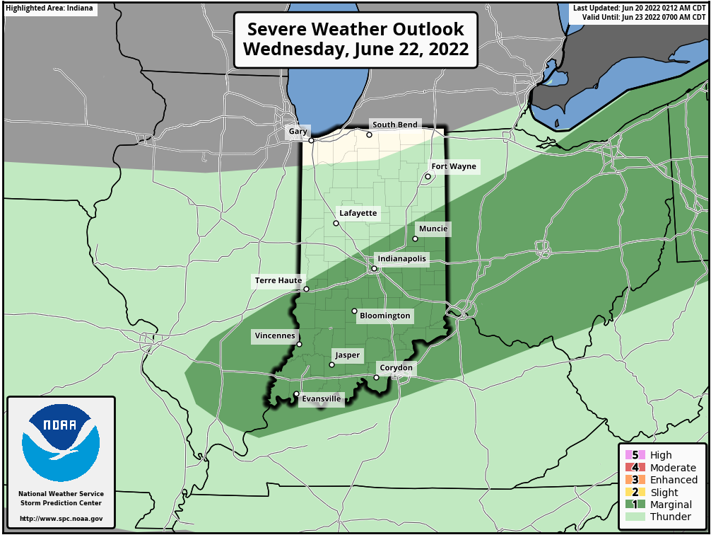
We’ll get a little relief Thursday and Friday, after a cold front brings scattered storms Wednesday. A few storms could produce large hail or damaging straight-line winds. The risk is level one of five.
Never miss me! Subscribe for free. My Huge Radar has real-time weather tracking, current temperatures, and severe weather watches and warnings. Get detailed Indiana conditions by clicking here. Click here to see my central Indiana 7-Day Forecast. Follow these links to get my forecasts for Lafayette, Muncie, Hendricks County, and Hamilton County. Need a second opinion? Click here for central Indiana National Weather Service forecasts. (Some charts via WeatherBELL.)
INDY SEVEN DAY FORECAST
Today: Mostly sunny. Hotter. High 89.
Tonight: Mostly clear. Low 65.
Tuesday: Sunny. Humidity returns. High 96.
Tuesday Night: Mostly clear. Muggy. Low 72.
Wednesday: Partly sunny, hot, and even more humid. Scattered afternoon showers and storms. High 95.
Wednesday Night: Scattered showers and storms in the evening. Low 67.
Thursday: Mostly sunny. Lower humidity again. High 90.
Thursday Night: Mostly clear. Low 64.
Friday: Partly sunny. High 90.
Friday Night: Partly cloudy. Low 69.
Saturday: Partly sunny. Humidity returns. High 93.
Saturday Night: Partly cloudy. Low 72.
Sunday: Partly sunny. High 89.

Never miss me! Subscribe for free. My Huge Radar has real-time weather tracking, current temperatures, and severe weather watches and warnings. Get detailed Indiana conditions by clicking here. Click here to see my central Indiana 7-Day Forecast. Follow these links to get my forecasts for Lafayette, Muncie, Hendricks County, and Hamilton County. Need a second opinion? Click here for central Indiana National Weather Service forecasts. (Some charts via WeatherBELL.)


