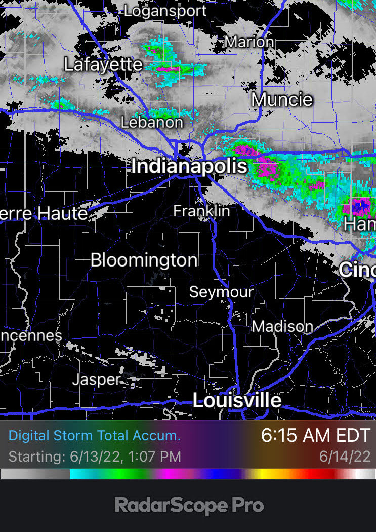
Highs will be near 100 today. The WIND SPEED was near 100 last night in Fort Wayne! A 98 mph gust was recorded at the International Airport at 10:39pm. It was associated with the second complex of storms Monday. The first stirred things up mainly in east-central Indiana into Ohio.
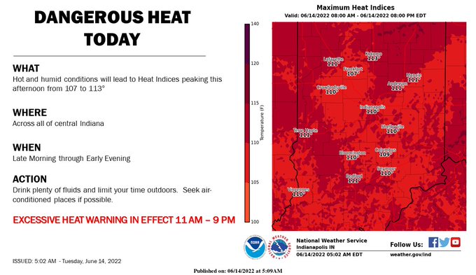
Storm threats are gone today and tomorrow. Temperatures are the thing, with triple-digit heat index numbers in the afternoon.
INDY SEVEN DAY FORECAST
**EXCESSIVE HEAT WARNING 11AM-9PM** Today: Partly to mostly sunny. Hot and humid. Present record high is 94. High 97.
**HEAT ADVISORY** Tonight: Clear and muggy. Low 76.
**HEAT ADVISORY UNTIL 9PM** Wednesday: Sunny, hot, and humid. High 98.
Wednesday Night: Mostly clear, and muggy. Low 77.
Thursday: Partly sunny, hot and humid. Spotty afternoon showers and storms possible. High 94.
Thursday Night: Spotty showers and storms. Low 69.
Friday: Sunny. Humidity falls in the afternoon. High 90.
Friday Night: Clear. Less humid. Low 63.
Saturday: Sunny. High 83.
Saturday Night: Clear. Low 58.
Sunday: Mostly sunny. High 89.
Sunday Night: Mostly clear. Low 64.
Monday: Sunny. Humidity increases again. High 95.
:end
Never miss me! Subscribe for free. My Huge Radar has real-time weather tracking, current temperatures, and severe weather watches and warnings. Get detailed Indiana conditions by clicking here. Click here to see my central Indiana 7-Day Forecast. Follow these links to get my forecasts for Lafayette, Muncie, Hendricks County, and Hamilton County. Need a second opinion? Click here for central Indiana National Weather Service forecasts. (Some charts via WeatherBELL.)


