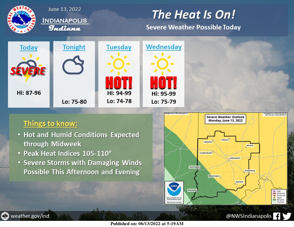
(Via @NWSIndianapolis.) Dangerous heat and humidity will build into central Indiana for the next few days with highs into the 90s and peak heat indices at 105-110 through Wednesday. A cluster of severe thunderstorms with damaging winds may drop into the NE half of the area this afternoon. #INwx #indy https://t.co/GJgP4Ix2Ls
My Huge Radar has real-time weather tracking, current temperatures, and severe weather watches and warnings. Get detailed Indiana conditions by clicking here. Follow these links to get my forecasts for Lafayette, Muncie, Hendricks County, and Hamilton County. Need a second opinion? Click here for central Indiana National Weather Service forecasts.
Never miss me! Subscribe for free. My Huge Radar has real-time weather tracking, current temperatures, and severe weather watches and warnings. Get detailed Indiana conditions by clicking here. Click here to see my central Indiana 7-Day Forecast. Follow these links to get my forecasts for Lafayette, Muncie, Hendricks County, and Hamilton County. Need a second opinion? Click here for central Indiana National Weather Service forecasts. (Some charts via WeatherBELL.)


